Category:Maps of Aberdeen (Scotland)
Jump to navigation
Jump to search
Category Maps of Aberdeen for media related to location and political maps related to Aberdeen, Scotland.
Subcategories
This category has the following 3 subcategories, out of 3 total.
Media in category "Maps of Aberdeen (Scotland)"
The following 56 files are in this category, out of 56 total.
-
 Aberdeen (location).png 236 × 226; 47 KB
-
 Aberdeen (Location).png 553 × 933; 177 KB
-
 Aberdeen - City of Aberdeen dot.png 1,802 × 2,589; 189 KB
-
 Aberdeen Central (Scottish Parliament constituency).svg 206 × 234; 61 KB
-
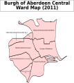 Aberdeen Central B Ward Map 2011.svg 653 × 731; 82 KB
-
 Aberdeen Central.PNG 955 × 1,102; 22 KB
-
 Aberdeen City, Aberdeenshire, Angus, Moray 1999.svg 596 × 747; 820 KB
-
 Aberdeen City, Aberdeenshire, Angus, Moray 2011.svg 599 × 746; 809 KB
-
 Aberdeen City, Aberdeenshire, Angus, Moray.svg 603 × 753; 671 KB
-
 Aberdeen council.PNG 2,733 × 3,411; 208 KB
-
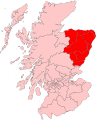
 Aberdeen Donside (Scottish Parliament constituency).svg 206 × 234; 61 KB
-
 Aberdeen Map 24 1 14 Wiki.jpg 1,653 × 2,338; 407 KB
-
 Aberdeen Medieval Friaries.png 1,668 × 1,738; 203 KB
-
 Aberdeen Medieval Hospitals.png 1,668 × 1,738; 266 KB
-
 Aberdeen new routes map.svg 1,425 × 1,189; 638 KB
-
 Aberdeen North ScottishParliamentConstituency.PNG 955 × 1,102; 22 KB
-
 Aberdeen outline map.png 600 × 524; 102 KB
-
 Aberdeen South ScottishParliamentConstituency.PNG 955 × 1,102; 22 KB
-
 Aberdeen Trades Hospitals 2 Wiki.jpg 4,530 × 4,747; 2.08 MB
-
 Aberdeen UK blank map.svg 1,425 × 1,189; 671 KB
-
 Aberdeen UK location map.svg 1,425 × 1,189; 630 KB
-
 Aberdeen UK parish map (blank).svg 1,425 × 1,189; 720 KB
-
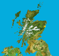
 Aberdeen UK relief location map.jpg 2,003 × 1,670; 213 KB
-
 Aberdeen UK ward map (blank).svg 1,425 × 1,189; 823 KB
-
 Aberdeen UK ward map 2017 (blank).svg 1,425 × 1,189; 796 KB
-
 Aberdeen UK ward map 2017 numbered.png 1,425 × 1,189; 210 KB
-
 Aberdeen WikiShootMe.png 1,920 × 856; 1.18 MB
-
 Aberdeen-Hospitals 1200 1600.jpg 1,401 × 1,372; 413 KB
-
 Aberdeen.svg 595 × 842; 50 KB
-
 AberdeenNorth2024Constituency.svg 512 × 747; 1.64 MB
-
 AberdeenSouth2024Constituency.svg 512 × 747; 1.64 MB
-
 AberdeenSouthConstituency.svg 278 × 412; 336 KB
-
 Chanonry Old Aberdeen Hospitals.jpg 1,653 × 2,338; 463 KB
-
 Chanonry Plan 14 2 14.jpg 1,653 × 2,338; 611 KB
-
 Deeside Drove Roads.jpg 2,338 × 1,653; 330 KB
-
 Dyce Bucksburn Danestone.png 719 × 600; 80 KB
-
 Location map Scotland Aberdeen.png 632 × 678; 285 KB
-
 Location map United Kingdom Aberdeen Central.png 796 × 740; 397 KB
-
 Location map United Kingdom Aberdeen.png 97 × 91; 15 KB
-
 Map of Aberdeen Boundary Stones with SVG numbering.svg 2,856 × 1,631; 3.86 MB
-
 Map of Aberdeen Boundary Stones.png 3,046 × 1,740; 2.71 MB
-
 NHSgrampian.png 2,733 × 3,411; 230 KB
-

-
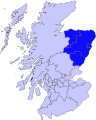
 North East.PNG 2,733 × 4,002; 224 KB
-
 NorthWestScotlandNumberd.PNG 955 × 1,102; 27 KB
-
 Ordnance Survey One-Inch Sheet 40 Aberdeen, Published 1959.jpg 8,220 × 10,003; 10.21 MB
-
 Ordnance Survey One-Inch Sheet 40 Aberdeen, Published 1969.jpg 8,287 × 9,857; 34.01 MB
-
 Ordnance Survey Sheet NJ 90 Aberdeen, Published 1957 Additions to 1970.jpg 7,612 × 8,797; 16.45 MB
-
 Scotland map modern.png 2,500 × 2,500; 1.61 MB
-
 ScotlandAberdeen.png 200 × 229; 28 KB
-
 ScotlandAberdeenshireBanffBuchan.png 191 × 261; 4 KB
-

-
 The Robert Gordon University, Garthdee campus map (2013).png 2,777 × 800; 421 KB
-
 The Robert Gordon University, Garthdee campus map.png 2,051 × 519; 290 KB
-
 Wyness Composite 2.jpg 15,175 × 11,617; 13.59 MB
-
 Wyness Gordon Plan.jpg 15,175 × 11,617; 6.87 MB
.png)
.png)

.svg)


.svg)


_(2011_numbered).svg)


.jpg)


.svg)
.svg)
.svg)
.png)