Category:Maps of 5th-century India
Jump to navigation
Jump to search
Countries of Asia: India
Media in category "Maps of 5th-century India"
The following 6 files are in this category, out of 6 total.
-
 Greatest extent of Kadamba Empire during reign of Kakktsavarma Emperor.jpg 872 × 1,245; 381 KB
-
 Kadamba Empire.png 330 × 268; 45 KB
-
 Map of ancient India during Gupta emperor Kumaragupta I's reign.jpg 960 × 827; 143 KB
-
 Rai Dynasty of Sindh under Rai Shasi II The Last.png 5,699 × 6,885; 4.37 MB
-
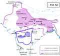 South Asia historical AD450 NL.svg 1,330 × 1,250; 750 KB
-
 South Asia in 400 CE.tif 737 × 655, 2 pages; 2.54 MB


