Category:Maps of 17th-century Italy
Jump to navigation
Jump to search
| Preceded by: Maps of 15th-century Italy |
Maps of 17th-century Italy 1601 AD-1700 AD |
Succeeded by: Maps of 18th-century Italy |
Media in category "Maps of 17th-century Italy"
The following 4 files are in this category, out of 4 total.
-
 Italia 1600-ast.svg 1,897 × 2,151; 671 KB
-
 Italia 1600-es.svg 1,897 × 2,151; 1.04 MB
-
 Italia 1600-hu.svg 1,897 × 2,151; 494 KB
-
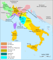
 Italia 1600.svg 1,897 × 2,151; 777 KB


