Category:Maps from Cohrs atlas över Sverige
Jump to navigation
Jump to search
English: Maps from Cohrs atlas över Sverige (12th ed., 1928). This is a "pocket sized" (13 x 20 cm) book of maps of Sweden. It first appeared in 1890. The first 10 editions contained statistical information as well. From its 11th edition in 1920, it was revised and enhanced by the publisher Generalstabens litografiska anstalt.
Svenska: Svenska: Kartor ur Cohrs atlas över Sverige (12:e upplagan, 1928).

|
This work may not be in the public domain in the United States because its U.S. copyright was restored by the URAA as it was still copyrighted in its source country (Sweden) on the URAA date (1 January 1996). In most cases, it is copyrighted in the U.S. until 95 years after the year in which it was initially published (exceptions are works published after 1977; see Commons:Hirtle chart). This template may not be used for files uploaded after 1 March 2012.
If you are the copyright holder of this file, and do not wish to have it hosted on Commons, please contact our designated agent or nominate the file for deletion, explaining the situation.
|
| Upload media | |||||
| Date of birth | 27 August 1858 | ||||
|---|---|---|---|---|---|
| Date of death | 27 July 1934 | ||||
| Occupation | |||||
| |||||
Media in category "Maps from Cohrs atlas över Sverige"
The following 34 files are in this category, out of 34 total.
-
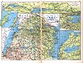
 Cohrs atlas över Sverige 0002 Översiktskarta.jpg 3,164 × 4,125; 3.04 MB
-
 Cohrs atlas över Sverige 0003 Kommunikationskarta.jpg 4,125 × 3,164; 2.57 MB
-
 Cohrs atlas över Sverige 0004 Skåne Blekinge.jpg 4,125 × 3,164; 3.2 MB
-
 Cohrs atlas över Sverige 0005 Sydskåne.jpg 4,125 × 3,164; 3.02 MB
-
 Cohrs atlas över Sverige 0006 Halland Bohuslän.jpg 4,125 × 3,164; 2.86 MB
-
 Cohrs atlas över Sverige 0007 Småland.jpg 4,125 × 3,164; 3.26 MB
-
 Cohrs atlas över Sverige 0008 Östergötland.jpg 4,125 × 3,164; 3.33 MB
-
 Cohrs atlas över Sverige 0009 Västergötland.jpg 3,164 × 4,125; 3.41 MB
-
 Cohrs atlas över Sverige 0010 Värmland.jpg 3,164 × 4,125; 2.91 MB
-
 Cohrs atlas över Sverige 0011 Närke Södermanland Västmanland.jpg 4,125 × 3,164; 3.39 MB
-
 Cohrs atlas över Sverige 0012 Uppland Gotland.jpg 4,125 × 3,164; 3.01 MB
-
 Cohrs atlas över Sverige 0013 Dalarna Gästrikland.jpg 4,125 × 3,164; 3.37 MB
-
 Cohrs atlas över Sverige 0014 Härjedalen Medelpad Hälsingland.jpg 4,125 × 3,164; 3.46 MB
-
 Cohrs atlas över Sverige 0015 Jämtland Ångermanland Västerbotten.jpg 4,125 × 3,164; 3.68 MB
-
 Cohrs atlas över Sverige 0016 Lappland Norrbotten.jpg 4,125 × 3,164; 3.36 MB
-
 Cohrs atlas över Sverige 0017 greater Stockholm.jpg 4,125 × 3,164; 3.44 MB
-
 Cohrs atlas över Sverige 0019 Mälaren.jpg 3,164 × 4,125; 3.33 MB
-
 Cohrs atlas över Sverige 0020 Göteborg Trollhättan.jpg 4,125 × 3,164; 3.02 MB
-
 Cohrs atlas över Sverige 0023 Göteborg.jpg 4,125 × 3,164; 2.72 MB
-
 Cohrs atlas över Sverige 0024 Malmö Norrköping.jpg 3,164 × 5,986; 3.99 MB
-
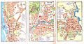 Cohrs atlas över Sverige 0025 Hälsingborg Örebro Linköping.jpg 5,986 × 3,164; 3.78 MB
-
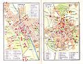 Cohrs atlas över Sverige 0026 Uppsala Lund.jpg 4,125 × 3,164; 2.4 MB
-
 Cohrs atlas över Sverige 0027 Gävle Eskilstuna.jpg 4,125 × 3,164; 2.66 MB
-
 Cohrs atlas över Sverige 0028 Jönköping Västerås.jpg 3,164 × 4,125; 2.63 MB
-
 Cohrs atlas över Sverige 0029 Visby Storsjön.jpg 3,164 × 2,074; 1.5 MB
-
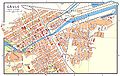 Cohrs Gävle 1928.jpg 3,020 × 1,904; 1.27 MB
-
 Cohrs Helsingborg 1928.jpg 1,891 × 2,932; 1.23 MB
-
 Cohrs Linköping 1928.jpg 1,896 × 2,952; 1.23 MB
-
 Cohrs Tåkern 1928.jpg 1,219 × 1,534; 510 KB
-
 Cohrs Visby 1928.jpg 1,444 × 1,496; 593 KB
-
 Cohrs Visingsö 1928.jpg 920 × 858; 210 KB
-
 Cohrs Örebro 1928.jpg 1,978 × 2,980; 1.29 MB
-
 Cohrs Örebro gymnasier 1928.jpg 988 × 1,008; 256 KB
-
 Stockholm map detail 1928.jpg 1,340 × 875; 648 KB


