Category:Maps from Africa by Élisée Reclus, Volume 3
Jump to navigation
Jump to search
Media in category "Maps from Africa by Élisée Reclus, Volume 3"
The following 200 files are in this category, out of 218 total.
(previous page) (next page)-
 AFR V3 D022 Depths of the Azorian Atlantic.jpg 457 × 603; 49 KB
-
 AFR V3 D029 Atlantic Winds and Currents.jpg 2,009 × 2,427; 866 KB
-
 AFR V3 D032 Depths of the South African Atlantic.jpg 2,125 × 3,126; 1.74 MB
-
 AFR V3 D034 Mean Annual Direction of the Winds in the South African Atlantic.jpg 2,057 × 1,618; 395 KB
-
 AFR V3 D035 Summer Winds in the South African Atlantic.jpg 2,055 × 1,643; 442 KB
-
 AFR V3 D036 Currents of the South Atlantic and Lines of Icebergs.jpg 2,088 × 2,287; 633 KB
-
 AFR V3 D040 Volcanic Axis of the Azores.jpg 2,061 × 1,823; 837 KB
-
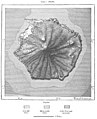
 AFR V3 D050 San-Miguel - Azores.jpg 1,960 × 1,423; 499 KB
-
 AFR V3 D051 Val das Furnas - Azores.jpg 2,038 × 2,763; 1.76 MB
-
 AFR V3 D052 Sete Cidades - Pona-Delgada - Azores.jpg 2,075 × 2,774; 1.33 MB
-
 AFR V3 D056 Ponta Delgada - Azores.jpg 2,083 × 2,062; 736 KB
-
 AFR V3 D057 Central Islands of the Azores Archipelago.jpg 2,029 × 1,781; 672 KB
-
 AFR V3 D060 Island of Corvo - Azores.jpg 2,137 × 2,999; 1.48 MB
-
 AFR V3 D065 Archipelago of Madeira.jpg 2,024 × 2,043; 846 KB
-
 AFR V3 D066 Eastern Peninsula of Madeira.jpg 2,073 × 2,187; 843 KB
-
 AFR V3 D075 Funchal and Socorridos Valley - Madeira.jpg 2,054 × 2,888; 1.39 MB
-
 AFR V3 D080 The Canary islands - left side of map in colour.jpg 2,866 × 4,594; 1.39 MB
-
 AFR V3 D080-081 The Canary islands- in colour.jpg 5,685 × 4,273; 2.87 MB
-
 AFR V3 D081 The Canary islands - right side of map in colour.jpg 2,866 × 4,594; 1.34 MB
-
 AFR V3 D084 Teyde Peak - Canary Islands.jpg 2,000 × 2,289; 1.11 MB
-
 AFR V3 D093 Recent Lavas of Lanzarote - Canary Islands.jpg 2,032 × 1,418; 593 KB
-
 AFR V3 D096 Cirque de Tejeda - Canary Islands.jpg 2,066 × 1,727; 819 KB
-
 AFR V3 D097 North-East Slope of Gran Canaria.jpg 2,039 × 2,548; 1.19 MB
-
 AFR V3 D098 Las Palmas and Port of La Luz - Canary Islands.jpg 1,436 × 2,634; 860 KB
-
 AFR V3 D102 Northern extremity of Teneriffe.jpg 2,061 × 1,870; 798 KB
-
 AFR V3 D103 Gomera - Canary Islands.jpg 2,098 × 2,100; 955 KB
-
 AFR V3 D104 La Palma - Canary Islands.jpg 1,817 × 2,818; 1.23 MB
-
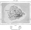
 AFR V3 D106 Hierro - Canary Islands.jpg 2,070 × 2,032; 945 KB
-
 AFR V3 D109 Cape Verd Islands.jpg 2,048 × 2,097; 832 KB
-
 AFR V3 D115 Santo-Antam and Sam Vincente - Cape Verde.jpg 2,016 × 2,334; 949 KB
-
 AFR V3 D116 Part of the Volcanic Plateau in Santo-Antam - Cape Verde.jpg 2,108 × 1,944; 1.19 MB
-
 AFR V3 D121 Praia - Cape Verde Islands.jpg 2,008 × 1,777; 606 KB
-
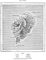
 AFR V3 D126 Tristam de Cunha.jpg 2,173 × 2,675; 1.2 MB
-
 AFR V3 D132 Island of St. Helena.jpg 2,059 × 2,373; 914 KB
-
 AFR V3 D139 Ascension Island.jpg 2,209 × 2,093; 818 KB
-
 AFR V3 D141 Sam-Thomé.jpg 2,120 × 2,778; 1.09 MB
-
 AFR V3 D147 Fernando-Po.jpg 2,141 × 2,663; 1.41 MB
-
 AFR V3 D148 Bay of Santa-Isabel.jpg 2,169 × 2,278; 863 KB
-
 AFR V3 D158 Geological Map of Senegambia.jpg 1,764 × 3,156; 1.21 MB
-
 AFR V3 D162 Senegal left half of map.jpg 2,866 × 4,594; 989 KB
-
 AFR V3 D162 Senegal map left page.jpg 2,866 × 4,272; 1,010 KB
-
 AFR V3 D163 Senegal map right page.jpg 2,902 × 4,365; 429 KB
-
 AFR V3 D163 Senegal right side of the map.jpg 2,902 × 4,616; 422 KB
-
 AFR V3 D166 The Felu Falls.jpg 2,051 × 2,123; 954 KB
-
 AFR V3 D169 Bars of the Senegal from 1825 to 1884.jpg 897 × 2,978; 456 KB
-
 AFR V3 D176 Natural Divisions of Senegambia.jpg 2,062 × 1,412; 294 KB
-
 AFR V3 D177 Chief Nations and Tribes of Senegambia.jpg 2,063 × 1,346; 269 KB
-
 AFR V3 D182 Distribution of the Fulahs in West Africa.jpg 2,022 × 1,325; 275 KB
-
 AFR V3 D190 Mineral Regions of Bambuk.jpg 1,958 × 3,011; 476 KB
-
 AFR V3 D192 Trade Routes and Projected Railways in Senegal.jpg 2,056 × 1,839; 314 KB
-
 AFR V3 D194 The Bafoulabé Railway.jpg 2,064 × 2,649; 424 KB
-
 AFR V3 D195 Saint-Louis in 1700.jpg 1,222 × 2,298; 551 KB
-
 AFR V3 D196 Saint-Louis in 1880.jpg 1,257 × 2,284; 597 KB
-
 AFR V3 D197 Gulf and Island of Arguin.jpg 2,036 × 2,152; 720 KB
-
 AFR V3 D201 Rufisque.jpg 2,092 × 1,900; 529 KB
-
 AFR V3 D205 Bafulabé.jpg 2,043 × 1,467; 334 KB
-
 AFR V3 D206 Rock of Kita.jpg 2,224 × 2,215; 803 KB
-
 AFR V3 D208 Timbo and the Sources of Bafing.jpg 1,889 × 1,883; 732 KB
-
 AFR V3 D211 Political Divisions of French Senegambia.jpg 2,090 × 1,953; 532 KB
-
 AFR V3 D214 Sources of the Dimma and Comba.jpg 2,097 × 2,497; 639 KB
-
 AFR V3 D218 Bathurst and entrance of the Gambia.jpg 2,082 × 2,575; 770 KB
-
 AFR V3 D222 Tribes of the Casamanza.jpg 2,079 × 1,701; 578 KB
-
 AFR V3 D224 Tribes of the Casamanza.jpg 2,077 × 1,716; 563 KB
-
 AFR V3 D231 Bissagos Archipelago.jpg 1,480 × 2,693; 692 KB
-
 AFR V3 D237 Tribes of the Casamanza.jpg 567 × 599; 54 KB
-
 AFR V3 D240 The Los Islands.jpg 2,051 × 2,436; 975 KB
-
 AFR V3 D243 Rivers of the South.jpg 2,027 × 1,815; 515 KB
-
 AFR V3 D244 Inhabitants of the Rivers of the South.jpg 2,044 × 1,802; 541 KB
-
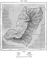
 AFR V3 D247 Peninsula of Sierra-Leone.jpg 2,208 × 3,104; 1.05 MB
-
 AFR V3 D252 Territory of the Western Mandingans in Sierra-Leone.jpg 1,986 × 2,223; 530 KB
-
 AFR V3 D253 Inhabitants of Sierra-Leone.jpg 1,981 × 2,209; 471 KB
-
 AFR V3 D256 Freetown - Sierra Leon.jpg 2,094 × 1,919; 762 KB
-
 AFR V3 D261 Territories annexed to the Colony of Monrovia.jpg 2,029 × 2,124; 401 KB
-
 AFR V3 D264 Chief Routes of Explorers in Liberia.jpg 1,617 × 2,174; 414 KB
-
 AFR V3 D269 Territory of the Kroomen.jpg 2,076 × 1,854; 488 KB
-
 AFR V3 D271 Inhabitants of Liberia.jpg 2,012 × 2,106; 623 KB
-
 AFR V3 D272 Robertsport and Fisherman's Lake.jpg 2,101 × 2,172; 782 KB
-
 AFR V3 D274 Monrovia and the Lower St Paul River.jpg 1,544 × 2,815; 682 KB
-
 AFR V3 D275 Grand Bassa and Mouth of the St John.jpg 2,009 × 2,509; 813 KB
-
 AFR V3 D278 Cape Palmas.jpg 2,013 × 1,478; 370 KB
-
 AFR V3 D279 Ditch of Little Bassam.jpg 2,081 × 1,931; 446 KB
-
 AFR V3 D281 Assini.jpg 2,025 × 2,040; 480 KB
-
 AFR V3 D288 Routes of Chief Explorers North and East of Cape Coast.jpg 1,480 × 2,615; 357 KB
-
 AFR V3 D290 The Lower Volta.jpg 2,040 × 2,040; 430 KB
-
 AFR V3 D298 Route from Accra to Cumassi.jpg 2,037 × 2,012; 579 KB
-
 AFR V3 D299 Gold Coast Possessions and Surrounding Districts.jpg 2,100 × 1,700; 333 KB
-
 AFR V3 D300 Inhabitants of the Gold Coast and Surrounding Districts.jpg 2,130 × 1,731; 342 KB
-
 AFR V3 D307 From Accra to the Sanatorium of Abouri.jpg 1,542 × 2,713; 459 KB
-
 AFR V3 D309 Abetifi Mountains.jpg 2,041 × 2,123; 1,002 KB
-
 AFR V3 D310 Mouths of the Volta.jpg 2,082 × 2,807; 788 KB
-
 AFR V3 D314 Shore-Line East of Lagos.jpg 2,066 × 2,311; 796 KB
-
 AFR V3 D317 Inhabitants of the Slave Coast.jpg 2,067 × 2,015; 402 KB
-
 AFR V3 D322 Togo District.jpg 2,068 × 1,637; 516 KB
-
 AFR V3 D324 Dahomey and Ajuda Coast.jpg 1,336 × 2,356; 321 KB
-
 AFR V3 D328 Lagos Nigeria.jpg 2,116 × 2,672; 929 KB
-
 AFR V3 D335 Hypotheses of the Old Explorers on the Course of the Niger.jpg 2,022 × 1,662; 167 KB
-
 AFR V3 D336 Chief Routes of the Explorers in the Niger Valley West of Benue.jpg 2,104 × 2,212; 466 KB
-
 AFR V3 D338 Upper Niger Valley.jpg 2,078 × 2,760; 1,023 KB
-
 AFR V3 D340 Backwaters South of Timbuktu.jpg 1,249 × 2,643; 258 KB
-
 AFR V3 D341 The Burum Defiles.jpg 2,012 × 1,459; 214 KB
-
 AFR V3 D342 The Bussa Rapids.jpg 1,223 × 2,955; 445 KB
-
 AFR V3 D343 Confluence of the Niger and Benoue.jpg 1,589 × 2,942; 800 KB
-
 AFR V3 D345 Mouths of the Nun and Brass.jpg 592 × 600; 106 KB
-
 AFR V3 D347 Ancient Empire of the Toucouleurs.jpg 2,150 × 2,134; 692 KB
-
 AFR V3 D348 Inhabitants of the Upper Niger.jpg 1,994 × 2,462; 295 KB
-
 AFR V3 D351 The Dio Watershed Between the Niger and Senegal.jpg 2,055 × 1,302; 354 KB
-
 AFR V3 D353 Bamaku.jpg 2,057 × 1,523; 432 KB
-
 AFR V3 D354 Segu Mali.jpg 2,014 × 1,660; 299 KB
-
 AFR V3 D355 Sansandig.jpg 2,119 × 1,683; 318 KB
-
 AFR V3 D360 The Hombori Mountains.jpg 2,055 × 1,387; 344 KB
-
 AFR V3 D361 Timbuktu.jpg 2,018 × 1,507; 294 KB
-
 AFR V3 D365 The Races of West Africa.jpg 2,173 × 1,856; 704 KB
-
 AFR V3 D370 Range of Mohammedanism in Central Africa.jpg 2,168 × 1,440; 506 KB
-
 AFR V3 D372 Inhabitants of the Haussa.jpg 2,020 × 2,002; 259 KB
-
 AFR V3 D374 Katsena and Dankama.jpg 1,609 × 1,587; 235 KB
-
 AFR V3 D375 Kano Nigeria.jpg 2,014 × 1,446; 141 KB
-
 AFR V3 D376 Plan of Sokoto and Map of Haussa, Drawn by Sultan Bello.jpg 2,064 × 1,358; 258 KB
-
 AFR V3 D378 Gando and Sokoto.jpg 2,185 × 2,596; 288 KB
-
 AFR V3 D380 Rabba Nigeria.jpg 2,064 × 1,454; 416 KB
-
 AFR V3 D382 Coast of Benin left side of Map.jpg 2,754 × 4,069; 1.41 MB
-
 AFR V3 D382 The Niger map left page.jpg 2,866 × 4,339; 895 KB
-
 AFR V3 D383 Niger right side of map.jpg 2,834 × 4,257; 806 KB
-
 AFR V3 D383 The Niger map right page.jpg 2,866 × 4,339; 779 KB
-
 AFR V3 D385 Bida and Kaduna.jpg 2,042 × 2,788; 887 KB
-
 AFR V3 D386 Egga Nigeria.jpg 2,119 × 1,517; 466 KB
-
 AFR V3 D389 The Upper Benue.jpg 2,022 × 2,065; 331 KB
-
 AFR V3 D392 Chief Routes of Explorers East of Benue.jpg 2,084 × 2,054; 330 KB
-
 AFR V3 D393 Riverain Population of the Benue and Lower Niger.jpg 2,100 × 2,268; 443 KB
-
 AFR V3 D395 Languages of the Benue and Lower Niger.jpg 2,443 × 2,312; 942 KB
-
 AFR V3 D397 Yola Nigeria.jpg 2,016 × 2,354; 1.07 MB
-
 AFR V3 D399 Yakoba and Mount Saranda.jpg 2,051 × 1,579; 488 KB
-
 AFR V3 D403 Idda Nigeria.jpg 2,075 × 1,720; 564 KB
-
 AFR V3 D404 Onitcha.jpg 2,092 × 2,151; 832 KB
-
 AFR V3 D405 Bonny and New Calabar.jpg 2,252 × 2,615; 643 KB
-
 AFR V3 D406 Old Calabar and Oyono.jpg 1,861 × 3,003; 732 KB
-
 AFR V3 D411 Routes of the Explorers in the Tsad Basin.jpg 2,085 × 1,816; 394 KB
-
 AFR V3 D414 Lake of Tuburi.jpg 1,401 × 2,660; 238 KB
-
 AFR V3 D416 Tsad and Bahr el Ghazal.jpg 2,017 × 2,055; 337 KB
-
 AFR V3 D423 Inhabitants of Kanem.jpg 2,176 × 2,378; 1.08 MB
-
 AFR V3 D429 Inhabitants of Bornu.jpg 2,151 × 2,024; 842 KB
-
 AFR V3 D431 Kuka (Kukawa), Nigeria.jpg 2,064 × 1,675; 413 KB
-
 AFR V3 D433 The Mora Mountains.jpg 1,803 × 2,160; 519 KB
-
 AFR V3 D442 Massena and East Baghirmi.jpg 2,142 × 1,017; 210 KB
-
 AFR V3 D444 Cameroons left side of map.png 2,604 × 4,231; 4.69 MB
-
 AFR V3 D444 Cameroons map left page.jpg 2,866 × 4,339; 1.49 MB
-
 AFR V3 D445 Bight of Biafra right side of the map.png 2,866 × 4,262; 2.38 MB
-
 AFR V3 D445 Cameroons map right page.jpg 2,866 × 4,339; 1.33 MB
-
 AFR V3 D450 Chief Routes of Explorers in the Cameroons.png 2,059 × 2,433; 636 KB
-
 AFR V3 D452 The Lobé Falls.png 2,098 × 1,963; 673 KB
-
 AFR V3 D455 Tribes of the Cameroons.png 2,000 × 3,073; 1.26 MB
-
 AFR V3 D460 Victoria and Bimbia.png 2,074 × 2,233; 1.08 MB
-
 AFR V3 D464 Left side map.png 2,573 × 4,301; 4.4 MB
-
 AFR V3 D465 Right side map.png 2,507 × 4,301; 1.85 MB
-
 AFR V3 D467 Chief Routes of the Explorers of Gaboon and Ogoway Basins.png 2,058 × 2,011; 517 KB
-
 AFR V3 D469 Confluence of the Komo and Ramboé.png 2,141 × 1,752; 638 KB
-
 AFR V3 D470 Supposed Course of the Ogoway before the late discoveries.png 2,110 × 1,998; 499 KB
-
 AFR V3 D474 The Ogoway and Zonengway.png 2,053 × 2,602; 984 KB
-
 AFR V3 D475 Lines of Equal Cloudiness in Africa.png 2,036 × 2,158; 702 KB
-
 AFR V3 D481 Inhabitants of the Gaboon and Ogoway Basins.png 2,048 × 2,454; 643 KB
-
 AFR V3 D487 The Banya Lagoon and Ba Lumbo Country.png 2,072 × 1,804; 1,016 KB
-
 AFR V3 D491 Corisco Bay.png 2,142 × 2,031; 717 KB
-
 AFR V3 D492 Elobey Islands.png 2,058 × 2,622; 804 KB
-
 AFR V3 D495 Libreville and Mouth of the Gaboon.png 2,060 × 2,361; 900 KB
-
 AFR V3 D496 Ma Poko Falls on the Upper Ogoway.png 1,694 × 2,213; 1.06 MB
-
 AFR V3 D497 Franceville Gabon.png 2,110 × 2,043; 648 KB
-
 AFR V3 D498 Mouth of the Kwilu.png 1,916 × 3,005; 741 KB
-
 AFR V3 D499 Portuguese Possessions North of the Congo.png 2,049 × 2,842; 1.05 MB
-
 AFR V3 D502 Africa According to Homann in 1711.png 2,089 × 2,153; 892 KB
-
 AFR V3 D504 The Congo Basin as Traced by Stanley After Crossing the Continent.png 2,063 × 1,978; 547 KB
-
 AFR V3 D505 Congo Basin as Known in 1887.png 2,142 × 2,226; 720 KB
-
 AFR V3 D506 Chief Routes of Modern Explorers in the Congo Basin.png 2,087 × 2,538; 670 KB
-
 AFR V3 D507 Lake Bangweolo according to Livingstone.png 2,146 × 1,872; 853 KB
-
 AFR V3 D508 Lake Bangweolo according to Giraud.png 2,148 × 2,725; 667 KB
-
 AFR V3 D512 Lake U-Nyamzi according to Erhardt and Rebmann.png 2,020 × 1,867; 649 KB
-
 AFR V3 D513 Lake Tanganyika.png 1,537 × 2,944; 662 KB
-
 AFR V3 D516 Lu Kuga before the Flush.png 2,157 × 2,442; 741 KB
-
 AFR V3 D518 The Congo and the U Banghi Confluence.png 2,001 × 2,300; 493 KB
-
 AFR V3 D521 The Congo Falls below the Stanley Pool.png 2,069 × 2,222; 530 KB
-
 AFR V3 D522 Last Rapids of the Congo.png 1,112 × 2,837; 452 KB
-
 AFR V3 D525 The Devil's Caldron.png 2,101 × 2,937; 2.69 MB
-
 AFR V3 D526 The Congo Bar.png 2,191 × 1,470; 471 KB
-
 AFR V3 D528 Lines of Navigation in the Congo Basin.png 2,137 × 2,039; 539 KB
-
 AFR V3 D532 Forests of the Parallel Affluents of the Kassai.png 2,036 × 2,545; 579 KB
-
 AFR V3 D537 Zone Open to Free Trade in the Congo Basin.png 2,087 × 1,982; 724 KB
-
 AFR V3 D539 Chief Routes of the Explorers in the Upper Congo Basin.png 2,040 × 1,856; 435 KB
-
 AFR V3 D541 Bunkeya and the Copper-Mine Region.png 2,028 × 2,382; 547 KB
-
 AFR V3 D542 Lake Bangwelo and the Lower Lua Laba according to Livingstone.png 1,724 × 2,885; 838 KB
-
 AFR V3 D544 Chief tribes in the Upper Congo Basin.png 2,041 × 1,882; 630 KB
-
 AFR V3 D546 Chief Routes of the Explorers in the Congo east of Tanganyika.png 1,805 × 2,751; 538 KB
-
 AFR V3 D549 Tabora and Gonda.jpg 1,392 × 2,614; 287 KB
-
 AFR V3 D550 Inhabitants of the Tanganyika Basin.png 1,799 × 2,762; 873 KB
-
 AFR V3 D553 Ujiji and the Malagarazi.png 1,219 × 1,043; 286 KB
-
 AFR V3 D554 Karema and Mpimbwe.png 1,998 × 1,346; 498 KB
-
 AFR V3 D556 Kavala Archipelago.png 2,023 × 2,045; 935 KB
-
 AFR V3 D558 Stanley Falls.png 2,053 × 2,405; 798 KB
-
 AFR V3 D563 Ba Ngala Station.png 2,011 × 1,976; 527 KB
-
 AFR V3 D564 Chief Routes of the Explorers in Monbuttu Land.png 2,145 × 1,695; 341 KB
-
 AFR V3 D566 Damaged page.png 2,591 × 1,975; 1.89 MB
-
 AFR V3 D568 Damaged page.png 1,927 × 1,528; 280 KB
-
 AFR V3 D571 Inhabitants of the Welle Basin.png 2,126 × 1,623; 475 KB


,_Nigeria.jpg)


