Category:Maps by user:David-waterways
Jump to navigation
Jump to search
The aim is to provide more selective context to clarify the locations of inland waterways in relation to their networks. Mapping produced for Transmanche Consultants SARL and for Imray Laurie Norie & Wilson Ltd. All these vignettes are based on the European Waterways Map and Directory, 5th edition (Transmanche), 3rd French edition (Transmanche) and 3rd German edition (Delius Klasing: Edition Maritim). Individual lines are highlighted in red on the original (Adobe Illustrator), then a screen grab is used to create the jpg in Photoshop.David-waterways (talk) 19:13, 22 July 2017 (UTC)
Media in category "Maps by user:David-waterways"
The following 16 files are in this category, out of 16 total.
-
 Ardennes-location.jpg 800 × 745; 399 KB
-
 Canal de Briare-location.jpg 700 × 848; 300 KB
-
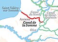 Canal de la Somme location.jpg 350 × 254; 80 KB
-
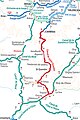 Canal de Saint-Quentin location.jpg 380 × 572; 240 KB
-
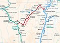 Canal du Centre location.jpg 800 × 581; 328 KB
-
 Canal du Midi location.jpg 550 × 355; 155 KB
-
 Classification Waterways UNECE.jpg 1,719 × 911; 486 KB
-
 Escaut Location.jpg 400 × 346; 166 KB
-
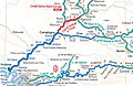 Oise Lateral Canal location.jpg 750 × 488; 346 KB
-
 Oise-upgrading-location.jpg 600 × 333; 91 KB
-
 Paris city canals location.jpg 350 × 295; 101 KB
-
 Paris-canals-location.jpg 400 × 262; 127 KB
-
 Rhone au Rhin location.jpg 350 × 329; 129 KB
-
 Rhone Rhine Canal location.jpg 350 × 329; 129 KB
-
 Roanne-Digoin Canal location.jpg 350 × 511; 134 KB
-
 UNECE-European-waterways-2012.jpg 2,245 × 1,832; 1.89 MB


