Category:Maps by Thomas Jefferys
Jump to navigation
Jump to search
Subcategories
This category has the following 11 subcategories, out of 11 total.
A
T
Media in category "Maps by Thomas Jefferys"
The following 200 files are in this category, out of 686 total.
(previous page) (next page)-
 (Plan of the town and harbour of St. Augustine. LOC 75693262.jpg 3,061 × 2,183; 1.24 MB
-
 (Plan of the town and harbour of St. Augustine. LOC 75693262.tif 3,061 × 2,183; 19.12 MB
-

-

-
 1755 PlymouthMA detail of map byJohnGreen BPL 12281.png 1,060 × 748; 1.27 MB
-
 1755 Rhode Island detail of map byJohnGreen BPL 12281.png 1,061 × 737; 1.27 MB
-
 1760 Plan of Martinique.jpg 2,941 × 2,745; 6.23 MB
-
 1761 Map of Bell-Isle after survey by M.Paris.jpg 5,258 × 3,640; 2.19 MB
-
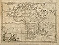 Jefferys Africa 1763 UTA.jpg 3,064 × 2,337; 6.96 MB
-
-
-
 1768 Jeffreys Wall Map of India and Ceylon - Geographicus - India-jeffreys-1768.jpg 7,000 × 5,455; 8.52 MB
-

-

-
 1775 map of Antigua by Robert Baker, updated by Thomas Jefferys.jpg 1,920 × 1,452; 963 KB
-
 1777 Map of Cuba and Yucatan.jpg 1,588 × 667; 247 KB
-
 Cartouche in a Ottoman map by Jefferys.jpg 640 × 703; 24 KB
-
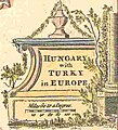
 Hungary with Turky in Europe.jpg 2,676 × 2,196; 288 KB
-
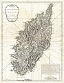 1794 Jeffreys Map of Corsica, France - Geographicus - Corsica-jeffreys-1794.jpg 3,000 × 3,870; 3.17 MB
-
 18th century - A map of the Propontis.jpg 4,824 × 2,648; 2.37 MB
-
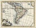 28 América del Sur.jpg 837 × 653; 146 KB
-

-

-

-

-

-
-

-

-

-

-

-

-

-

-

-

-

-

-
 A chart of the British Channel... - btv1b53010915k.jpg 25,252 × 12,559; 36.12 MB
-
 A chart of the British Channel... - btv1b530110555.jpg 25,333 × 12,610; 36.17 MB
-

-

-
 A Chart of the harbour of Halifax - Jefferys - btv1b530894958.jpg 8,368 × 5,968; 4.57 MB
-
 A Chart of the harbour of Halifax - Jefferys - btv1b530899201 (1 of 2).jpg 8,985 × 6,706; 7.11 MB
-
 A Chart of the harbour of Halifax - Jefferys - btv1b530899201 (2 of 2).jpg 2,769 × 1,537; 755 KB
-

-

-

-

-

-

-

-
-
 A chart of the Magdalen Islands - Jefferys - btv1b530895980.jpg 6,488 × 4,168; 2.78 MB
-
 A chart of the Magdalen Islands - Jefferys - btv1b53089599f.jpg 6,976 × 4,776; 2.69 MB
-

-

-

-

-
-

-

-

-

-

-

-
 A description of the maritime parts of France Fleuron T130589-4.png 1,588 × 773; 82 KB
-
 A description of the maritime parts of France Fleuron T146750-4.png 1,722 × 1,277; 108 KB
-
 A description of the maritime parts of France Fleuron T146750-5.png 1,075 × 408; 39 KB
-
 A Draught of Churchill River (1752).jpg 7,120 × 2,745; 4.62 MB
-
 A Draught of Nelson & Hayes's Rivers (1752).jpg 7,045 × 2,813; 3.47 MB
-
-
 A general chart of the island of Newfoundland with the rocks & soundings (5960816713).jpg 2,000 × 1,469; 2.44 MB
-
 A general map of North America; from the latest observations. LOC 75690000.jpg 4,527 × 3,692; 3.08 MB
-
 A general map of North America; from the latest observations. LOC 75690000.tif 4,527 × 3,692; 47.82 MB
-

-

-

-

-

-

-

-

-

-

-

-

-

-

-

-

-

-

-

-

-

-

-

-

-

-

-

-

-
-

-

-

-

-

-

-

-

-

-

-

-

-

-

-

-

-

-

-

-

-

-

-

-

-

-

-

-

-

-
 A Large & particular plan of Shegnecto - Jefferys - btv1b53089919n.jpg 9,559 × 7,052; 11.5 MB
-

-

-

-
 A map of Canada and the north part of Louisiana with the adjacent countrys (18160884519).jpg 2,000 × 1,283; 1.67 MB
-
 A map of Canada and the north part of Louisiana with the adjacent countrys. LOC 73695757.jpg 5,399 × 3,460; 2.46 MB
-
 A map of Canada and the north part of Louisiana with the adjacent countrys. LOC 73695757.tif 5,399 × 3,460; 53.45 MB
-
 A map of Canada and the north part of Louisiana with the adjacent countrys. LOC 73695758.jpg 9,492 × 4,088; 4.88 MB
-
 A map of Canada and the north part of Louisiana with the adjacent countrys. LOC 73695758.tif 9,492 × 4,088; 111.02 MB
-
 A map of Cyprus - T. Jefferys delin. et sculp. - btv1b8592867b.jpg 4,105 × 5,327; 3.32 MB
-
 A map of Kamtschatka engraved from the russian map by Tho Jefferys.jpg 2,499 × 2,123; 969 KB
-

-

-

-

-

-
-

-

-

-
-

-
 A map of the island of Guadaloupe (18162453400).jpg 2,000 × 1,441; 1.84 MB
-

-
 A map of the island of Guadeloupe - engraved by Thomas Jefferys - btv1b85963243.jpg 10,432 × 7,888; 11.85 MB
-

-

-
 A map of the isle of Cuba - btv1b5970704n.jpg 6,840 × 5,216; 4.61 MB
-

-

-

-

-

-

-
 A map of the most inhabited part of New England (2674889207).jpg 1,942 × 2,000; 3.57 MB
-

-

-

-

-

-

-

-

-
-

-
-

-

-

-

-

-

-

-
-
-
-

-
 A map of the Propontis - T. Jefferys sculpsit - btv1b5964217h (cropped).jpg 4,634 × 1,947; 1.9 MB
-
 A map of the Propontis - T. Jefferys sculpsit - btv1b5964217h.jpg 4,824 × 2,648; 2.27 MB
-

-
 A Map of the South part of Nova Scotia - Jefferys - btv1b53089485v.jpg 7,240 × 5,928; 5.64 MB
-
 A Map of the South part of Nova Scotia - Jefferys - btv1b53089494t.jpg 7,360 × 5,136; 4.16 MB
-

-

-
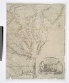
 A map of Virginia and Maryland. NYPL976286.tiff 5,419 × 4,600; 49.19 MB
-


.jpg)


_-_btv1b530900324_(2_of_2).jpg)
.jpg)
.jpg)
.jpg)
.jpg)
.jpg)
.jpg)
.jpg)
.jpg)


.jpg)
.jpg)
.jpg)
.jpg)
.jpg)
.jpg)


.jpg)
.jpg)
.jpg)
.jpg)
.jpg)


.jpg)
.jpg)

.jpg)
.jpg)
.jpg)
.jpg)


.jpg)
.jpg)

.jpg)


.jpg)
_(cropped).jpg)
.jpg)
.jpg)


.jpg)
.jpg)


.jpg)


.jpg)

.jpg)


.jpg)


.jpg)

.jpg)


.jpg)
.jpg)


.jpg)

.jpg)


_-_Geographicus_-_NewYorkNewJersey-sayer-1768.jpg)
.jpg)
.jpg)