Category:Maps by Emanuel Bowen
Jump to navigation
Jump to search
Subcategories
This category has only the following subcategory.
1
- 1747 Persia map by Emanuel Bowen (22 F)
Media in category "Maps by Emanuel Bowen"
The following 92 files are in this category, out of 92 total.
-
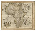
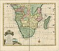 1455808337AnewandaccuratemapofthesouthernpartsofAfricaREDUCED.jpg 2,260 × 1,957; 1.51 MB
-
-
 Japan1744.jpg 430 × 358; 39 KB
-
 Japán jezsuita misszió 1560-70 körül.jpg 750 × 615; 241 KB
-
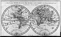
 1744 Bowen Map of the World in Hemispheres - Geographicus - World-bowen-1744.jpg 3,697 × 2,174; 2.48 MB
-

-
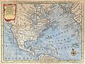 1747 Bowen Map of North America - Geographicus - NorthAmerica-bowen-1747.jpg 1,500 × 1,132; 677 KB
-

-

-

-

-
 Antique map of Japan, 1752.jpg 1,000 × 786; 185 KB
-
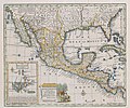 Bowen Mexico or New Spain 1752 UTA.jpg 2,664 × 2,230; 7.49 MB
-

-

-

-

-

-

-

-

-

-

-

-

-

-
 A new correct map of England and Wales... - Senex Moll - btv1b531192426.jpg 9,546 × 7,116; 11.94 MB
-
 A new & accurate map of China LOC 2006629424.jpg 7,154 × 5,799; 7.9 MB
-
 A new & accurate map of China LOC 2006629424.tif 7,154 × 5,799; 118.69 MB
-
 Sayer Accurate Map of North America 1775 UTA (bottom).jpg 1,458 × 639; 707 KB
-
 Sayer Accurate Map of North America 1775 UTA (top).jpg 1,431 × 640; 804 KB
-

-

-

-

-
 A new & accurate map of the islands of Hispaniola or St.jpg 2,000 × 847; 1.67 MB
-

-
-

-

-

-

-
 A Plan of the City of Canton on the River Ta Ho (1744).jpg 1,218 × 1,772; 822 KB
-

-

-
 Africa North 1747, Emanuel Bowen (4006898-recto).jpg 5,826 × 4,715; 4.51 MB
-
 An accurate map of the island of Barbadoes LOC 95684860.jpg 5,462 × 4,758; 4.33 MB
-
 An accurate map of the northwest part of Germany... - by Eman. Bowen... - btv1b8468856b.jpg 4,378 × 6,036; 4.18 MB
-
 Bowen - Britannia Depicta (The West Riding of Yorkshire).jpg 692 × 1,004; 655 KB
-
 Bowen - Britannica Depicta (Cardigan).jpg 500 × 764; 121 KB
-
 Bowen, Emanuel. Anatolia, Syria. 1747 (D).jpg 894 × 438; 82 KB
-
 Bowen, Emanuel. Anatolia, Syria. 1747. (A).jpg 4,075 × 3,311; 3.73 MB
-
 Bowen, Emanuel. Anatolia, Syria. 1747. (B).jpg 1,302 × 1,507; 602 KB
-
 Bowen, Emanuel. Anatolia, Syria. 1747. (C).jpg 1,302 × 1,215; 477 KB
-
 Bowen, Emanuel. Anatolia, Syria. 1747.jpg 5,852 × 4,312; 4.64 MB
-

-
 Bowen, Emanuel; Orbeliani, Sulxan-Saba. A new and accurate map of the Caspian Sea. 1747.jpg 2,906 × 4,220; 2.05 MB
-
 Bowen- A Complete map of the Southern Continent.jpg 3,000 × 2,323; 1.94 MB
-
 Brixton Hundred.jpg 640 × 440; 101 KB
-
-

-
 Cartouche in a Europe map by Bowen.jpg 806 × 1,010; 218 KB
-
 Cartouche in an Australia map by Bowen.jpg 1,212 × 589; 434 KB
-
 Emanual Bowen, "A complete system of geography" Wellcome L0017516.jpg 1,528 × 1,252; 697 KB
-
 Emanuel Bowen - Devonshire.jpg 650 × 517; 509 KB
-
 Europe map 1747 Bowen.jpg 5,828 × 4,344; 4.35 MB
-
 Libya in the map Africa North 1747, Emanuel Bowen (4006898-recto) (cropped).jpg 2,523 × 1,633; 827 KB
-
 Little Great and white Russias 1747 Bowen map.jpg 1,328 × 1,296; 440 KB
-
 Map of the Arctic, 1780s - B&W.jpeg 10,928 × 9,392; 16.09 MB
-
 Map of the Arctic, 1780s.jpeg 10,928 × 9,392; 15.9 MB
-
 Mapa da Ilha da Madeira por Emanuel Bowen, 1747.jpg 1,015 × 848; 238 KB
-
 MapaPerú.EmanBowen.JPG 2,206 × 1,846; 972 KB
-
 MapaPerú.EmanBowen2.JPG 2,208 × 1,842; 1.3 MB
-
 Navigantium atque itinerantium bibliotheca Fleuron N010532-12.png 3,303 × 725; 59 KB
-
 Navigantium atque itinerantium bibliotheca Fleuron N010532-15.png 2,204 × 1,673; 122 KB
-
 Navigantium atque itinerantium bibliotheca Fleuron N010532-17.png 895 × 1,025; 53 KB
-
 Navigantium atque itinerantium bibliotheca Fleuron N010532-21.png 3,221 × 797; 86 KB
-
 Navigantium atque itinerantium bibliotheca Fleuron N010532-44.png 2,935 × 517; 55 KB
-
 Navigantium atque itinerantium bibliotheca Fleuron T145685-34.png 1,915 × 1,484; 111 KB
-
 New & Accurate Map of Negroland - DPLA - 4c1e7a939c99adfc779e5ac80ada9d1d.jpg 1,000 × 780; 256 KB
-
 New & Accurate Map of Negroland.jpg 4,000 × 3,117; 3.09 MB
-

-
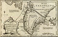 Old Greenland 1747.jpg 2,048 × 1,307; 2.23 MB
-

-

-
 Resized-inu-afrmap-4004357-recto-master.png 3,695 × 3,111; 19.99 MB
-
 Resized-inu-afrmap-4004497-recto-master.png 3,733 × 3,064; 19.99 MB
-
 Resized-inu-afrmap-4006782-recto-master.png 3,736 × 3,055; 20 MB
-
 Safavid Persian Empire cropped - Caucasus.jpg 396 × 301; 59 KB
-
 Safavid Persian Empire.jpg 1,195 × 969; 370 KB
-
 Salmas in 1747 Emanuel Bowen Map of the "Persian Empire at the Time of Afsharid Dynasty".jpg 5,420 × 4,548; 8.66 MB
-
 South Asia, 1744.jpg 6,453 × 5,161; 7.02 MB


_-_Geographicus_-_America-bowen-1747.jpg)
_-_Geographicus_-_OldGreenland-bowen-1747.jpg)
_-_Geographicus_-_CarolinaGeorgia-bowen-1747.jpg)


.jpg)
.jpg)

.jpg)
.jpg)


.jpg)
_a_Map_of_the_Isthmus_of_Panama_exhibiting_the_Roads_with_the_Course_of_the_River_Ch%C3%A2gre_thro_the_same_(2)_Curious_Perspective_Views_of_the_Harbour,_Town..._-_btv1b8493166k.jpg)
.jpg)
.jpg)


.jpg)
.jpg)
.jpg)
.jpg)
.jpg)
.jpg)

.jpg)


.jpg)


_(cropped).jpg)


