Category:Magnolia, Seattle, Washington
Jump to navigation
Jump to search
human settlement in Seattle, Washington, United States of America   Localisation de Magnolia à Seattle | |||||
| Upload media | |||||
| Instance of | |||||
|---|---|---|---|---|---|
| Location | Seattle, King County, Washington, Pacific Northwest, Washington, Pacific States Region | ||||
 | |||||
Subcategories
This category has the following 15 subcategories, out of 15 total.
3
- 32nd Avenue West Park (15 F)
A
- Admiral's House (Seattle) (5 F)
D
E
- Elliott Bay Marina (23 F)
F
- Fire Station No. 41, Seattle (4 F)
- Fourmile Rock (6 F)
M
- Magnolia Bridge (Seattle) (24 F)
- Magnolia Tidelands Park (9 F)
P
- Palisade (restaurant) (6 F)
S
U
- Ursula Judkins Viewpoint (1 F)
W
Media in category "Magnolia, Seattle, Washington"
The following 95 files are in this category, out of 95 total.
-
 32nd Ave W & W Thurman St, Lawton Park, Seattle.jpg 4,032 × 3,024; 4.51 MB
-
 Asahel Curtis panorama of Pleasant Valley, Magnolia district, Seattle, 1909.jpg 2,854 × 661; 528 KB
-
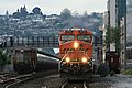
 BNSFtracks-kiwanisravine-seattle.jpg 1,024 × 1,280; 226 KB
-
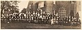
 Boys watching sewer inspection crew, Seattle, 1960 (49588778952).jpg 700 × 604; 101 KB
-
 Buena Vista Addition, Magnolia district, Seattle (CURTIS 299).jpeg 768 × 489; 55 KB
-
 Cable car stop, Seattle, circa 1900.jpg 1,200 × 801; 354 KB
-

-
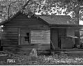 Dilapidated house in Magnolia, 1953.jpg 3,012 × 2,400; 1.16 MB
-
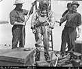 Diver at North Trunk Sewer, Seattle, 1912.jpg 1,200 × 1,019; 305 KB
-
 Elliot Bay Sunset - panoramio.jpg 864 × 486; 403 KB
-
 Everpresent Mt Rainier - panoramio.jpg 3,648 × 2,056; 291 KB
-
 GLO map of Interbay and Magnolia claims - 1863.jpg 795 × 522; 67 KB
-

-

-

-

-
-

-
-

-
 Line shaft drill press retrofitted with an engine.jpg 4,000 × 6,000; 13.82 MB
-
 Magnolia - panoramio.jpg 1,599 × 1,199; 469 KB
-
 Magnolia neighborhood of Seattle, 1946 (52227677544).jpg 3,090 × 2,400; 2.64 MB
-
 Magnolia Park, Washington - tree and bench.jpg 1,200 × 1,600; 508 KB
-
 Magnolia Sunset - panoramio.jpg 3,264 × 2,448; 449 KB
-
 Magnolia water tank, 1950.jpg 1,200 × 934; 252 KB
-

-
 Ole Shillestad house, Ballard, Washington Territory, 1880.jpg 1,200 × 821; 330 KB
-

-

-
 Pleasant Valley, Magnolia district, Seattle (CURTIS 935).jpeg 768 × 606; 89 KB
-
 Pleasant Valley, Magnolia district, Seattle (CURTIS 936).jpeg 768 × 614; 96 KB
-
 Pleasant Valley, Magnolia district, Seattle (CURTIS 937).jpeg 768 × 614; 92 KB
-
 Pleasant Valley, Magnolia district, Seattle (CURTIS 938).jpeg 768 × 614; 94 KB
-
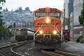
 Rail yard.jpg 4,032 × 3,024; 5.88 MB
-
 Road ends also (1455917545).jpg 1,024 × 768; 631 KB
-
 Rough cabin near Fort Lawton, Washington, March 26, 1899 (KIEHL 33).jpeg 559 × 511; 134 KB
-
 Salmon Bay Bridge 01 (cut).jpg 4,950 × 3,124; 9.08 MB
-
 Salmon Bay Bridge 01.jpg 6,000 × 4,000; 10.86 MB
-
 Salmon Bay from Magnolia, Seattle, ca 1922 (MOHAI 2072).jpg 640 × 519; 43 KB
-
 Salmon Bay, Seattle, 1900.jpg 1,200 × 842; 361 KB
-
 Seattle (17403871364).jpg 3,888 × 2,592; 4.05 MB
-
 Seattle (17838332238).jpg 3,888 × 2,592; 3.94 MB
-
 Seattle (17841386129).jpg 3,888 × 2,592; 4.72 MB
-
 Seattle (17999949396).jpg 2,592 × 3,888; 5.82 MB
-
 Seattle (18022815932).jpg 3,888 × 2,592; 6.31 MB
-
 Seattle (18023039012).jpg 3,888 × 2,592; 5.26 MB
-
 Seattle (18026043345).jpg 3,888 × 2,592; 5.06 MB
-
 Seattle (18027096781).jpg 3,888 × 2,592; 3.36 MB
-
 Seattle - 16th & Dravus, 1960 (50348575718).jpg 700 × 895; 120 KB
-
 Seattle - 31st Ave W & W McGraw St, 1953.jpg 1,200 × 956; 677 KB
-
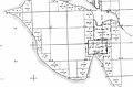
 Seattle - Briarcliff map.jpg 868 × 1,133; 174 KB
-
 Seattle - corner of Gilman Pl. W. and 26th Ave. W.jpg 6,000 × 4,000; 13.37 MB
-
 Seattle - Discovery Park 06.jpg 2,592 × 1,944; 2.45 MB
-
 Seattle - Discovery Park 07.jpg 2,592 × 1,944; 2.16 MB
-
 Seattle - Discovery Park 08.jpg 2,592 × 1,944; 1.99 MB
-
 Seattle - former Smith Cove tideflats from Soundview Terrace 01.jpg 3,264 × 2,448; 2.1 MB
-
 Seattle - House damaged in Perkins Lane landslide, 1954.gif 1,200 × 976; 994 KB
-
 Seattle - Landslide at 24th Ave W & Smith Street, 1963.jpg 2,376 × 1,914; 535 KB
-
 Seattle - Lawton Park map.jpg 1,674 × 1,182; 290 KB
-
 Seattle - looking south on Gilman Pl. W. from just north of W. Jameson St.jpg 6,000 × 4,000; 10.47 MB
-
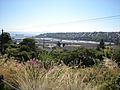
 Seattle - Magnolia and Queen Anne from Elliott Bay 01.jpg 6,000 × 4,000; 9.9 MB
-
 Seattle - Magnolia from Elliott Bay 01.jpg 6,000 × 4,000; 10.48 MB
-
 Seattle - Magnolia Library interior 01.jpg 4,288 × 2,848; 4.99 MB
-
 Seattle - Magnolia Library interior 02.jpg 3,264 × 2,448; 2.28 MB
-
 Seattle - Magnolia Library interior 02A.jpg 3,016 × 2,332; 1.94 MB
-
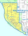
 Seattle - Magnolia map.jpg 1,246 × 1,421; 255 KB
-
 Seattle - Magnolia Village, 1951 (49434832586).jpg 3,089 × 2,401; 1.04 MB
-
 Seattle - Magnolia Village, 1951 (51398997047).jpg 3,059 × 2,400; 2.2 MB
-
 Seattle - ofo bike 01.jpg 4,288 × 2,848; 6.31 MB
-
 Seattle - ofo bike 02.jpg 2,848 × 4,288; 5.55 MB
-
 Seattle - Paving work at 35th W & W McGraw, 1963.jpg 1,200 × 962; 412 KB
-
 Seattle - Perkins Lane and Alki from Discovery Park 01.jpg 5,847 × 3,803; 7.24 MB
-
 Seattle - Perkins Lane from beach, 1951.jpg 1,200 × 934; 446 KB
-
 Seattle - Perkins Lane from Discovery Park 01.jpg 5,854 × 3,815; 9.33 MB
-
 Seattle - Perkins Lane landslide, 1937 (22526893603).jpg 1,200 × 860; 440 KB
-
 Seattle - Road work on Magnolia Boulevard, 1910 (49340177721).jpg 1,200 × 927; 286 KB
-
 Seattle - Sewer break at 32nd & Bertona, 1957 (52003372082).jpg 1,200 × 929; 676 KB
-
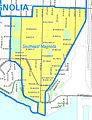 Seattle - Southeast Magnolia map.jpg 658 × 858; 117 KB
-
 Seattle - Terminal 86 and environs from the water.jpg 6,000 × 4,000; 10.65 MB
-
 Seattle - View toward Ray's Boathouse from Henry L. Kotkins Pier 01.jpg 6,000 × 4,000; 11 MB
-
 Seattle - View toward Ray's Boathouse from Henry L. Kotkins Pier 02.jpg 6,000 × 4,000; 12.19 MB
-
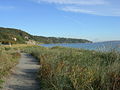
 Seattle - woods upland of Magnolia Tidelands Park 01.jpg 6,000 × 4,000; 13.39 MB
-
 Seattle - woods upland of Magnolia Tidelands Park 02.jpg 6,000 × 4,000; 13.68 MB
-
 Seattle - woods upland of Magnolia Tidelands Park 03.jpg 4,000 × 6,000; 13.68 MB
-
 Seattle - woods upland of Magnolia Tidelands Park 04.jpg 6,000 × 4,000; 13.44 MB
-
 Seattle - woods upland of Magnolia Tidelands Park 05.jpg 6,000 × 4,000; 13.32 MB
-
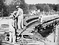 Seattle - Workers on W. Howe Street Bridge, 1947 (51176698026).jpg 3,086 × 2,400; 2.82 MB
-
 Seattle 2013.jpg 4,608 × 3,456; 5.28 MB
-
 Seattle City Council District 7 neighborhoods.png 2,422 × 2,422; 2.29 MB
-
 Seattle Harbor Police boat, 1963 (28715104106).jpg 1,200 × 944; 441 KB
-
 Seattle Map - Magnolia.png 394 × 698; 14 KB
-
 Seattle skyline from Ella Bailey Park, June 2022.jpg 3,426 × 2,258; 2.71 MB
-
 South Side of Salmon Bay, Seattle, 1889 (MOHAI 4164).jpg 700 × 434; 63 KB
-


.jpg)
.jpeg)

.jpg)


.jpeg)
.jpeg)
.jpeg)

.jpg)
.jpeg)
.jpeg)


.jpg)


.jpeg)

.jpg)
.jpeg)
.jpeg)
.jpeg)
.jpeg)
.jpeg)

.jpg)
.jpeg)
.jpg)

.jpg)

.jpg)
.jpg)
.jpg)
.jpg)
.jpg)
.jpg)
.jpg)
.jpg)
.jpg)


.jpg)
.jpg)


.jpg)
.jpg)
.jpg)


.jpg)


.jpg)

.jpg)
.jpg)
.jpg)