Category:Londonthorpe and Harrowby Without
Jump to navigation
Jump to search

civil parish in South Kesteven | |||||
| Upload media | |||||
| Instance of | |||||
|---|---|---|---|---|---|
| Location | South Kesteven, Lincolnshire, East Midlands, England | ||||
| Has part(s) | |||||
 | |||||
Subcategories
This category has the following 11 subcategories, out of 11 total.
Media in category "Londonthorpe and Harrowby Without"
The following 130 files are in this category, out of 130 total.
-
 A grade II listed bus shelter (geograph 6712717).jpg 3,749 × 4,148; 7.38 MB
-
 A pair of Land Settlement Association houses - geograph.org.uk - 5675276.jpg 1,024 × 768; 195 KB
-
 A small stream crosses the golf course - geograph.org.uk - 1764575.jpg 2,848 × 2,136; 2.96 MB
-
 A tee off area on Belton Park golf course - geograph.org.uk - 1764679.jpg 2,848 × 2,136; 2.98 MB
-
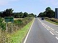
 A52 (High Dike) - geograph.org.uk - 4214714.jpg 640 × 480; 242 KB
-
 A52 approaching roundabout - geograph.org.uk - 3076522.jpg 640 × 480; 47 KB
-
 A52 Eastbound - geograph.org.uk - 4217036.jpg 640 × 480; 253 KB
-
 A52 heading west - geograph.org.uk - 3076518.jpg 640 × 480; 44 KB
-
 A52 near Cold Harbour - geograph.org.uk - 4214562.jpg 640 × 480; 284 KB
-

-
 A52 towards Spalding and Boston - geograph.org.uk - 4214555.jpg 640 × 480; 271 KB
-
 A52 westbound - geograph.org.uk - 5787029.jpg 640 × 439; 39 KB
-
 A52 westbound - geograph.org.uk - 5787038.jpg 640 × 419; 42 KB
-
 A52 westbound - geograph.org.uk - 5787043.jpg 640 × 480; 51 KB
-
 A52 westbound - geograph.org.uk - 5787050.jpg 640 × 420; 45 KB
-
 Access road to underground reservoir - geograph.org.uk - 3076029.jpg 640 × 480; 74 KB
-

-
 An uphill A52 heading east - geograph.org.uk - 3176072.jpg 640 × 480; 71 KB
-
 B6403 towards Colsterworth - geograph.org.uk - 3076527.jpg 640 × 480; 76 KB
-
 B6403, High Dike near Old Somerby - geograph.org.uk - 4214548.jpg 640 × 427; 223 KB
-

-
 Belton Lane, Grantham - geograph.org.uk - 3905418.jpg 4,272 × 2,848; 5.82 MB
-
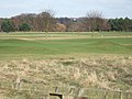 Belton Park golf course - geograph.org.uk - 1764567.jpg 2,848 × 2,136; 3.05 MB
-
 Belton Park Golf Course - geograph.org.uk - 4116914.jpg 640 × 480; 279 KB
-
 Belton Park Golf Course - geograph.org.uk - 4117005.jpg 640 × 480; 327 KB
-
 Cottage on Harrowby Lane - geograph.org.uk - 208800.jpg 640 × 427; 65 KB
-
 Cottages at Harrowby - geograph.org.uk - 5675330.jpg 1,024 × 768; 122 KB
-
 Covered reservoir, Harrowby - geograph.org.uk - 5674115.jpg 1,024 × 768; 123 KB
-
 Crop field off Turnor Road - geograph.org.uk - 3076041.jpg 640 × 480; 93 KB
-
 Cross country fence - geograph.org.uk - 1764624.jpg 2,848 × 2,136; 2.86 MB
-
 Drifting snow on Whalebone Lane (geograph 3382319).jpg 640 × 480; 70 KB
-
 Drifting snow on Whalebone Lane - geograph.org.uk - 3382313.jpg 640 × 480; 53 KB
-
 Driveway to Manthorpe Mill - geograph.org.uk - 3947034.jpg 3,776 × 2,520; 3.86 MB
-
 Entrance to Grantham (Somerby) Driving Test Centre - geograph.org.uk - 6215796.jpg 2,592 × 1,944; 1.39 MB
-
 Entrance to Londonthorpe Wood near Grantham - geograph.org.uk - 1764673.jpg 2,848 × 2,136; 3.04 MB
-

-

-
 Farm track near Harrowby Hall - geograph.org.uk - 5675325.jpg 1,024 × 760; 272 KB
-
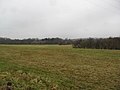 Farmland near Grantham - geograph.org.uk - 3346654.jpg 640 × 480; 56 KB
-
 Farmland near Londonthorpe - geograph.org.uk - 3076072.jpg 640 × 480; 87 KB
-
 Farmland off High Dike - geograph.org.uk - 3076044.jpg 640 × 480; 90 KB
-
 Farmland off High Dike - geograph.org.uk - 3076057.jpg 640 × 480; 48 KB
-
 Farmland off the B6403 - geograph.org.uk - 3076525.jpg 640 × 480; 34 KB
-
 Farmland off Turnor Road - geograph.org.uk - 341108.jpg 640 × 427; 83 KB
-
 Farmland off Whalebone Lane - geograph.org.uk - 3176073.jpg 640 × 480; 89 KB
-
 Fence and Gate, Belton Park - geograph.org.uk - 4117011.jpg 640 × 480; 333 KB
-
 Field edge, Spittlegate Heath - geograph.org.uk - 6322113.jpg 1,024 × 768; 186 KB
-

-
 Footpath off Turnor Road - geograph.org.uk - 3076036.jpg 640 × 480; 121 KB
-
 Footpath towards Londonthorpe - geograph.org.uk - 3076085.jpg 640 × 492; 73 KB
-
 Former Land Settlement Association smallholding - geograph.org.uk - 5674126.jpg 1,024 × 768; 161 KB
-
 Former Land Settlement Association smallholding - geograph.org.uk - 5675286.jpg 1,024 × 768; 285 KB
-
 Grantham (Somerby) Driving Test Centre - geograph.org.uk - 6215815.jpg 2,592 × 1,944; 1.38 MB
-
 Grassland and pylons - geograph.org.uk - 6212790.jpg 1,024 × 768; 185 KB
-
 Green Lane near Harrowby - geograph.org.uk - 208801.jpg 640 × 427; 128 KB
-
 Hall Farm Cottages - geograph.org.uk - 5674375.jpg 1,024 × 768; 139 KB
-
 Hall farm house (geograph 6712731).jpg 6,252 × 4,164; 3.95 MB
-
 Harrowby from Turnor Lane - geograph.org.uk - 5675355.jpg 1,024 × 768; 126 KB
-
 Harrowby Hall Farm - geograph.org.uk - 5674098.jpg 1,024 × 768; 184 KB
-
 Harrowby Lane - geograph.org.uk - 2881780.jpg 1,280 × 853; 487 KB
-
 Harrowby Lane heading east - geograph.org.uk - 3076030.jpg 640 × 480; 86 KB
-
 HARROWBY SETTLEMENTS.jpg 2,307 × 1,648; 1.05 MB
-
 High Dike (B6403) heading north - geograph.org.uk - 3076050.jpg 640 × 480; 84 KB
-
 High Dike (B6403) heading north - geograph.org.uk - 3076059.jpg 640 × 480; 81 KB
-
 High Dike (B6403) heading north - geograph.org.uk - 3076062.jpg 640 × 480; 65 KB
-
 High Dike (B6403) heading north - geograph.org.uk - 3076066.jpg 640 × 480; 103 KB
-
 High Dike (B6403) heading north - geograph.org.uk - 3076070.jpg 640 × 480; 71 KB
-

-
 Junction on B6403 - geograph.org.uk - 3899952.jpg 4,272 × 2,848; 4.74 MB
-
 Lake in a country park - geograph.org.uk - 1764473.jpg 2,848 × 2,136; 3.06 MB
-
 Lake in the park - geograph.org.uk - 1764459.jpg 2,848 × 2,136; 3.17 MB
-
 Land Settlement Association houses - geograph.org.uk - 5674088.jpg 1,024 × 768; 185 KB
-
 Lincolnshire landscape - geograph.org.uk - 4326871.jpg 640 × 430; 37 KB
-
 Londonthorpe poppies - geograph.org.uk - 473513.jpg 640 × 427; 88 KB
-
 Londonthorpe Road - geograph.org.uk - 3905430.jpg 4,272 × 2,848; 5.18 MB
-
 Londonthorpe Wood - geograph.org.uk - 208678.jpg 640 × 427; 172 KB
-
 Meadow near Heath Farm with Triangulation Pillar - geograph.org.uk - 3890809.jpg 4,000 × 3,000; 4.85 MB
-
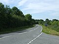
 Minor road towards Belton - geograph.org.uk - 3076087.jpg 640 × 480; 72 KB
-
 Minor Road towards Grantham - geograph.org.uk - 3076081.jpg 640 × 480; 64 KB
-
 New woodland creation at Londonthorpe Wood - geograph.org.uk - 2390354.jpg 1,024 × 681; 480 KB
-
 Newgate Lane - geograph.org.uk - 2881782.jpg 1,280 × 853; 359 KB
-
 Newgate Lane towards Londonthorpe - geograph.org.uk - 3899747.jpg 4,272 × 2,848; 6.21 MB
-
 Pair of Land Settlement Association houses - geograph.org.uk - 5674519.jpg 1,024 × 768; 105 KB
-
 Perimeter fence, Army Barracks - geograph.org.uk - 3176070.jpg 640 × 480; 150 KB
-
 Prince William of Gloucester Barracks (ex RAF Spitalgate) - geograph.org.uk - 6260596.jpg 4,608 × 3,072; 5.98 MB
-
 Public Footpath at end of Turnor Road - geograph.org.uk - 2881797.jpg 682 × 1,024; 277 KB
-
 Pylons near Londonthorpe - geograph.org.uk - 5674145.jpg 1,024 × 768; 98 KB
-
 Radio mast - geograph.org.uk - 130334.jpg 640 × 427; 55 KB
-
 Radio mast at British Gas Alma wood site - geograph.org.uk - 2877717.jpg 682 × 1,024; 156 KB
-
 Red and White - geograph.org.uk - 473518.jpg 640 × 427; 114 KB
-
 Road Junction with A52 - geograph.org.uk - 3187598.jpg 3,088 × 2,056; 1.1 MB
-
 Silent Flight National Finals - geograph.org.uk - 1062728.jpg 640 × 425; 66 KB
-
 Single Land Settlement Association House - geograph.org.uk - 5675270.jpg 1,024 × 768; 120 KB
-
 Snowy parkland - geograph.org.uk - 1624537.jpg 640 × 426; 59 KB
-
 Somerby Hill near Army Barracks - geograph.org.uk - 2881799.jpg 1,280 × 853; 351 KB
-
 Somerby Hill, A52 - geograph.org.uk - 4214810.jpg 640 × 480; 278 KB
-
 Somerby Hill, Grantham - geograph.org.uk - 4214811.jpg 640 × 480; 250 KB
-
 South Lodge, Belton Park (geograph 6632875).jpg 1,024 × 768; 238 KB
-
 Spring is in the air - geograph.org.uk - 5354114.jpg 4,608 × 3,456; 3.41 MB
-
 The B6403, High Dike joins the A52 - geograph.org.uk - 2995547.jpg 800 × 600; 79 KB
-
 The Hermitage - geograph.org.uk - 5363774.jpg 1,024 × 683; 420 KB
-
 The Hermitage - geograph.org.uk - 5363780.jpg 1,024 × 683; 403 KB
-
 The old flying field at RAF Spitalgate - geograph.org.uk - 6260601.jpg 4,608 × 3,072; 4.78 MB
-
-
 The Witham valley - geograph.org.uk - 6363614.jpg 1,024 × 768; 102 KB
-
 Three against one - geograph.org.uk - 5354119.jpg 2,961 × 2,219; 1.52 MB
-
 Towards Grantham - geograph.org.uk - 2624390.jpg 640 × 497; 96 KB
-
 Track beside Londonthorpe Wood (geograph 3076080).jpg 640 × 480; 112 KB
-
 Track off Londonthorpe Road - geograph.org.uk - 3905458.jpg 4,272 × 2,848; 7.51 MB
-
 Track off Whalebone Lane - geograph.org.uk - 3104833.jpg 1,504 × 2,256; 2.02 MB
-
 Turnor Road - geograph.org.uk - 3899736.jpg 4,272 × 2,848; 5.84 MB
-
 Turnor road facing east - geograph.org.uk - 2881788.jpg 1,280 × 853; 379 KB
-
 Turnor Road heading east - geograph.org.uk - 3076039.jpg 640 × 480; 75 KB
-

-
 Undergoing conversion - geograph.org.uk - 5678832.jpg 1,024 × 768; 193 KB
-
 Uphill track at the side of Londonthorpe Wood, Grantham - geograph.org.uk - 1764662.jpg 2,848 × 2,136; 3.15 MB
-
 View towards Bellmount Plantation - geograph.org.uk - 5674132.jpg 1,024 × 768; 161 KB
-

-
 Wentworth Drive - geograph.org.uk - 3349185.jpg 640 × 480; 52 KB
-

-
 Westbound A52 - geograph.org.uk - 4214779.jpg 640 × 480; 255 KB
-
 Whalebone Lane - geograph.org.uk - 3079067.jpg 2,256 × 1,504; 1.95 MB
-
 Whalebone Lane - geograph.org.uk - 3176074.jpg 640 × 480; 115 KB
-
 Whalebone Lane - geograph.org.uk - 3205224.jpg 1,600 × 2,220; 657 KB
-
 Whalebone Lane - geograph.org.uk - 3205254.jpg 640 × 420; 111 KB
-
 Whalebone Lane - geograph.org.uk - 3382306.jpg 640 × 480; 66 KB
-
 Whalebone Lane - geograph.org.uk - 6322114.jpg 1,024 × 768; 349 KB
-
 Woodnook, the home of Kesteven RFC - geograph.org.uk - 2995558.jpg 800 × 600; 84 KB
-
 East Towthorpe Hollow Pond, Belton Park - geograph.org.uk - 268027.jpg 640 × 427; 103 KB
-
 Strip woodland on High Dike - geograph.org.uk - 341125.jpg 640 × 427; 104 KB
.jpg)


_-_geograph.org.uk_-_4214714.jpg)


.jpg)


_Driving_Test_Centre_-_geograph.org.uk_-_6215796.jpg)


_Driving_Test_Centre_-_geograph.org.uk_-_6215815.jpg)


.jpg)


_heading_north_-_geograph.org.uk_-_3076050.jpg)
_heading_north_-_geograph.org.uk_-_3076059.jpg)
_heading_north_-_geograph.org.uk_-_3076062.jpg)
_heading_north_-_geograph.org.uk_-_3076066.jpg)
_heading_north_-_geograph.org.uk_-_3076070.jpg)


_-_geograph.org.uk_-_6260596.jpg)


.jpg)


.jpg)


