Category:London Borough of Ealing
Jump to navigation
Jump to search
Boroughs of London: City of London · City of Westminster · Barking and Dagenham · Barnet · Bexley · Brent · Bromley · Camden · Croydon · Ealing · Enfield · Greenwich · Hackney · Hammersmith and Fulham · Haringey · Harrow · Havering · Hillingdon · Hounslow · Islington · Kensington and Chelsea · Kingston · Lambeth · Lewisham · Merton · Newham · Redbridge · Richmond · Southwark · Sutton · Tower Hamlets · Waltham Forest · Wandsworth
borough in the London Region in England   | |||||
| Upload media | |||||
| Instance of | |||||
|---|---|---|---|---|---|
| Location | Greater London, London, England | ||||
| Capital | |||||
| Legislative body |
| ||||
| Executive body |
| ||||
| Head of government |
| ||||
| Inception |
| ||||
| Population |
| ||||
| Area |
| ||||
| Different from | |||||
| official website | |||||
 | |||||
Subcategories
This category has the following 24 subcategories, out of 24 total.
Media in category "London Borough of Ealing"
The following 200 files are in this category, out of 2,737 total.
(previous page) (next page)-
 "Cafe Open" (NOT) on Christmas Day - geograph.org.uk - 2740144.jpg 2,613 × 1,961; 1.7 MB
-

-
 "Rehearsal Rooms" apartment block, North Acton - geograph.org.uk - 5680739.jpg 2,191 × 1,651; 1.35 MB
-

-
 "Wrong" gate and fence in conservation area - geograph.org.uk - 1842158.jpg 1,280 × 957; 889 KB
-
 'Empire' at Engineer's Wharf - geograph.org.uk - 3178327.jpg 640 × 480; 114 KB
-
 'Ghost sign', Hanwell - geograph.org.uk - 4337666.jpg 1,400 × 935; 965 KB
-
 'Mount View', Mount Avenue - geograph.org.uk - 5361129.jpg 1,024 × 683; 204 KB
-
-
 19 storey tent for student residence - geograph.org.uk - 4120805.jpg 3,542 × 2,657; 1.1 MB
-
 1A East Churchfield Road - geograph.org.uk - 2767432.jpg 1,280 × 938; 441 KB
-
 31 storey student residence by London Overground, Acton - geograph.org.uk - 6249755.jpg 3,394 × 2,594; 1.52 MB
-
 395 bus on Castle Road, Northolt - geograph.org.uk - 3964868.jpg 2,304 × 1,728; 835 KB
-
 5-a-side football, North Acton Playing Field - geograph.org.uk - 5490214.jpg 3,648 × 2,736; 2.25 MB
-
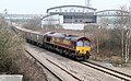
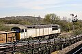 56103 Gets The Road - geograph.org.uk - 5303912.jpg 1,600 × 1,048; 618 KB
-
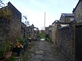 A back alley in Harlesden - geograph.org.uk - 3769416.jpg 4,000 × 3,000; 3.92 MB
-
 A back alley in Harlesden - geograph.org.uk - 3769435.jpg 4,000 × 3,000; 4.5 MB
-
 A Brand New Avenue - geograph.org.uk - 6300352.jpg 5,334 × 3,126; 1.94 MB
-
 A glimpse of the Sikh temple, Southall - geograph.org.uk - 4127111.jpg 640 × 480; 113 KB
-
 A green in West Acton - geograph.org.uk - 4121969.jpg 4,000 × 3,000; 4.05 MB
-
-
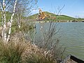 A lake in Northala Fields - geograph.org.uk - 4916707.jpg 4,608 × 3,456; 3.36 MB
-
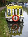
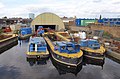
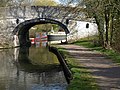
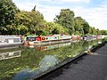
 A lock on the Grand Union Canal - geograph.org.uk - 4110365.jpg 4,000 × 3,000; 3.96 MB
-

-
-
-
 A small dock - geograph.org.uk - 4001168.jpg 640 × 430; 54 KB
-
 A small dock - geograph.org.uk - 4001170.jpg 640 × 430; 85 KB
-
 A Small Patch of Woodland - geograph.org.uk - 5194196.jpg 1,024 × 768; 429 KB
-
 A view to two old churches - geograph.org.uk - 4917597.jpg 4,608 × 3,456; 3.97 MB
-
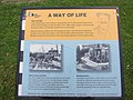 A Way of Life information board - geograph.org.uk - 2512033.jpg 640 × 480; 87 KB
-
 A.G.V.A., W3 - geograph.org.uk - 2057751.jpg 3,504 × 2,336; 1.97 MB
-
 A1 Washing Machines, Hanwell - geograph.org.uk - 3947894.jpg 640 × 430; 63 KB
-
 A312 - A4090 Junction - geograph.org.uk - 5665489.jpg 640 × 425; 67 KB
-
 A312 - geograph.org.uk - 5397885.jpg 640 × 425; 47 KB
-
 A312 - geograph.org.uk - 5559014.jpg 640 × 426; 61 KB
-
 A312 - geograph.org.uk - 5649952.jpg 640 × 426; 58 KB
-
 A312 - geograph.org.uk - 5665729.jpg 640 × 426; 39 KB
-
 A312 -A4090 - geograph.org.uk - 5558682.jpg 640 × 299; 52 KB
-
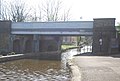
 A40 Bridge, Grand Union Canal - geograph.org.uk - 3987566.jpg 640 × 430; 85 KB
-
 A40 Bridge, Grand Union Canal - geograph.org.uk - 3987569.jpg 640 × 430; 69 KB
-
 A40 near Hanger Lane - geograph.org.uk - 3461341.jpg 640 × 430; 59 KB
-
 A4020, A4000 junction - geograph.org.uk - 4059362.jpg 640 × 430; 71 KB
-
 A406 Aqueduct - geograph.org.uk - 3046030.jpg 640 × 429; 81 KB
-
 A406 At Night - geograph.org.uk - 2335253.jpg 1,600 × 1,145; 478 KB
-
 A406 enters the Hanger Lane Gyratory - geograph.org.uk - 4144827.jpg 4,000 × 2,307; 1.06 MB
-
 A4090 - geograph.org.uk - 5885787.jpg 1,024 × 511; 99 KB
-
 A4090-A312 junction - geograph.org.uk - 5394126.jpg 640 × 426; 53 KB
-

-
-
 Access Self Storage, West Ealing - geograph.org.uk - 2865772.jpg 640 × 366; 63 KB
-
 Acock Grove - geograph.org.uk - 4469794.jpg 2,000 × 1,167; 1.39 MB
-
 Across The Broadway - geograph.org.uk - 6150032.jpg 1,024 × 768; 593 KB
-
 Across the lakes in Northala Fields - geograph.org.uk - 4916701.jpg 4,608 × 3,456; 3.35 MB
-
 Acton Baptist Church - geograph.org.uk - 5561876.jpg 1,024 × 768; 154 KB
-
 Acton Bound - geograph.org.uk - 3413718.jpg 1,600 × 985; 1.26 MB
-
 Acton Cemetery bridge - geograph.org.uk - 4996222.jpg 640 × 480; 143 KB
-
 Acton crossrail diveunder, view East 2017 - geograph.org.uk - 5490114.jpg 3,648 × 2,736; 3.2 MB
-
 Acton Crossrail diveunder, view West 2017 - geograph.org.uk - 5490127.jpg 3,648 × 2,736; 3.04 MB
-
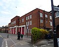 Acton Fire Station - geograph.org.uk - 6120056.jpg 640 × 512; 76 KB
-
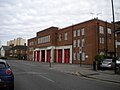 Acton Fire Station, Gunnersbury Lane - geograph.org.uk - 5561866.jpg 1,024 × 768; 140 KB
-
 Acton Green Common - geograph.org.uk - 6151724.jpg 4,758 × 3,412; 2.32 MB
-
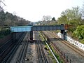
 Acton Lane Junction - geograph.org.uk - 2205640.jpg 1,280 × 872; 280 KB
-
 Acton marshalling yard - geograph.org.uk - 3383556.jpg 640 × 360; 55 KB
-
 Acton Park - geograph.org.uk - 5352954.jpg 3,439 × 2,592; 2.78 MB
-
 Acton Park Lodge - geograph.org.uk - 4088641.jpg 4,000 × 3,000; 3.84 MB
-
 Acton Park Lodge and the Acton Waterwise Garden - geograph.org.uk - 4086404.jpg 4,000 × 3,000; 4.38 MB
-
 Acton Police Station - geograph.org.uk - 6120049.jpg 800 × 625; 93 KB
-
 Acton sewage pumping station - geograph.org.uk - 2768117.jpg 1,280 × 950; 654 KB
-
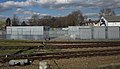
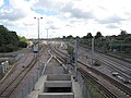
 Acton sidings - geograph.org.uk - 5201438.jpg 640 × 426; 52 KB
-
 Acton sidings - geograph.org.uk - 5587991.jpg 640 × 426; 67 KB
-
 Acton sidings - geograph.org.uk - 5587992.jpg 640 × 426; 73 KB
-
 Acton sidings - geograph.org.uk - 5683226.jpg 640 × 426; 68 KB
-
 Acton sidings - geograph.org.uk - 5683228.jpg 640 × 426; 74 KB
-
 Acton Sidings - geograph.org.uk - 5796195.jpg 640 × 426; 76 KB
-
 Acton Sidings - geograph.org.uk - 5796196.jpg 640 × 426; 67 KB
-
 Acton Sidings - geograph.org.uk - 5796197.jpg 640 × 425; 67 KB
-
 Acton Sidings - geograph.org.uk - 6026364.jpg 1,024 × 681; 112 KB
-
 Acton sorting office, W3 - geograph.org.uk - 2138530.jpg 3,504 × 2,336; 1.97 MB
-
 Acton Town Hotel - geograph.org.uk - 2645096.jpg 640 × 452; 123 KB
-
 Acton Town Hotel, blocks of rooms, off Gunnersbury Lane - geograph.org.uk - 4397088.jpg 1,600 × 1,064; 452 KB
-
 Acton Waterwise Garden - geograph.org.uk - 2767407.jpg 1,280 × 1,013; 1.04 MB
-
 Acton Works Entrance - geograph.org.uk - 3755048.jpg 1,600 × 1,067; 585 KB
-
 Acton, Bollo Bridge Road - geograph.org.uk - 3140269.jpg 3,388 × 2,231; 6.38 MB
-
-
 Acton, Gala Bingo Club - geograph.org.uk - 2205378.jpg 640 × 480; 77 KB
-
 Acton, The 'Goldsmith's Arms' - geograph.org.uk - 4352768.jpg 2,816 × 2,112; 1.36 MB
-
 Acton, The Windmill - geograph.org.uk - 2216480.jpg 640 × 480; 74 KB
-
 Adelaide Dock - geograph.org.uk - 2083931.jpg 640 × 420; 71 KB
-
 Adelaide Dock in Southall - geograph.org.uk - 4630480.jpg 800 × 556; 120 KB
-
 Adelaide Dock, Grand Union Canal - geograph.org.uk - 6300670.jpg 5,472 × 3,648; 2.11 MB
-
 Advertising outside Perivale sports ground - geograph.org.uk - 3066076.jpg 1,600 × 1,200; 578 KB
-
 Aladdin Tower now open as Dunelm Mill store - geograph.org.uk - 2968852.jpg 1,600 × 1,200; 344 KB
-
 Alexandra House, seen from Church Road, W3 - geograph.org.uk - 4397061.jpg 1,600 × 1,064; 409 KB
-
 All ways pedestrian crossing - geograph.org.uk - 2766820.jpg 1,280 × 960; 539 KB
-
 Alley off Castle Road, Northolt - geograph.org.uk - 3964777.jpg 2,304 × 1,728; 755 KB
-
 Allied Way - geograph.org.uk - 2768073.jpg 1,280 × 960; 461 KB
-
 Allington Close, Greenford - geograph.org.uk - 4800687.jpg 2,304 × 1,728; 828 KB
-
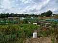
 Allotment Gardens, Dormers Wells Lane, Southall - geograph.org.uk - 1812860.jpg 1,024 × 678; 247 KB
-
 Allotments at Bixley Field - geograph.org.uk - 4109102.jpg 4,000 × 3,000; 4.35 MB
-
 Allotments at Bixley Field - geograph.org.uk - 4110357.jpg 4,000 × 3,000; 4.31 MB
-
 Allotments by the River Brent - geograph.org.uk - 3501802.jpg 640 × 430; 121 KB
-
 Allotments by the River Brent - geograph.org.uk - 3947948.jpg 640 × 430; 87 KB
-
 Allotments in Hanwell - geograph.org.uk - 5769256.jpg 4,896 × 3,672; 6.02 MB
-
 Allotments on Northfield Avenue - geograph.org.uk - 5558950.jpg 1,600 × 1,192; 674 KB
-
 Allotments, The Crescent, East Acton - geograph.org.uk - 2075051.jpg 3,648 × 2,736; 5.61 MB
-
 Along Woodville Road - geograph.org.uk - 6150035.jpg 768 × 1,024; 764 KB
-
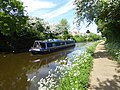
 Alperton, moorings - geograph.org.uk - 4891079.jpg 1,024 × 768; 174 KB
-
 Alwyne Road Park - geograph.org.uk - 4110516.jpg 4,000 × 3,000; 4.16 MB
-
 An Acton Rec - geograph.org.uk - 3066138.jpg 640 × 429; 71 KB
-
 An Artist's House - geograph.org.uk - 6151701.jpg 5,152 × 3,864; 3.07 MB
-
 An overflowing Hanwell Bottom Lock No 97 - geograph.org.uk - 4631316.jpg 800 × 603; 148 KB
-
 Apartments, Devon Close - geograph.org.uk - 3789474.jpg 640 × 430; 79 KB
-
 Apartments, Engineer's Wharf - geograph.org.uk - 3979003.jpg 640 × 430; 62 KB
-
 Apartments, Engineer's Wharf - geograph.org.uk - 3979007.jpg 640 × 430; 76 KB
-
 Apartments, North Acton - geograph.org.uk - 3275027.jpg 480 × 640; 86 KB
-
-
 Approaching a lock on the Grand Union Canal - geograph.org.uk - 4109115.jpg 4,000 × 3,000; 4.12 MB
-
 Approaching Greenford - geograph.org.uk - 5303932.jpg 1,600 × 1,078; 621 KB
-
 Approaching Osterley Lock - geograph.org.uk - 3037368.jpg 1,600 × 1,056; 910 KB
-
-

-
 Aqueduct, Grand Union Canal - geograph.org.uk - 3804295.jpg 640 × 430; 83 KB
-
 Aqueduct, Grand Union Canal - geograph.org.uk - 3804300.jpg 640 × 430; 73 KB
-
 Aqueduct, Grand Union Canal - geograph.org.uk - 3804323.jpg 640 × 430; 55 KB
-
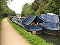
 Aquilion - coastal motor barge on Paddington Arm canal - geograph.org.uk - 4445731.jpg 3,648 × 2,736; 2.52 MB
-
 Arcadia Centre boarded up after riots - geograph.org.uk - 2550102.jpg 2,191 × 1,643; 662 KB
-
 Arcadia, narrowboat on Paddington Branch Canal - geograph.org.uk - 4598589.jpg 3,648 × 2,736; 3.48 MB
-
 Arethusa - narrowboat on Paddington Arm, Grand Union Canal - geograph.org.uk - 4446877.jpg 3,648 × 2,736; 3.95 MB
-
 Ark Priory Primary Academy, Acton W3 - geograph.org.uk - 6120045.jpg 800 × 552; 121 KB
-
 Artistic License, Horsenden Farm - geograph.org.uk - 4236506.jpg 2,688 × 2,036; 1.17 MB
-
 Aston Road meets Woodville Road - geograph.org.uk - 6150037.jpg 768 × 1,024; 551 KB
-
 Asylum Lock, Grand Union Canal, Hanwell - geograph.org.uk - 2656945.jpg 2,560 × 1,920; 991 KB
-
 At Hanger Lane, heading south - geograph.org.uk - 5499254.jpg 3,484 × 2,308; 2.02 MB
-
 At the end of Greenhill Gardens - geograph.org.uk - 6099375.jpg 1,600 × 1,225; 702 KB
-
 Athletics Ground, Perivale Park - geograph.org.uk - 4224961.jpg 1,600 × 1,200; 436 KB
-
 Auriol Drive - geograph.org.uk - 3700148.jpg 1,600 × 1,067; 727 KB
-
 Auriol Drive - geograph.org.uk - 3776573.jpg 640 × 430; 61 KB
-
 Autumn Afternoon in Tentelow Wood - geograph.org.uk - 5596599.jpg 800 × 600; 341 KB
-
 Autumn colours - geograph.org.uk - 6053067.jpg 1,024 × 681; 343 KB
-
 Autumn colours in a cutting - geograph.org.uk - 6053066.jpg 1,024 × 681; 194 KB
-
 Autumn in a cutting - geograph.org.uk - 5645468.jpg 640 × 426; 117 KB
-
 Avenue of trees in Ravenor Park - geograph.org.uk - 5753116.jpg 4,000 × 3,000; 4.91 MB
-
 Average speed check warning sign, A40 Western Avenue - geograph.org.uk - 4718319.jpg 3,648 × 2,736; 2.19 MB
-
 Ayr Court, Hanger Hill - geograph.org.uk - 3520651.jpg 2,325 × 1,581; 845 KB
-
 B4492 Bridge, Grand Union Canal - geograph.org.uk - 3807288.jpg 640 × 430; 75 KB
-
 B490 - B409 junction - geograph.org.uk - 4062861.jpg 640 × 430; 109 KB
-
 B490 - B491 junction - geograph.org.uk - 4059668.jpg 640 × 430; 63 KB
-
 Badger - narrowboat on Paddington Arm, Grand Union Canal - geograph.org.uk - 4446535.jpg 3,648 × 2,736; 3.08 MB
-
 Bai-Hu of Braunston, narrowboat on Paddington Branch canal - geograph.org.uk - 4638235.jpg 3,648 × 2,736; 3.81 MB
-

-
-
 Bakery loading bay - geograph.org.uk - 3166734.jpg 640 × 480; 95 KB
-
 Bakery on Oldfield Lane North - geograph.org.uk - 5898095.jpg 1,024 × 768; 253 KB
-
 Ballot Box Bridge - geograph.org.uk - 2864565.jpg 640 × 441; 99 KB
-
 Ballot Box Bridge - geograph.org.uk - 2864611.jpg 640 × 480; 107 KB
-
 Ballot Box public house near Sudbury - geograph.org.uk - 5423985.jpg 1,600 × 1,200; 486 KB
-
 Balzac, narrowboat on Paddington Branch canal - geograph.org.uk - 4598892.jpg 3,648 × 2,736; 3.8 MB
-
 Baptist chapel, Church Street, Acton - geograph.org.uk - 4402532.jpg 1,064 × 1,600; 281 KB
-
 Barber's shop, Horn Lane, North Acton - geograph.org.uk - 4395038.jpg 1,511 × 1,813; 1.02 MB
-
 Barge for maintenance materials, Grand Union Canal, Osterly - geograph.org.uk - 4793728.jpg 3,648 × 2,736; 3.24 MB
-
 Barge on the River Brent - geograph.org.uk - 3512146.jpg 640 × 430; 68 KB
-
 Barge, Grand Union Canal - geograph.org.uk - 3967192.jpg 640 × 430; 85 KB
-
 Baron's Pond - geograph.org.uk - 2629036.jpg 640 × 480; 215 KB
-
 Baron's Pond - geograph.org.uk - 2629042.jpg 640 × 480; 207 KB
-
 Baron's Pond - geograph.org.uk - 2629051.jpg 640 × 480; 214 KB
-
 Baron's Pond - geograph.org.uk - 4049210.jpg 640 × 430; 92 KB
-
 Barrier to allow cycle access on canal towpath - geograph.org.uk - 2389250.jpg 3,648 × 2,736; 4.46 MB
-
 Barrier to the towpath - geograph.org.uk - 2388112.jpg 640 × 480; 225 KB
-
 Basketball hoops, North Acton Playing Field - geograph.org.uk - 5490195.jpg 2,492 × 1,868; 1.4 MB
-
 Basketball, Jubilee Park - geograph.org.uk - 6093413.jpg 4,495 × 2,708; 1.65 MB
-
 Bay window at The Windmill - geograph.org.uk - 2766878.jpg 960 × 1,280; 667 KB
-
 Beaconsfield Road, Chiswick - geograph.org.uk - 4531895.jpg 2,304 × 1,728; 828 KB
-
-
 Bedford Road at the junction of Broadway - geograph.org.uk - 4261348.jpg 2,304 × 1,728; 814 KB
-
 Bedwyn Bound - geograph.org.uk - 3336480.jpg 1,600 × 1,067; 1.11 MB
-
 Behind the shops - geograph.org.uk - 2327593.jpg 640 × 480; 100 KB
-
 Belfast Islamic Centre, Southall - geograph.org.uk - 2388192.jpg 1,024 × 768; 226 KB
-
 Bell Industrial Estate, Acton Green - geograph.org.uk - 4478729.jpg 2,304 × 1,728; 825 KB
-
 Below the Wharncliffe Viaduct - geograph.org.uk - 5587972.jpg 640 × 426; 56 KB
-
 Belvue Park - geograph.org.uk - 4916647.jpg 4,608 × 3,456; 3.38 MB
-
 Ben Gorton, narrowboat on Paddington Branch canal - geograph.org.uk - 4638316.jpg 3,648 × 2,736; 3.64 MB
-
 Berkshire Court - geograph.org.uk - 2943704.jpg 640 × 430; 83 KB
-
 Bicycle Repair Station by Acton Central Station - geograph.org.uk - 2503590.jpg 1,704 × 1,277; 1.07 MB
-

-
 Big Net on the Golf Course - geograph.org.uk - 4203804.jpg 4,000 × 3,000; 2.42 MB
-
 Bike Bumps - geograph.org.uk - 3531211.jpg 3,888 × 2,592; 1.47 MB
-
 Billy Pilgrim, narrowboat on Paddington Branch canal - geograph.org.uk - 4598866.jpg 3,648 × 2,736; 3.4 MB
-
 Birch Grove, Acton - geograph.org.uk - 5352485.jpg 1,600 × 1,067; 480 KB
-
 Birkbeck Way, Greenford - geograph.org.uk - 4800685.jpg 2,304 × 1,728; 856 KB
-
 Bittern's Field - geograph.org.uk - 3487821.jpg 640 × 430; 116 KB
-
 Bittern's Field - geograph.org.uk - 3487829.jpg 640 × 430; 52 KB
-
 Bittern's Field - geograph.org.uk - 3487833.jpg 640 × 430; 52 KB
-
 Bittern's Field - geograph.org.uk - 3487837.jpg 640 × 430; 53 KB
-
 Bittern's Field - geograph.org.uk - 3487851.jpg 640 × 430; 54 KB
-
 Bittern's Field - geograph.org.uk - 3488139.jpg 640 × 430; 50 KB
-
 Black George - geograph.org.uk - 2949391.jpg 640 × 430; 74 KB
-
 Blossom in Brent Valley Park - geograph.org.uk - 5754489.jpg 4,000 × 3,000; 4.95 MB
-
 Blossom in Islip Manor Park - geograph.org.uk - 4916244.jpg 4,608 × 3,456; 3.4 MB
-
 Blossom in Islip Manor Park - geograph.org.uk - 4916734.jpg 4,608 × 3,456; 3.35 MB
_on_Christmas_Day_-_geograph.org.uk_-_2740144.jpg)


_Joices_Pub_and_Restaurant,_Hanger_Green,_W5_-_geograph.org.uk_-_5478046.jpg)


,_West_Ealing,_London_-_geograph.org.uk_-_6120098.jpg)


_-_geograph.org.uk_-_2768894.jpg)


