Category:Locator maps of former countries of Asia (gray and green globe scheme)
Jump to navigation
Jump to search
Subcategories
This category has only the following subcategory.
Media in category "Locator maps of former countries of Asia (gray and green globe scheme)"
The following 21 files are in this category, out of 21 total.
-
 AfsharidGreatestextentIranica.png 2,000 × 2,000; 733 KB
-
 Al-Andalus Vilayet 750AD.png 3,558 × 3,558; 1.44 MB
-
 Far Eastern Republic (orthographic projection).png 1,995 × 1,995; 730 KB
-
 French indochina map.png 1,000 × 1,000; 297 KB
-
 German New Guinea.png 1,000 × 1,000; 196 KB
-
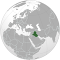 Iraq 1932.png 1,900 × 1,900; 791 KB
-
 Kingdom of Sikkim.png 545 × 540; 96 KB
-
 Kingdom of Thailand World War II orthographic map.png 541 × 541; 112 KB
-
 Maguindanao Sultanate.png 1,000 × 1,000; 291 KB
-
 Map of Outer Mongolian State (1915).png 599 × 599; 128 KB
-
 Map of the Emirate of Afghanistan.png 800 × 800; 192 KB
-
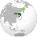
 Map of the Liao Empire.png 2,000 × 2,000; 620 KB
-
 North Kyrgyz Confederation (orthographic projection).png 1,378 × 1,378; 703 KB
-
 Qing Dynasty-1760.png 720 × 720; 202 KB
-
 Russian State (1 Jan 1919).png 6,171 × 6,171; 2.64 MB
-
 Seljuk Empire 1078 (orthographic-projection).png 2,048 × 2,048; 815 KB
-
 South Moluccas (orthographic projection).png 1,000 × 1,000; 195 KB
-

-
 Tuva map.png 1,000 × 1,000; 125 KB
-
 Union of Soviet Socialist Republics (orthographic projection).png 2,000 × 2,000; 818 KB
-
 Xaojie map.png 1,280 × 1,280; 443 KB


.png)


.png)


.png)

.png)
.png)
.png)


.png)
