Category:Locator maps of Sierra Leone
Jump to navigation
Jump to search
Subcategories
This category has the following 4 subcategories, out of 4 total.
Media in category "Locator maps of Sierra Leone"
The following 11 files are in this category, out of 11 total.
-
 Location Sierra Leone AU Africa.svg 1,400 × 1,300; 2.17 MB
-
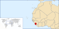 LocationSierraLeone.svg 1,000 × 500; 2.76 MB
-
 Locator map of Sierra Leone in Africa.svg 1,000 × 1,000; 188 KB
-
 Mano River Union.png 650 × 400; 14 KB
-
 Sierra Leone - Location Map (2012) - SLE - UNOCHA.svg 250 × 250; 268 KB
-
 Sierra Leone Eastern.png 443 × 442; 5 KB
-
 Sierra Leone Northern.png 443 × 442; 5 KB
-
 Sierra Leone Southern.png 443 × 442; 5 KB
-
 Sierra Leone Western.png 443 × 442; 5 KB
-
 Sierra-Leone-Kailahun-District-chiefdoms.png 1,522 × 1,659; 54 KB
-
 World Factbook (1982) Sierra Leone.jpg 587 × 588; 79 KB


_-_SLE_-_UNOCHA.svg)


_Sierra_Leone.jpg)