Category:Llantrisant, Monmouthshire
Jump to navigation
Jump to search
village in Monmouthshire, Wales  Eglwys y Seintiau Pedr, Paul ac Ioan, Llantrisant | |||||
| Upload media | |||||
| Instance of | |||||
|---|---|---|---|---|---|
| Location | Monmouthshire, Wales | ||||
 | |||||
Main Wikipedia article: Llantrisant, Monmouthshire.
Subcategories
This category has only the following subcategory.
Media in category "Llantrisant, Monmouthshire"
The following 18 files are in this category, out of 18 total.
-
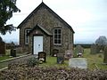 Chapel - geograph.org.uk - 118620.jpg 640 × 481; 56 KB
-
 Church Farm farmhouse (geograph 6906725).jpg 5,179 × 3,451; 4.14 MB
-
 Conifers in Llantrisant churchyard (geograph 6905909).jpg 5,179 × 3,451; 5.37 MB
-
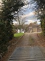
 Footbridge at Llantrisant - geograph.org.uk - 1270506.jpg 640 × 426; 124 KB
-
 Nantybanw, Llantrisant.jpg 3,024 × 4,032; 9.46 MB
-
 Pumping station at Llantrisant - geograph.org.uk - 1270511.jpg 640 × 426; 69 KB
-
 River Usk near Llantrisant - geograph.org.uk - 1273053.jpg 640 × 426; 104 KB
-
 Royal Oak, Llantrisant (geograph 6906742).jpg 5,179 × 3,451; 4.18 MB
-
 Shepherds Cottage - geograph.org.uk - 300215.jpg 640 × 427; 73 KB
-
 Warren Lane - geograph.org.uk - 1241484.jpg 640 × 480; 106 KB
-
 Warren Lane - geograph.org.uk - 1243194.jpg 640 × 480; 98 KB
-
 Barn at Arch Farm - geograph.org.uk - 300201.jpg 640 × 427; 81 KB
-
 Converting the barn at Pen-yr-heol - geograph.org.uk - 300210.jpg 640 × 427; 71 KB
-

-
 River Usk - geograph.org.uk - 120768.jpg 640 × 481; 76 KB
-
 Track to Tump Farm - geograph.org.uk - 300207.jpg 640 × 427; 78 KB
-
 Usk Valley Walk - geograph.org.uk - 252073.jpg 640 × 480; 159 KB
-
 Ysguborwen - geograph.org.uk - 118621.jpg 640 × 481; 37 KB

.jpg)
.jpg)


.jpg)


