Category:Llanigon
Jump to navigation
Jump to search
hamlet in the county of Powys, Wales  | |||||
| Upload media | |||||
| Instance of | |||||
|---|---|---|---|---|---|
| Patron saint |
| ||||
| Location | Powys, Wales | ||||
| Population |
| ||||
| Area |
| ||||
 | |||||
English: Llanigon is a village and community (civil parish) in Powys, Wales on the edge of the Brecon Beacons National Park, north of the Black Mountains. The village has approximately 280 inhabitants (2005). The nearest town is Hay-on-Wye, some 1.5 miles (2 km) to the east.

Subcategories
This category has the following 3 subcategories, out of 3 total.
Media in category "Llanigon"
The following 200 files are in this category, out of 599 total.
(previous page) (next page)-
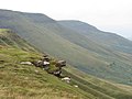
 "Worrying" Sheep with Precipice - geograph.org.uk - 3046088.jpg 3,065 × 1,765; 1.2 MB
-
 4 dustbins in Cusop - geograph.org.uk - 3757342.jpg 800 × 600; 179 KB
-
 518 metre spot height on Gospel Pass - geograph.org.uk - 5971586.jpg 2,560 × 1,920; 2.38 MB
-

-

-
 A growing maize crop - geograph.org.uk - 4041990.jpg 1,024 × 680; 316 KB
-
 A Llanigon Churchyard Yew - geograph.org.uk - 5374379.jpg 960 × 1,440; 969 KB
-
 A lone walker on Offa's Dyke Path - geograph.org.uk - 1108585.jpg 640 × 426; 102 KB
-
 A patchwork of fields in the Wye Valley - geograph.org.uk - 1502742.jpg 640 × 424; 125 KB
-

-
 Above Blaen Bwch - geograph.org.uk - 1589846.jpg 640 × 480; 39 KB
-
 Access land below Hay Bluff - geograph.org.uk - 739010.jpg 640 × 480; 70 KB
-
 Access road to Llangwathan Farm - geograph.org.uk - 3757492.jpg 800 × 610; 175 KB
-
 Afon Honddu terraces - geograph.org.uk - 3046113.jpg 1,728 × 1,296; 821 KB
-
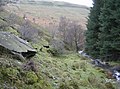
 Afon Honddu, from the footpath to Ty'r Onnen - geograph.org.uk - 5424211.jpg 1,024 × 768; 246 KB
-
 An Interesting Yew - geograph.org.uk - 5374628.jpg 1,556 × 1,038; 1.02 MB
-
 Approaching Gospel Pass - geograph.org.uk - 2840772.jpg 1,600 × 1,200; 940 KB
-
 Approaching Rhiw y Fan - geograph.org.uk - 1748857.jpg 640 × 426; 114 KB
-
 Approaching the summit of Chwarel y Fan - geograph.org.uk - 704256.jpg 639 × 479; 185 KB
-
 April weather in the Black Mountains - geograph.org.uk - 2912410.jpg 640 × 480; 73 KB
-
 Ascending from Gospel Pass to Hay Bluff - geograph.org.uk - 2286630.jpg 1,024 × 768; 138 KB
-

-
 B4350 at Ffordd fawr - geograph.org.uk - 4333452.jpg 800 × 451; 167 KB
-
 B4350 at Pont yr Angel - geograph.org.uk - 4333462.jpg 800 × 451; 175 KB
-
 B4350 at The Hollybush Inn and Campsite - geograph.org.uk - 5327879.jpg 640 × 427; 392 KB
-
 B4350 towards Hay-on-Wye - geograph.org.uk - 5327916.jpg 640 × 480; 359 KB
-
 B4350, Sunnybank - geograph.org.uk - 5327905.jpg 640 × 427; 347 KB
-
 Back on the tarmac - geograph.org.uk - 245038.jpg 640 × 480; 204 KB
-
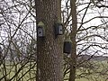 Bat boxes beside the path - geograph.org.uk - 5660328.jpg 640 × 480; 142 KB
-
 Below Hay Bluff - geograph.org.uk - 3264548.jpg 1,771 × 1,184; 611 KB
-
 Below Hay Bluff - geograph.org.uk - 4206782.jpg 640 × 360; 55 KB
-
 Below Hay Bluff - geograph.org.uk - 5276618.jpg 1,000 × 665; 866 KB
-

-
 Bench and bin, Cusop Dingle - geograph.org.uk - 3019913.jpg 640 × 507; 93 KB
-
 Bends Ahead, B4350 near Llanigon - geograph.org.uk - 5327886.jpg 640 × 427; 336 KB
-
 Bends on a stream near Pennant - geograph.org.uk - 2343868.jpg 4,000 × 3,000; 4.31 MB
-
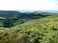
 Black Mountains ridge above Hay-on-Wye - geograph.org.uk - 2933044.jpg 1,510 × 836; 337 KB
-
 Black Mountains scarp - geograph.org.uk - 2690958.jpg 3,264 × 2,448; 1.55 MB
-
 Black Mountains' northern escarpement - geograph.org.uk - 3590176.jpg 4,000 × 3,000; 2.92 MB
-
 Blaen-bwch - geograph.org.uk - 4591036.jpg 800 × 451; 189 KB
-
 Blaenau Stone Circle - geograph.org.uk - 12967.jpg 640 × 480; 54 KB
-
 Boulder runs in Gospel Pass - geograph.org.uk - 3101731.jpg 3,008 × 2,000; 1.57 MB
-
 Bracken and Hay Bluff - geograph.org.uk - 4049741.jpg 800 × 531; 160 KB
-
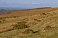
 Bracken growing on common land - geograph.org.uk - 4050561.jpg 1,024 × 680; 341 KB
-
 Bracken slope above upper valley of Afon Honddu - geograph.org.uk - 5160538.jpg 1,500 × 978; 1.22 MB
-
 Bracken-covered hillside - geograph.org.uk - 4597870.jpg 800 × 451; 201 KB
-
 Bracken-covered slopes - geograph.org.uk - 4597836.jpg 800 × 451; 208 KB
-

-

-
 Bridge over the Esgym Brook - geograph.org.uk - 4333544.jpg 800 × 451; 201 KB
-
 Bridges over the Nant Bwch - geograph.org.uk - 4590500.jpg 800 × 451; 218 KB
-
 Bwlch yr Efengyl - Gospel Pass - geograph.org.uk - 4515946.jpg 640 × 480; 69 KB
-
 Cairn on Darren Lwyd - geograph.org.uk - 3590194.jpg 3,847 × 2,884; 4.17 MB
-
 Cairn on Darren Lwyd - geograph.org.uk - 3590195.jpg 4,000 × 3,000; 4.19 MB
-
 Cairn on Lord Hereford's Knob - geograph.org.uk - 5858620.jpg 2,560 × 1,440; 1.5 MB
-
 Cairn on Offa's Dyke footpath - geograph.org.uk - 3101195.jpg 4,752 × 3,168; 3.44 MB
-
 Cairn on the summit of Twmpa - geograph.org.uk - 2574775.jpg 640 × 480; 116 KB
-
 Cairns on Twmpa - geograph.org.uk - 2912319.jpg 640 × 480; 70 KB
-
 Car park near Hay Bluff - geograph.org.uk - 2400684.jpg 1,024 × 667; 142 KB
-
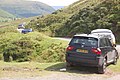 Car parking on Gospel Pass in August - geograph.org.uk - 3101715.jpg 3,008 × 2,000; 1.52 MB
-

-

-
 Common land below Hay Bluff, 1 - geograph.org.uk - 4597942.jpg 800 × 451; 199 KB
-
 Common land below Hay Bluff, 2 - geograph.org.uk - 4597945.jpg 800 × 451; 176 KB
-
 Common land below Hay Bluff, 3 - geograph.org.uk - 4597952.jpg 800 × 451; 195 KB
-
 Common land near Hay Bluff - geograph.org.uk - 2400666.jpg 1,024 × 681; 150 KB
-
 Conifer Plantation - geograph.org.uk - 2153329.jpg 1,600 × 818; 215 KB
-
 Cottage on B4350 Approaching Hay-on-Wye - geograph.org.uk - 5327895.jpg 640 × 480; 395 KB
-
 Cottages near Cusop - geograph.org.uk - 5659621.jpg 640 × 480; 125 KB
-
 Country road below Twmpa - geograph.org.uk - 5963598.jpg 1,024 × 768; 193 KB
-
 Craggy edge of Darren Lwyd - geograph.org.uk - 4597802.jpg 800 × 451; 195 KB
-
 Cultivated field by Blaen-bwch - geograph.org.uk - 4584810.jpg 800 × 451; 191 KB
-
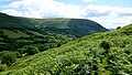
 Darren Lwyd - geograph.org.uk - 2840778.jpg 1,600 × 1,200; 903 KB
-
 Darren Lwyd - geograph.org.uk - 2840782.jpg 1,600 × 1,200; 857 KB
-
 Darren Lwyd - geograph.org.uk - 4546204.jpg 640 × 378; 50 KB
-
 Darren Lwyd, from the road to the Monastery - geograph.org.uk - 5443348.jpg 3,282 × 2,118; 2.39 MB
-
 Descending under Hay Bluff - geograph.org.uk - 6235350.jpg 1,024 × 768; 821 KB
-
 Descent from Hay Bluff - geograph.org.uk - 2004972.jpg 640 × 480; 83 KB
-
 Descent from Hay Bluff - geograph.org.uk - 2102745.jpg 1,024 × 768; 238 KB
-
 Descent from Hay Bluff in 1979 - geograph.org.uk - 3930795.jpg 1,024 × 867; 241 KB
-
 Dingle near New Forest Farm - geograph.org.uk - 4333474.jpg 800 × 451; 190 KB
-
 Disused quarry - geograph.org.uk - 1031375.jpg 640 × 424; 73 KB
-
 Downhill all the way^ - geograph.org.uk - 4597955.jpg 800 × 451; 202 KB
-
 Driveway to Pant Barn - geograph.org.uk - 1905207.jpg 640 × 480; 249 KB
-
 Dulas Brook - geograph.org.uk - 1454210.jpg 640 × 480; 60 KB
-
 Dulas Brook ford near Brickyard Cottage - geograph.org.uk - 3757563.jpg 800 × 600; 231 KB
-
 Dulas Brook, Offa's Dyke Footpath, Hay-on-Wye - geograph.org.uk - 3783161.jpg 683 × 1,024; 1.2 MB
-
 East from Hay Bluff - geograph.org.uk - 5276556.jpg 1,000 × 665; 741 KB
-
 Eastern edge of Darren Lwyd - geograph.org.uk - 1418305.jpg 640 × 427; 88 KB
-
 Eastern escarpment of Darren Lwyd - geograph.org.uk - 649002.jpg 640 × 480; 101 KB
-
 Eastern slope of Rhos Dirion - geograph.org.uk - 4591191.jpg 800 × 600; 253 KB
-
 Edge of New Forest Plantation - geograph.org.uk - 4333536.jpg 800 × 451; 178 KB
-

-
 Farm and sheds - geograph.org.uk - 5661821.jpg 640 × 480; 86 KB
-
-

-
 Farmland above the Wye valley - geograph.org.uk - 4049704.jpg 800 × 531; 175 KB
-
 Farmland and Rook Wood - geograph.org.uk - 4040149.jpg 800 × 531; 151 KB
-
 Farmland below the Black Mountains - geograph.org.uk - 4049680.jpg 800 × 531; 143 KB
-
 Farmland near Maestorglwydd - geograph.org.uk - 4050683.jpg 800 × 531; 127 KB
-

-
 Ffordd lechi - Paved way - geograph.org.uk - 4515383.jpg 640 × 480; 76 KB
-
 Field access track near Cusop Dingle - geograph.org.uk - 1746087.jpg 640 × 426; 93 KB
-
 Field edge path - geograph.org.uk - 5660365.jpg 640 × 480; 57 KB
-
 Field gate and road to Llanigon - geograph.org.uk - 4042396.jpg 1,024 × 680; 279 KB
-
 Field of silage bales - geograph.org.uk - 4040135.jpg 1,024 × 680; 292 KB
-
 Flanks of Hay Bluff - geograph.org.uk - 4235636.jpg 1,600 × 1,200; 817 KB
-
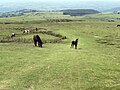
 Foal on Hay Bluff - geograph.org.uk - 3135059.jpg 640 × 480; 98 KB
-

-
 Footbridge on the ascent out of Hay - geograph.org.uk - 1031351.jpg 640 × 424; 135 KB
-

-
 Footpath in the Vale of Ewyas - geograph.org.uk - 3590225.jpg 4,000 × 3,000; 3.74 MB
-
 Footpath near Trwyn-tal - geograph.org.uk - 3590218.jpg 4,000 × 3,000; 3.67 MB
-
 Footpath near Trwyn-tal - geograph.org.uk - 3590221.jpg 4,000 × 3,000; 4.04 MB
-
 Footpath to the Digedi Brook - geograph.org.uk - 318071.jpg 640 × 480; 113 KB
-
 Ford - geograph.org.uk - 923753.jpg 640 × 480; 98 KB
-
 Ford and falls - geograph.org.uk - 923754.jpg 640 × 480; 117 KB
-
 Ford at Lanigon - geograph.org.uk - 5237605.jpg 4,032 × 3,024; 4.22 MB
-
 Ford at Lanigon - geograph.org.uk - 5237616.jpg 4,032 × 3,024; 4.14 MB
-
 Ford at Plas Celyn - geograph.org.uk - 5237620.jpg 4,032 × 3,024; 3.76 MB
-
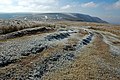
 Ford slabs plunging falls - geograph.org.uk - 3046097.jpg 1,728 × 1,296; 1.2 MB
-
 Fork in the road, Cusop Dingle - geograph.org.uk - 3019933.jpg 640 × 480; 110 KB
-

-

-
 From Penhenallt looking towards Hay-on-Wye - geograph.org.uk - 2392465.jpg 2,848 × 2,136; 3.06 MB
-
 From the summit of Tmwpa - geograph.org.uk - 3590188.jpg 4,000 × 3,000; 3.88 MB
-
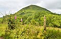
 Gargwy Fawr - geograph.org.uk - 642981.jpg 640 × 477; 100 KB
-
 Gate to Llanigon Church, Powys - geograph.org.uk - 4946197.jpg 1,600 × 1,200; 721 KB
-
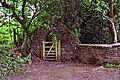 Gate to the Monastery garden - geograph.org.uk - 5441931.jpg 3,248 × 2,160; 2.6 MB
-
 Geographer and Maen Llwyd menhir. - geograph.org.uk - 647118.jpg 640 × 480; 84 KB
-
 Glimpse through the forestry - geograph.org.uk - 647147.jpg 480 × 640; 123 KB
-
 Gospel Pass - geograph.org.uk - 2214538.jpg 800 × 600; 171 KB
-
 Gospel Pass - geograph.org.uk - 2214541.jpg 800 × 600; 136 KB
-
 Gospel Pass - geograph.org.uk - 2214556.jpg 800 × 600; 75 KB
-
 Gospel Pass - geograph.org.uk - 2840776.jpg 1,600 × 1,200; 857 KB
-
 Gospel Pass - geograph.org.uk - 3942768.jpg 2,700 × 2,030; 2.2 MB
-
 Gospel Pass - geograph.org.uk - 4597792.jpg 800 × 451; 186 KB
-
 Gospel Pass and Hay Bluff - geograph.org.uk - 2574741.jpg 640 × 480; 77 KB
-
 Gospel Pass car park - geograph.org.uk - 3135069.jpg 640 × 480; 58 KB
-
 Gospel Pass from Hay Bluff - geograph.org.uk - 2574668.jpg 640 × 480; 88 KB
-
 Gospel Pass from Hay Bluff - geograph.org.uk - 3135066.jpg 640 × 480; 75 KB
-
 Gospel Pass road - geograph.org.uk - 2690965.jpg 3,264 × 2,448; 1.55 MB
-
 Gospel Pass road - geograph.org.uk - 2827687.jpg 640 × 411; 218 KB
-
 Gospel Travellers - geograph.org.uk - 1987522.jpg 640 × 480; 150 KB
-
 Grazing Under The Bluff - geograph.org.uk - 5367503.jpg 1,078 × 808; 382 KB
-
 Hang-gliding, Hay Bluff, 1987 - geograph.org.uk - 5755346.jpg 1,024 × 683; 149 KB
-
 Harvested silage field - geograph.org.uk - 4040216.jpg 800 × 531; 232 KB
-
 Hay Bluff - geograph.org.uk - 3367262.jpg 2,592 × 1,944; 1.52 MB
-
 Hay Bluff - geograph.org.uk - 4325855.jpg 1,056 × 734; 453 KB
-
 Hay Bluff - north side - geograph.org.uk - 2690978.jpg 3,248 × 2,035; 1.13 MB
-

-
 Hay Bluff from Twmpa - geograph.org.uk - 4597786.jpg 800 × 451; 188 KB
-
 Hay Bluff in January - geograph.org.uk - 2782820.jpg 4,288 × 3,216; 4.51 MB
-
 Hay Bluff path - geograph.org.uk - 2690969.jpg 2,448 × 3,264; 1.79 MB
-
 Hay Bluff scarp - geograph.org.uk - 4235622.jpg 1,600 × 1,200; 646 KB
-
 Hay Bluff trig - geograph.org.uk - 3135024.jpg 640 × 480; 57 KB
-
 Hay Bluff trig point - geograph.org.uk - 2004968.jpg 640 × 480; 57 KB
-
 Hay Bluff trig point - geograph.org.uk - 2574587.jpg 640 × 480; 71 KB
-
 Hay Bluff trig point - geograph.org.uk - 2690991.jpg 3,264 × 2,448; 1.36 MB
-
 Hay Bluff trig point - geograph.org.uk - 5276565.jpg 1,000 × 665; 780 KB
-
 Hay Bluff trig point - geograph.org.uk - 5276569.jpg 1,000 × 665; 898 KB
-

-
 Hay Bluff's dark bulk - geograph.org.uk - 4597950.jpg 800 × 451; 191 KB
-
 Hay Bluff. Black Mountains Hay-on-Wye - geograph.org.uk - 30553.jpg 640 × 480; 103 KB
-
 Hay Common - geograph.org.uk - 2935620.jpg 1,734 × 1,145; 321 KB
-
 Hay-making in the valley - geograph.org.uk - 4597959.jpg 800 × 451; 160 KB
-
 Head of path on Hay Bluff - geograph.org.uk - 2690983.jpg 3,264 × 2,448; 1.82 MB
-
 Headwater east Afon Honddu - geograph.org.uk - 3046120.jpg 4,320 × 3,240; 2.41 MB
-
 Here lies Charlie Stoner .... - geograph.org.uk - 5441167.jpg 2,491 × 3,263; 2.79 MB
-
 Here lies Elizabeth Angela Williams, died 1956 - geograph.org.uk - 5441253.jpg 2,160 × 3,248; 3.33 MB
-
 Hill Farm - geograph.org.uk - 4598126.jpg 800 × 451; 191 KB
-

-

-
 Hillside near Hay Bluff - geograph.org.uk - 2004920.jpg 640 × 480; 86 KB
-
 Horses on slope above Afon Honddu - geograph.org.uk - 5160648.jpg 1,500 × 1,125; 1.94 MB
-
 Ice cream van at the main Hay Bluff car park - geograph.org.uk - 3101122.jpg 4,752 × 3,168; 2.37 MB
-
 January on Hay Bluff - geograph.org.uk - 2782780.jpg 4,288 × 3,216; 4.77 MB
-

-
 Large cairn on Darren Lwyd - geograph.org.uk - 3590211.jpg 4,000 × 3,000; 3.34 MB
-
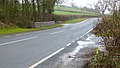
 Layby on a Bend near Hay-on-Wye - geograph.org.uk - 5327908.jpg 640 × 427; 257 KB
-
 Line of a footpath across the field - geograph.org.uk - 5660338.jpg 640 × 480; 68 KB
-
 Llanigon Village Hall - geograph.org.uk - 4042385.jpg 1,024 × 680; 288 KB
-

-
 Llanigon, the bridge over Digedi Brook - geograph.org.uk - 1506833.jpg 640 × 480; 105 KB
-
 Llanthomas Farm, Llanigon, Powys - geograph.org.uk - 4946191.jpg 1,600 × 1,200; 476 KB
-
 Llwynnon - Ashgrove - geograph.org.uk - 471044.jpg 640 × 480; 94 KB
-

-
 Looking back to Rhos Dirion - geograph.org.uk - 3590169.jpg 4,000 × 3,000; 2.7 MB
-

-

-
 Looking towards Cwmcoynant - geograph.org.uk - 2214624.jpg 800 × 600; 97 KB
-
 Looking up the valley of the Nant Bwch - geograph.org.uk - 3590470.jpg 4,000 × 3,000; 3.72 MB
-
 Lord Hereford's knob - geograph.org.uk - 2782794.jpg 4,288 × 3,216; 3.83 MB
-
 Lord Hereford's Knob or Twmpa - geograph.org.uk - 2444166.jpg 1,600 × 1,200; 406 KB
-
 Lord Hereford's Knob or Twmpa - geograph.org.uk - 4050550.jpg 1,024 × 680; 269 KB
-
 Lord Herefords Knob from trig point - geograph.org.uk - 1055815.jpg 640 × 480; 62 KB
-
 Lord Herefords Knob or The Twmpa nr Hay-On-Wye - geograph.org.uk - 4323676.jpg 1,078 × 808; 698 KB
-
 Lower Wenallt and Allt Wood - geograph.org.uk - 4049714.jpg 800 × 531; 111 KB
-
 Lunch stop - geograph.org.uk - 4575296.jpg 4,256 × 2,832; 4.62 MB
-
 Maen Llwyd - geograph.org.uk - 645322.jpg 640 × 477; 90 KB


_-_geograph.org.uk_-_1506840.jpg)


