Category:Lindrick with Studley Royal and Fountains
Jump to navigation
Jump to search
civil parish in Harrogate, North Yorkshire, England  | |||||
| Upload media | |||||
| Instance of | |||||
|---|---|---|---|---|---|
| Location | Harrogate, North Yorkshire, Yorkshire and the Humber, England | ||||
 | |||||
Subcategories
This category has the following 2 subcategories, out of 2 total.
S
Media in category "Lindrick with Studley Royal and Fountains"
The following 200 files are in this category, out of 423 total.
(previous page) (next page)-
 'Surprise view' from Ann Boleyn's seat - geograph.org.uk - 4759422.jpg 640 × 480; 100 KB
-

-
 A long vista in Studley Royal - geograph.org.uk - 3239847.jpg 3,872 × 2,592; 3.47 MB
-
 A multitude of switches - geograph.org.uk - 1946055.jpg 2,048 × 1,536; 597 KB
-
 Abbey illuminations - geograph.org.uk - 4771406.jpg 427 × 640; 82 KB
-
 Abbey Illuminations - geograph.org.uk - 4771414.jpg 640 × 427; 92 KB
-
 Abbey Mills Bridge - geograph.org.uk - 5593756.jpg 640 × 427; 176 KB
-
 Abbey ruins - geograph.org.uk - 4771401.jpg 640 × 427; 110 KB
-
 Abbey Wall at Kitchen Bank - geograph.org.uk - 5496615.jpg 1,024 × 769; 181 KB
-
 Abbey with River Skell - geograph.org.uk - 3904659.jpg 640 × 480; 69 KB
-
 Abbot Huby's Tower - geograph.org.uk - 6014021.jpg 3,240 × 4,319; 1.66 MB
-
 Above the canal - geograph.org.uk - 5747160.jpg 640 × 427; 215 KB
-
 Access Lane to Low Lindrick - geograph.org.uk - 3181562.jpg 4,320 × 3,240; 5.93 MB
-
 Along the Canal - geograph.org.uk - 5747169.jpg 640 × 427; 230 KB
-
 Approaching the abbey - geograph.org.uk - 4771398.jpg 640 × 427; 91 KB
-
 Artwork and Octagon Tower - geograph.org.uk - 5747156.jpg 427 × 640; 207 KB
-
 Autumn at Fountains Abbey - geograph.org.uk - 3242114.jpg 3,872 × 2,592; 5.15 MB
-
 Autumn leaves Studley Royal Water Garden - geograph.org.uk - 5195212.jpg 4,000 × 3,000; 7.36 MB
-
 Autumn trees at Fountains Abbey - geograph.org.uk - 2690455.jpg 3,872 × 2,592; 4.97 MB
-
 Autumnal scene Studley Royal - geograph.org.uk - 3225491.jpg 2,560 × 1,920; 2.24 MB
-
 Autumnal sunshine on De Grey Walk Fountains Abbey - geograph.org.uk - 5195284.jpg 4,000 × 3,000; 7.46 MB
-
 Bank Quarry - geograph.org.uk - 1717173.jpg 640 × 480; 154 KB
-
 Bank Quarry - geograph.org.uk - 6233415.jpg 800 × 533; 246 KB
-
 Bank Quarry Lime Kiln - geograph.org.uk - 6233432.jpg 800 × 533; 180 KB
-
 Banqueting Hall - geograph.org.uk - 5747155.jpg 640 × 427; 242 KB
-
 Bee Orchid - geograph.org.uk - 1946063.jpg 1,536 × 2,048; 1.43 MB
-
 Beech on Constitution Hill - geograph.org.uk - 3945812.jpg 1,920 × 2,175; 691 KB
-
 Beech Woodland - geograph.org.uk - 5593771.jpg 640 × 427; 179 KB
-
 Bench Mark (close-up) - geograph.org.uk - 2066317.jpg 1,024 × 681; 225 KB
-
 Bench Mark, Canal View Seat - geograph.org.uk - 2066307.jpg 1,024 × 681; 216 KB
-
 Bench With A View, Studley Park - geograph.org.uk - 3077018.jpg 1,024 × 682; 224 KB
-
 Birkby Wood Cottages - geograph.org.uk - 4861710.jpg 1,600 × 1,200; 592 KB
-
 Bridge above the cascade - geograph.org.uk - 5747285.jpg 640 × 427; 225 KB
-
 Bridge and Cascade - geograph.org.uk - 5747290.jpg 640 × 427; 233 KB
-
 Bridge over River Skell, Fountains Abbey - geograph.org.uk - 2833891.jpg 425 × 640; 372 KB
-
 Bridge over The Canal - geograph.org.uk - 3224887.jpg 2,560 × 1,920; 2.03 MB
-
 Bridge over the River Skell, Fountains Abbey - geograph.org.uk - 5981818.jpg 4,000 × 3,000; 4.47 MB
-
 Bridge over the Skell, Fountains Abbey - geograph.org.uk - 3945975.jpg 1,920 × 1,485; 845 KB
-
 Bridge over the Skell, Fountains Abbey - geograph.org.uk - 3953188.jpg 1,920 × 1,440; 882 KB
-
 Bridleway from Low Lindrick - geograph.org.uk - 6240190.jpg 800 × 533; 187 KB
-
 Bridleway through Mackershaw Wood - geograph.org.uk - 4805846.jpg 427 × 640; 131 KB
-
 Bridleway through National Trust land - geograph.org.uk - 5640876.jpg 1,279 × 1,287; 208 KB
-
 Bridleway to Whitcliffe Hall - geograph.org.uk - 5978707.jpg 480 × 640; 457 KB
-
 Café, Fountains Abbey - geograph.org.uk - 4618004.jpg 3,008 × 2,000; 2.62 MB
-
 Canal in the water gardens - geograph.org.uk - 5747162.jpg 640 × 427; 243 KB
-
 Carols at Fountains - geograph.org.uk - 6014024.jpg 2,929 × 3,467; 2.17 MB
-
 Carved Stone reused as a top-stone - geograph.org.uk - 1946074.jpg 2,048 × 1,536; 1.38 MB
-
 Cascade into The Lake - Studley Royal Water Garden - geograph.org.uk - 6164511.jpg 4,128 × 3,096; 5.81 MB
-
 Cascade, Studley Park - geograph.org.uk - 6273988.jpg 1,024 × 683; 195 KB
-
 Cast Iron sign - geograph.org.uk - 1946047.jpg 2,048 × 1,536; 622 KB
-
 Chancel roof St Mary's Studley Royal - geograph.org.uk - 5772327.jpg 4,608 × 3,456; 4.45 MB
-
 Chancel roof, St Mary's Church, Studley Royal - geograph.org.uk - 5498118.jpg 768 × 1,024; 244 KB
-
 Chinese Wood - geograph.org.uk - 1263101.jpg 640 × 480; 119 KB
-
 Choir stalls in Fountains Abbey - geograph.org.uk - 4429614.jpg 480 × 640; 94 KB
-
 Choristers' House - geograph.org.uk - 4781366.jpg 640 × 427; 101 KB
-
 Choristers' House, Studley Park - geograph.org.uk - 5497961.jpg 1,024 × 768; 273 KB
-

-
 Church of St Mary, Studley Royal - geograph.org.uk - 5498107.jpg 1,024 × 769; 158 KB
-
 Church Walk - geograph.org.uk - 3952432.jpg 1,920 × 2,560; 780 KB
-
 Cliff Face, Fountains Abbey - geograph.org.uk - 2066346.jpg 1,024 × 681; 278 KB
-
 Coiled-straw skeps, Swanley Grange - geograph.org.uk - 5496561.jpg 1,024 × 768; 237 KB
-
 Collapsing Lime Kiln at Bank Quarry - geograph.org.uk - 6233422.jpg 800 × 533; 202 KB
-
 Crowds near the Abbey - geograph.org.uk - 4771405.jpg 640 × 427; 93 KB
-
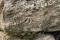 Cut Bench Mark (close-up) - geograph.org.uk - 2066350.jpg 1,024 × 681; 306 KB
-
 Cut Bench Mark (close-up) - geograph.org.uk - 2395132.jpg 1,024 × 681; 291 KB
-
 Deer and Ripon Minster - geograph.org.uk - 6010589.jpg 890 × 1,024; 744 KB
-
 Deer at Studley - geograph.org.uk - 4781390.jpg 640 × 427; 102 KB
-
 Deer in Studley Royal - geograph.org.uk - 6010587.jpg 1,024 × 819; 698 KB
-
 Deer in the park - geograph.org.uk - 4781391.jpg 640 × 427; 91 KB
-
 Deer on a sunlit hillside (geograph 1633556, high-res).jpg 1,024 × 683; 195 KB
-
 Deer on a sunlit hillside - geograph.org.uk - 1633556.jpg 640 × 427; 102 KB
-

-
 Discarded Foundation Stone - geograph.org.uk - 1118876.jpg 480 × 640; 124 KB
-
 Ditch, Studley Royal - geograph.org.uk - 3952737.jpg 1,920 × 1,440; 689 KB
-
 Doorways at Fountains Abbey - geograph.org.uk - 4429606.jpg 480 × 640; 72 KB
-
 Down River - geograph.org.uk - 1317048.jpg 620 × 640; 110 KB
-
 Drive, Studley Park - geograph.org.uk - 5496662.jpg 770 × 1,024; 215 KB
-
 Drive, Studley Park - geograph.org.uk - 5496735.jpg 767 × 1,024; 216 KB
-
 Entrance to Fountains Hall - geograph.org.uk - 5747212.jpg 427 × 640; 262 KB
-
 Evidence of Flood Damage, Studley Royal - geograph.org.uk - 3354022.jpg 3,000 × 2,000; 2.85 MB
-

-
 Fallen tree in Studley Park - geograph.org.uk - 5978310.jpg 640 × 480; 317 KB
-
 Fallow deer, Studley Royal Park - geograph.org.uk - 6084445.jpg 640 × 360; 104 KB
-
 Fenced in or fenced out^ - geograph.org.uk - 1734562.jpg 3,264 × 2,448; 3.1 MB
-
 Fields near High Lindrick Farm - geograph.org.uk - 6164497.jpg 4,128 × 3,096; 6.92 MB
-
 Filming at Fountains Abbey - geograph.org.uk - 5819097.jpg 640 × 379; 106 KB
-
 Fish pond near Abbey Wall - geograph.org.uk - 5496610.jpg 1,024 × 768; 364 KB
-
 Fish Pond ^ Abbey Wall - geograph.org.uk - 5496624.jpg 1,024 × 768; 275 KB
-

-
 Flock of pigeons - geograph.org.uk - 5593749.jpg 640 × 427; 56 KB
-
 Flooded Field - geograph.org.uk - 312237.jpg 640 × 480; 79 KB
-
 Footbridge over a canal - geograph.org.uk - 3508842.jpg 1,024 × 680; 177 KB
-
 Footbridge over the River Skell - geograph.org.uk - 3241000.jpg 3,872 × 2,592; 5.44 MB
-
 Footpath across front of Temple of Piety - geograph.org.uk - 5195314.jpg 2,978 × 3,984; 4.66 MB
-
 Ford and bridge in Seven Bridges Valley - geograph.org.uk - 5978706.jpg 640 × 480; 402 KB
-
 Ford at Studley Royal - geograph.org.uk - 5019741.jpg 3,000 × 2,000; 1.46 MB
-
 Ford at Studley Royal - geograph.org.uk - 5019762.jpg 3,000 × 2,000; 1.95 MB
-
 Ford at Studley Royal - geograph.org.uk - 5019800.jpg 3,000 × 2,000; 1.43 MB
-
 Ford at Studley Royal - geograph.org.uk - 5019824.jpg 3,264 × 2,448; 3.5 MB
-
 Ford at Studley Royal - geograph.org.uk - 5019847.jpg 3,000 × 2,000; 1.75 MB
-
 Ford at The Lake, Studley Royal - geograph.org.uk - 5019713.jpg 3,000 × 2,000; 1.04 MB
-
 Ford over the River Skell - geograph.org.uk - 4805849.jpg 427 × 640; 132 KB
-
 Former Bench and Fallen Tree, Studley Park - geograph.org.uk - 3471960.jpg 1,024 × 682; 255 KB
-

-
 Fountain's Fish-pond - geograph.org.uk - 3394053.jpg 1,044 × 1,498; 240 KB
-
 Fountain's Mill - geograph.org.uk - 5125393.jpg 4,896 × 3,672; 6.09 MB
-
 Fountains Abbey & Studley Royal Water Garden (24) (geograph 7028393).jpg 4,320 × 3,240; 5.08 MB
-
 Fountains Abbey & Studley Royal Water Garden (25) (geograph 7028398).jpg 4,069 × 3,051; 3.32 MB
-
 Fountains Abbey & Studley Royal Water Garden (26) (geograph 7028399).jpg 4,320 × 3,240; 4.73 MB
-
 Fountains Abbey & Studley Royal Water Garden (30) (geograph 7029255).jpg 3,801 × 2,851; 3.5 MB
-
 Fountains Abbey & Studley Royal Water Garden (31) (geograph 7029260).jpg 3,051 × 4,069; 4.19 MB
-
 Fountains Abbey & Studley Royal Water Garden (32) (geograph 7029263).jpg 4,320 × 3,240; 4.47 MB
-
 Fountains Abbey & Studley Royal Water Garden (33) (geograph 7029264).jpg 3,012 × 4,016; 3.51 MB
-
 Fountains Abbey & Studley Royal Water Garden (51) (geograph 7029613).jpg 3,934 × 2,950; 2.87 MB
-
 Fountains Abbey & Studley Royal Water Garden (52) (geograph 7029615).jpg 4,320 × 3,240; 3.25 MB
-
 Fountains Abbey (monochrome) - geograph.org.uk - 5498184.jpg 1,024 × 768; 277 KB
-
 Fountains Abbey - geograph.org.uk - 2840658.jpg 1,600 × 1,200; 616 KB
-
 Fountains Abbey - geograph.org.uk - 2910793.jpg 2,816 × 2,112; 1.98 MB
-
 Fountains Abbey - geograph.org.uk - 4651242.jpg 4,608 × 3,072; 1.11 MB
-
 Fountains Abbey - geograph.org.uk - 5125097.jpg 4,896 × 3,672; 5.98 MB
-
 Fountains Abbey - geograph.org.uk - 5125467.jpg 4,896 × 3,672; 5.12 MB
-
 Fountains Abbey - geograph.org.uk - 5125472.jpg 4,896 × 3,672; 5.67 MB
-
 Fountains Abbey - geograph.org.uk - 5373165.jpg 1,024 × 683; 174 KB
-
 Fountains Abbey - geograph.org.uk - 5373201.jpg 1,024 × 683; 292 KB
-
 Fountains Abbey - geograph.org.uk - 5373202.jpg 1,024 × 683; 313 KB
-
 Fountains Abbey - geograph.org.uk - 5373224.jpg 1,024 × 683; 252 KB
-
 Fountains Abbey - geograph.org.uk - 5373230.jpg 1,024 × 683; 238 KB
-
 Fountains Abbey - geograph.org.uk - 5472744.jpg 662 × 1,000; 1.07 MB
-
 Fountains Abbey - geograph.org.uk - 5472758.jpg 662 × 1,000; 926 KB
-
 Fountains Abbey - geograph.org.uk - 5472761.jpg 1,000 × 662; 819 KB
-
 Fountains Abbey - geograph.org.uk - 5472770.jpg 662 × 1,000; 990 KB
-
 Fountains Abbey - geograph.org.uk - 5472776.jpg 1,000 × 662; 830 KB
-
 Fountains Abbey - geograph.org.uk - 5472781.jpg 1,000 × 662; 850 KB
-
 Fountains Abbey - geograph.org.uk - 5472850.jpg 662 × 1,000; 849 KB
-
 Fountains Abbey - geograph.org.uk - 5472854.jpg 662 × 1,000; 762 KB
-
 Fountains Abbey - geograph.org.uk - 5496605.jpg 1,024 × 768; 244 KB
-
 Fountains Abbey - geograph.org.uk - 5502322.jpg 427 × 640; 88 KB
-
 Fountains Abbey - geograph.org.uk - 5568761.jpg 640 × 480; 108 KB
-
 Fountains Abbey - geograph.org.uk - 5640854.jpg 1,312 × 1,651; 455 KB
-
 Fountains Abbey - geograph.org.uk - 5883614.jpg 4,925 × 2,771; 3.25 MB
-
 Fountains Abbey - geograph.org.uk - 5928512.jpg 2,000 × 1,333; 2.69 MB
-
 Fountains Abbey - geograph.org.uk - 5975544.jpg 3,888 × 5,184; 4.2 MB
-
 Fountains Abbey - geograph.org.uk - 5978309.jpg 640 × 480; 301 KB
-
 Fountains Abbey - geograph.org.uk - 6164521.jpg 4,128 × 3,096; 5.93 MB
-
 Fountains Abbey - geograph.org.uk - 6273996.jpg 1,024 × 683; 181 KB
-
 Fountains Abbey - microhydropower - geograph.org.uk - 4797273.jpg 640 × 480; 80 KB
-
 Fountains Abbey - Path to Fountains Hall - geograph.org.uk - 2537995.jpg 1,280 × 960; 1.02 MB
-
 Fountains Abbey and the River Skell - geograph.org.uk - 5195251.jpg 3,980 × 2,974; 4.05 MB
-
 Fountains Abbey from De Grey's Walk - geograph.org.uk - 5195266.jpg 3,996 × 2,994; 4.7 MB
-
 Fountains Abbey from the south west - geograph.org.uk - 5179724.jpg 3,990 × 2,548; 2.59 MB
-
 Fountains Abbey from the Surprise View - geograph.org.uk - 2835944.jpg 425 × 640; 293 KB
-
 Fountains Abbey Mill - geograph.org.uk - 4758861.jpg 640 × 468; 92 KB
-
 Fountains Abbey viewed from the east - geograph.org.uk - 4429617.jpg 640 × 480; 64 KB
-
 Fountains Abbey Visitor Centre - geograph.org.uk - 2690439.jpg 3,872 × 2,592; 4.14 MB
-
 Fountains Abbey Visitor Centre - geograph.org.uk - 5928509.jpg 2,000 × 1,333; 2.79 MB
-
 Fountains Abbey, aerial 2016 - geograph.org.uk - 5090695.jpg 640 × 427; 68 KB
-
 Fountains Abbey, North Yorkshire - geograph.org.uk - 5819089.jpg 480 × 640; 67 KB
-
 Fountains Abbey, North Yorkshire - geograph.org.uk - 5819092.jpg 480 × 640; 87 KB
-
 Fountains Abbey, North Yorkshire - geograph.org.uk - 5819095.jpg 640 × 480; 98 KB
-
 Fountains Hall - geograph.org.uk - 5125384.jpg 4,896 × 3,672; 5.95 MB
-
 Fountains Hall - geograph.org.uk - 5373242.jpg 1,024 × 683; 229 KB
-
 Fountains Hall - geograph.org.uk - 5472355.jpg 1,000 × 662; 963 KB
-
 Fountains Hall - geograph.org.uk - 5472356.jpg 1,000 × 662; 1.02 MB
-
 Fountains Hall - geograph.org.uk - 5747203.jpg 427 × 640; 222 KB
-
 Fountains Hall - geograph.org.uk - 5978306.jpg 640 × 480; 319 KB
-
 Fountains Hall - geograph.org.uk - 5981737.jpg 4,000 × 3,000; 4.74 MB
-
 Fountains Hall - geograph.org.uk - 5981738.jpg 4,000 × 3,000; 5.14 MB
-

-
 Fountains Hall from the south - geograph.org.uk - 5496596.jpg 1,024 × 768; 225 KB
-
 Fountains Hall seen across the River Skell - geograph.org.uk - 5981745.jpg 4,000 × 3,000; 5.11 MB
-
 Fountains Lake and Cafe - geograph.org.uk - 2935832.jpg 1,600 × 1,200; 545 KB
-
 Fountains Lane - geograph.org.uk - 2654601.jpg 640 × 425; 90 KB
-
 Fountains Restaurant - geograph.org.uk - 4781378.jpg 640 × 427; 106 KB
-

-
 Freezing Over - geograph.org.uk - 1629097.jpg 640 × 474; 48 KB
-
 Frosty morning at Fountains - geograph.org.uk - 2790323.jpg 1,531 × 951; 105 KB
-
 Fungi around a tree stump Studley Royal Water Garden - geograph.org.uk - 5195236.jpg 3,988 × 2,984; 7.67 MB
-
 Fungi at tree base - geograph.org.uk - 1560619.jpg 480 × 640; 121 KB
-
 Galphay Mill Bridge - geograph.org.uk - 312471.jpg 640 × 480; 138 KB
-
 Galphay Mill Bridge - geograph.org.uk - 312472.jpg 640 × 480; 117 KB
-
 Galphay Mill Bridge - geograph.org.uk - 4861701.jpg 1,600 × 1,200; 942 KB
-
 Gates to Studley Royal Water Gardens - geograph.org.uk - 4758876.jpg 480 × 640; 95 KB
-
 Golf Cottage - geograph.org.uk - 474551.jpg 480 × 640; 66 KB
-
 GR Postbox - geograph.org.uk - 889478.jpg 411 × 640; 85 KB
-
 Grassland in Mackershaw - geograph.org.uk - 1128198.jpg 640 × 480; 54 KB
-
 Green Man Carving - geograph.org.uk - 3743182.jpg 3,264 × 2,176; 3.25 MB
-
 Guarding the Canal - geograph.org.uk - 5683658.jpg 640 × 615; 48 KB
-
 Guest accommodation, Fountains Abbey - geograph.org.uk - 3945991.jpg 1,920 × 2,328; 1.1 MB
-
 Guest House Bridge - geograph.org.uk - 5179766.jpg 4,000 × 3,000; 3.15 MB
-
 Ha-ha - geograph.org.uk - 6084461.jpg 640 × 427; 195 KB
-
 Half Moon Pond and Tent Hill - geograph.org.uk - 5747172.jpg 640 × 427; 209 KB
-
 Half Moon Reservoir (1) - geograph.org.uk - 5178334.jpg 3,773 × 2,400; 2 MB
-
 Half Moon Reservoir (2) - geograph.org.uk - 5178342.jpg 4,000 × 2,339; 2 MB
-
 Hare Bells (Campanula rotundifolia) - geograph.org.uk - 1464717.jpg 640 × 480; 160 KB
-
 High Lindrick Farm - geograph.org.uk - 6164499.jpg 4,106 × 2,075; 4.15 MB
-
 Hillside below Temple of Fame, Studley Royal - geograph.org.uk - 3952777.jpg 1,920 × 2,560; 1.64 MB
-
 Huby's Tower, Winter Sun - geograph.org.uk - 1658463.jpg 640 × 397; 51 KB
-
 Illuminated Abbey - geograph.org.uk - 4771409.jpg 427 × 640; 98 KB
-
 Illuminated Abbey - geograph.org.uk - 4771416.jpg 640 × 314; 39 KB
-
 Illuminations in the Abbey - geograph.org.uk - 4771413.jpg 427 × 640; 93 KB


_-_geograph.org.uk_-_2066317.jpg)


_-_geograph.org.uk_-_2066350.jpg)
_-_geograph.org.uk_-_2395132.jpg)


.jpg)


_(geograph_7028393).jpg)
_(geograph_7028398).jpg)
_(geograph_7028399).jpg)
_(geograph_7029255).jpg)
_(geograph_7029260).jpg)
_(geograph_7029263).jpg)
_(geograph_7029264).jpg)
_(geograph_7029613).jpg)
_(geograph_7029615).jpg)
_-_geograph.org.uk_-_5498184.jpg)


_-_geograph.org.uk_-_5178334.jpg)
_-_geograph.org.uk_-_5178342.jpg)
_-_geograph.org.uk_-_1464717.jpg)


