Category:Leconfield
Jump to navigation
Jump to search
English: Leconfield is a village and civil parish in the East Riding of Yorkshire, England. It is situated approximately 3 miles (4.8 km) north west of Beverley town centre and lies on the A164 road.
village in the United Kingdom  | |||||
| Upload media | |||||
| Instance of | |||||
|---|---|---|---|---|---|
| Location |
| ||||
 | |||||
Subcategories
This category has the following 5 subcategories, out of 5 total.
A
D
R
S
Media in category "Leconfield"
The following 200 files are in this category, out of 701 total.
(previous page) (next page)-
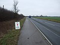
 A bend in Driffield Road (A164) - geograph.org.uk - 4341271.jpg 640 × 480; 50 KB
-
 A bend in the A164 - geograph.org.uk - 4355079.jpg 640 × 480; 47 KB
-
 A bridge near Decoy Farm - geograph.org.uk - 3714487.jpg 1,024 × 681; 338 KB
-
 A bridge no more - geograph.org.uk - 4253108.jpg 4,608 × 3,456; 6.17 MB
-
 A bridleway towards Scorborough - geograph.org.uk - 3714200.jpg 1,024 × 681; 264 KB
-
 A bridleway towards Scorborough - geograph.org.uk - 3714208.jpg 1,024 × 681; 342 KB
-
 A bridleway towards Scorborough - geograph.org.uk - 3714213.jpg 1,024 × 681; 389 KB
-
 A bridleway towards Scorborough - geograph.org.uk - 3714219.jpg 1,024 × 681; 297 KB
-
 A Bridlington bound train near Leconfield - geograph.org.uk - 3715289.jpg 1,024 × 681; 252 KB
-
 A crop sprayer near Black Hill - geograph.org.uk - 3715966.jpg 1,024 × 681; 288 KB
-
 A crossroads of paths near Lakes Farm - geograph.org.uk - 3714226.jpg 1,024 × 681; 319 KB
-
 A farm bridge over Catchwater Drain, Arram - geograph.org.uk - 3714982.jpg 1,024 × 681; 359 KB
-
 A farm Track at Black Hill - geograph.org.uk - 3715968.jpg 1,024 × 681; 290 KB
-
 A farm track leading to the A164 - geograph.org.uk - 3714236.jpg 1,024 × 681; 301 KB
-
 A farmhouse near Scorborough - geograph.org.uk - 3714223.jpg 1,024 × 681; 314 KB
-
 A farmhouse near Scorborough - geograph.org.uk - 3714233.jpg 1,024 × 681; 309 KB
-
 A footbridge near Leconfield Low Parks Farm - geograph.org.uk - 3715902.jpg 681 × 1,024; 410 KB
-
 A footbridge over Catch Water Drain - geograph.org.uk - 3715260.jpg 1,024 × 681; 373 KB
-
 A footbridge over Catch Water Drain - geograph.org.uk - 3715262.jpg 1,024 × 681; 340 KB
-

-
 A full River Hull with Pulfin Bog Nature Reserve Beyond - geograph.org.uk - 4785287.jpg 4,608 × 3,456; 5.08 MB
-
 A headland strip - geograph.org.uk - 5401806.jpg 640 × 426; 38 KB
-
-
 A litter bin on Chapel Garth, Arram - geograph.org.uk - 3715065.jpg 1,024 × 681; 388 KB
-
 A minor road at Scorborough - geograph.org.uk - 3714240.jpg 1,024 × 681; 319 KB
-
 A missing bridge over Catch Water Drain - geograph.org.uk - 3715284.jpg 1,024 × 681; 357 KB
-
 A new house in Leconfield - geograph.org.uk - 799246.jpg 640 × 454; 191 KB
-
 A path leading to Lickham Hall - geograph.org.uk - 3714417.jpg 1,024 × 681; 313 KB
-
 A path leading to Lickham Hall - geograph.org.uk - 3714419.jpg 1,024 × 681; 344 KB
-
 A path leaves the Hudson Way rail trail - geograph.org.uk - 2210277.jpg 800 × 600; 254 KB
-
 A pillbox on Scorborough Lane - geograph.org.uk - 3714431.jpg 1,024 × 681; 350 KB
-
 A pillbox on Scorborough Lane - geograph.org.uk - 3714432.jpg 1,024 × 681; 406 KB
-
 A pillbox on Scorborough Lane - geograph.org.uk - 3714433.jpg 1,024 × 681; 388 KB
-
 A pond at Arram Carr, near Arram - geograph.org.uk - 2247891.jpg 800 × 600; 285 KB
-
 A pond at the Army School of Transport - geograph.org.uk - 3715287.jpg 1,024 × 681; 301 KB
-
 A rail crossing near Leconfield Low Parks - geograph.org.uk - 3715862.jpg 1,024 × 681; 221 KB
-
 A road at Scorborough - geograph.org.uk - 2273081.jpg 640 × 468; 41 KB
-
 A train passes Arram - geograph.org.uk - 3715142.jpg 1,024 × 681; 342 KB
-
 A walk to Beverley ^100 - geograph.org.uk - 1986312.jpg 800 × 600; 153 KB
-
 A walk to Beverley ^88 - geograph.org.uk - 1985416.jpg 800 × 600; 141 KB
-
 A walk to Beverley ^89 - geograph.org.uk - 1985435.jpg 800 × 600; 137 KB
-
 A walk to Beverley ^90 - geograph.org.uk - 1985801.jpg 800 × 600; 103 KB
-
 A walk to Beverley ^91 - geograph.org.uk - 1985806.jpg 800 × 600; 181 KB
-
 A walk to Beverley ^92 - geograph.org.uk - 1985813.jpg 800 × 600; 186 KB
-
 A walk to Beverley ^93 - geograph.org.uk - 1985818.jpg 800 × 600; 140 KB
-
 A walk to Beverley ^94 - geograph.org.uk - 1985821.jpg 800 × 600; 184 KB
-
 A walk to Beverley ^95 - geograph.org.uk - 1985827.jpg 800 × 600; 117 KB
-
 A walk to Beverley ^96 - geograph.org.uk - 1985832.jpg 800 × 600; 203 KB
-
 A walk to Beverley ^97 - geograph.org.uk - 1985836.jpg 800 × 600; 178 KB
-
 A walk to Beverley ^98 - geograph.org.uk - 1986281.jpg 800 × 600; 158 KB
-
 A walk to Beverley ^99 - geograph.org.uk - 1986302.jpg 800 × 600; 253 KB
-
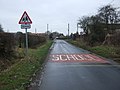
 A warning sign near Leconfield - geograph.org.uk - 3715870.jpg 1,024 × 681; 274 KB
-
 A wind turbine near Arram - geograph.org.uk - 3714964.jpg 1,024 × 681; 225 KB
-
 A164 beside Normanby Barracks - geograph.org.uk - 4341244.jpg 640 × 480; 79 KB
-
 A164 south of Scorborough - geograph.org.uk - 5249331.jpg 640 × 480; 57 KB
-
 A164 to Driffield - geograph.org.uk - 1042556.jpg 640 × 427; 308 KB
-
 A164 towards Beverley - geograph.org.uk - 4339333.jpg 640 × 480; 58 KB
-
 A164 towards Beverley - geograph.org.uk - 4340559.jpg 640 × 480; 41 KB
-
 A164 towards Beverley - geograph.org.uk - 4341287.jpg 640 × 480; 69 KB
-
 A164 towards Beverley - geograph.org.uk - 4355075.jpg 640 × 480; 59 KB
-
 A164 towards Beverley - geograph.org.uk - 4361522.jpg 640 × 480; 46 KB
-
 A164 towards Driffield - geograph.org.uk - 1497269.jpg 640 × 480; 46 KB
-

-
 Access road to Leconfield Grange - geograph.org.uk - 4411524.jpg 4,608 × 3,456; 7.12 MB
-
 Acres Farm - geograph.org.uk - 1497297.jpg 640 × 480; 94 KB
-
 Alpaca's the new wool trade - geograph.org.uk - 2971429.jpg 4,000 × 3,000; 4.42 MB
-
 Amerglasser sails up the River Hull - geograph.org.uk - 4843377.jpg 1,200 × 799; 404 KB
-
 Anonymous lane through wheatfields - geograph.org.uk - 1042520.jpg 640 × 427; 388 KB
-
 Approaching Arram Station - geograph.org.uk - 2971419.jpg 4,000 × 3,000; 3.53 MB
-
-
 Approaching Leconfield - geograph.org.uk - 1497255.jpg 640 × 480; 53 KB
-
 Approaching Leconfield - geograph.org.uk - 2247942.jpg 800 × 600; 184 KB
-
 Approaching Leconfield - geograph.org.uk - 4339325.jpg 640 × 480; 65 KB
-
 Approaching the A164 - geograph.org.uk - 4790201.jpg 1,024 × 768; 254 KB
-

-
 Arram Carrs - geograph.org.uk - 4703822.jpg 1,024 × 768; 152 KB
-
 Arram Carrs - geograph.org.uk - 5383933.jpg 640 × 394; 27 KB
-
 Arram Carrs - geograph.org.uk - 5383935.jpg 640 × 426; 36 KB
-
 Arram Grange - geograph.org.uk - 4703511.jpg 1,024 × 768; 137 KB
-
 Arram Grange - geograph.org.uk - 5880979.jpg 1,024 × 768; 173 KB
-

-
 Arram Green Farm, Arram - geograph.org.uk - 3715045.jpg 1,024 × 681; 366 KB
-
 Arram Nursery, Arram - geograph.org.uk - 3715055.jpg 1,024 × 681; 258 KB
-
 Arram Road - geograph.org.uk - 6375750.jpg 1,024 × 721; 74 KB
-
 Arram Road Leconfield.jpg 640 × 454; 107 KB
-
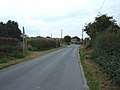
 Arram Road, Leconfield - geograph.org.uk - 4340550.jpg 640 × 480; 75 KB
-
 Arram Road, Leconfield - geograph.org.uk - 4340551.jpg 640 × 480; 60 KB
-
 Arram station - geograph.org.uk - 4703474.jpg 1,024 × 768; 238 KB
-
 Arram Station - geograph.org.uk - 5383986.jpg 640 × 426; 83 KB
-
 Arram Station - geograph.org.uk - 5383994.jpg 640 × 426; 89 KB
-
 Barley and wheat, near Arram Grange - geograph.org.uk - 4618830.jpg 454 × 640; 394 KB
-
 Barn and farm building at Leconfield - geograph.org.uk - 4411554.jpg 4,608 × 3,456; 4.92 MB
-
 Barn on Main Street, Leconfield - geograph.org.uk - 6356136.jpg 800 × 600; 70 KB
-
 Bench mark on St Leonard's, Scorborough - geograph.org.uk - 3323326.jpg 480 × 640; 128 KB
-
 Bench on Old Road, Leconfield - geograph.org.uk - 5953140.jpg 1,600 × 1,064; 1.04 MB
-
 Bend in the road towards Leconfield - geograph.org.uk - 4339321.jpg 640 × 480; 46 KB
-

-
 Beside the tidal River Hull - geograph.org.uk - 4459555.jpg 1,280 × 960; 1.09 MB
-
 Between Beverley and Barmston Drain and River Hull - geograph.org.uk - 4459563.jpg 1,280 × 960; 1.09 MB
-
 Beverley and Barmston Drain - geograph.org.uk - 5933145.jpg 1,024 × 768; 172 KB
-

-
 Beverley and Barmston Drain looking northeast - geograph.org.uk - 4253131.jpg 4,608 × 3,456; 3.56 MB
-
 Black Hill - geograph.org.uk - 5436311.jpg 640 × 330; 26 KB
-
 Bridge over Beverley and Barmston Drain - geograph.org.uk - 5880975.jpg 1,024 × 768; 171 KB
-
 Bridge over North Bullock Dike - geograph.org.uk - 4355161.jpg 640 × 480; 83 KB
-

-
 Bridge over the Beverley and Barmston Drain - geograph.org.uk - 4703522.jpg 1,024 × 768; 143 KB
-
 Bridge over the Catchwater Drain - geograph.org.uk - 4704383.jpg 1,024 × 768; 220 KB
-
 Bridleway and Carr House Farm - geograph.org.uk - 4703500.jpg 1,024 × 768; 119 KB
-
 Bridleway and North Bullock Dike - geograph.org.uk - 4785308.jpg 4,600 × 3,446; 5.27 MB
-
 Bridleway beside North Bullock Dike - geograph.org.uk - 4361538.jpg 640 × 480; 60 KB
-
 Bridleway beside North Bullock Dike - geograph.org.uk - 4361543.jpg 640 × 480; 67 KB
-
 Bridleway by ditch - geograph.org.uk - 5401801.jpg 640 × 441; 41 KB
-
 Bridleway heading east - geograph.org.uk - 4339397.jpg 640 × 480; 78 KB
-
 Bridleway heading east - geograph.org.uk - 4342664.jpg 640 × 480; 93 KB
-
 Bridleway leading to Arram Grange - geograph.org.uk - 4703514.jpg 1,024 × 768; 148 KB
-

-

-

-

-
 Bridleway near Carr House - geograph.org.uk - 4355153.jpg 640 × 480; 89 KB
-
 Bridleway to Arram - geograph.org.uk - 1497199.jpg 640 × 480; 84 KB
-
 Bridleway to Fairy Ground - geograph.org.uk - 252299.jpg 640 × 480; 110 KB
-
 Bridleway to Fairy Ground - geograph.org.uk - 4790179.jpg 1,024 × 768; 137 KB
-
 Bridleway to Gomary Hall Farm - geograph.org.uk - 4846025.jpg 1,024 × 787; 111 KB
-
 Bridleway to Watton - geograph.org.uk - 1516567.jpg 640 × 427; 395 KB
-
 Bridleway towards Fairy Ground - geograph.org.uk - 4341275.jpg 640 × 480; 83 KB
-
 Bridleway towards Leconfield - geograph.org.uk - 5953134.jpg 1,600 × 1,064; 659 KB
-
 Bungalows on Old Road, Leconfield - geograph.org.uk - 6355917.jpg 4,215 × 3,108; 2.4 MB
-
 Bus stop and shelter, Scorborough - geograph.org.uk - 5249336.jpg 640 × 480; 64 KB
-
 Bus stop on the A164 - geograph.org.uk - 4341266.jpg 640 × 480; 63 KB
-
 Bus stop on the A164 - geograph.org.uk - 4355081.jpg 640 × 480; 57 KB
-
 Bus stop on the A164, Leconfield - geograph.org.uk - 4339330.jpg 640 × 480; 67 KB
-
 By Scorborough Lane - geograph.org.uk - 4889733.jpg 640 × 506; 616 KB
-

-
 Carr House - geograph.org.uk - 4342667.jpg 640 × 480; 85 KB
-
 Carr House - geograph.org.uk - 4342670.jpg 640 × 480; 116 KB
-
 Carr House farm - geograph.org.uk - 4459579.jpg 1,280 × 960; 1.32 MB
-
 Carr House farm used to be here - geograph.org.uk - 4459576.jpg 1,280 × 960; 1.4 MB
-
 Carr House Farm viewed from the east - geograph.org.uk - 3015674.jpg 3,192 × 2,280; 1.16 MB
-
 Catchwater Drain - geograph.org.uk - 1497233.jpg 640 × 480; 123 KB
-
 Catchwater Drain - geograph.org.uk - 1516522.jpg 640 × 427; 391 KB
-
 Catchwater Drain - geograph.org.uk - 1516540.jpg 640 × 427; 380 KB
-
 Catchwater Drain - geograph.org.uk - 1516542.jpg 640 × 427; 363 KB
-
 Catchwater Drain - geograph.org.uk - 2221281.jpg 3,264 × 2,448; 1.54 MB
-
 Catchwater Drain - geograph.org.uk - 3362670.jpg 1,024 × 768; 157 KB
-
 Catchwater Drain - geograph.org.uk - 3362677.jpg 1,024 × 768; 175 KB
-
 Catchwater Drain - geograph.org.uk - 5383942.jpg 640 × 426; 41 KB
-
 Catchwater Drain - geograph.org.uk - 5401826.jpg 640 × 521; 56 KB
-
 Catchwater Drain - northwards - geograph.org.uk - 1516526.jpg 640 × 427; 410 KB
-
 Catchwater Drain beside former RAF Leconfield - geograph.org.uk - 4459572.jpg 1,280 × 960; 1.42 MB
-
 Catchwater Drain, Arram - geograph.org.uk - 3715147.jpg 1,024 × 681; 329 KB
-
 Catchwater Drain, near Arram, E Yorks - geograph.org.uk - 2900133.jpg 476 × 640; 212 KB
-
 Catchwater Drain, near Scorborough - geograph.org.uk - 2900151.jpg 640 × 462; 198 KB
-
 Chapel Garth, Arram - geograph.org.uk - 3715057.jpg 1,024 × 681; 383 KB
-
 Chapel Garth, Arram - geograph.org.uk - 3715155.jpg 1,024 × 681; 311 KB
-
 Chapel Garth, Arram - geograph.org.uk - 4339308.jpg 640 × 480; 71 KB
-
 Chapel Garth, Arram - geograph.org.uk - 4339309.jpg 640 × 480; 94 KB
-
 Clogged drains - geograph.org.uk - 4703773.jpg 1,024 × 768; 244 KB
-
 Close up, Elizabeth II postbox on Old Road, Leconfield - geograph.org.uk - 6355916.jpg 2,491 × 4,760; 3.05 MB
-

-
 Cottage and church, Scorborough - geograph.org.uk - 4889748.jpg 640 × 494; 393 KB
-
 Cowthorpe, Arram Road - geograph.org.uk - 4851754.jpg 1,024 × 768; 217 KB
-
 Croft Hill House, Arram - geograph.org.uk - 3715170.jpg 1,024 × 681; 401 KB
-
 Crop field and hedgerow - geograph.org.uk - 4339399.jpg 640 × 480; 70 KB
-
 Crop field and hedgerow - geograph.org.uk - 4341264.jpg 640 × 480; 60 KB
-

-
 Crop field and power lines - geograph.org.uk - 4342753.jpg 640 × 480; 40 KB
-
 Crop field and power lines - geograph.org.uk - 4355158.jpg 640 × 480; 46 KB
-

-
 Crop field near Carr House - geograph.org.uk - 4355151.jpg 640 × 480; 66 KB
-
 Crop field near Carr House - geograph.org.uk - 4355156.jpg 640 × 480; 75 KB
-
 Crop field near Carr House - geograph.org.uk - 4361545.jpg 640 × 480; 60 KB
-
 Crop field near Leconfield - geograph.org.uk - 4341239.jpg 640 × 480; 59 KB
-
 Crop field near Leconfield Low Parks - geograph.org.uk - 4342658.jpg 640 × 480; 68 KB
-
 Crop field near Pump Bridge - geograph.org.uk - 4341258.jpg 640 × 438; 48 KB
-
 Crop field of the A164 - geograph.org.uk - 4355077.jpg 640 × 480; 66 KB
-
 Crop field south of Carr House - geograph.org.uk - 4342766.jpg 640 × 480; 70 KB
-

-
 Crop field west of Driffield Road - geograph.org.uk - 4341268.jpg 640 × 480; 65 KB
-
 Crop field, Black Hill - geograph.org.uk - 4361557.jpg 640 × 480; 97 KB
-
 Crop field, Black Hill - geograph.org.uk - 4361564.jpg 640 × 480; 67 KB
-
 Crop field, Leconfield Low Parks - geograph.org.uk - 4340899.jpg 640 × 480; 70 KB
-
 Crop field, Leconfield Low Parks - geograph.org.uk - 4342619.jpg 640 × 480; 99 KB
-
 Crop field, Leconfield Low Parks - geograph.org.uk - 4361535.jpg 640 × 480; 80 KB
-
 Crop field, Molescroft - geograph.org.uk - 4341301.jpg 640 × 480; 60 KB
-
 Crop field,Leconfield Grange - geograph.org.uk - 4340516.jpg 640 × 480; 59 KB
-
 Crops by Minster Way - geograph.org.uk - 5449916.jpg 640 × 282; 31 KB
-
 Crops in a field - geograph.org.uk - 5436297.jpg 640 × 426; 64 KB
-
 Crops, farm and wind turbine - geograph.org.uk - 5436298.jpg 640 × 426; 55 KB
-
 Crops, Holderness - geograph.org.uk - 5449907.jpg 640 × 426; 49 KB
-
 Crossing gates, Leconfield Low Parks - geograph.org.uk - 4339390.jpg 640 × 480; 57 KB
-
 Crow Tree Farm, Arram - geograph.org.uk - 3715216.jpg 1,024 × 681; 398 KB
-
 Cycle path beside the A164 - geograph.org.uk - 4341262.jpg 640 × 480; 46 KB
-
 Decoy Farm from Station Road - geograph.org.uk - 2247803.jpg 800 × 600; 245 KB
-
 Derelict farmhouse south of Arram - geograph.org.uk - 4618817.jpg 640 × 480; 514 KB
-

-
 Ditch by the railway - geograph.org.uk - 5401833.jpg 640 × 426; 43 KB
-
 Drain and plantation - geograph.org.uk - 4846079.jpg 1,024 × 768; 248 KB
-
 Drain beside bridleway - geograph.org.uk - 4339392.jpg 640 × 480; 129 KB
_-_geograph.org.uk_-_4341271.jpg)


