Category:Lake Pend Oreille
Jump to navigation
Jump to search
lake in Kootenai and Bonner counties in Idaho, United States  | |||||
| Upload media | |||||
| Instance of | |||||
|---|---|---|---|---|---|
| Located in protected area |
| ||||
| Location |
| ||||
| Length |
| ||||
| Area |
| ||||
| Elevation above sea level |
| ||||
| Inflows |
| ||||
| Outflows | |||||
| Drainage basin |
| ||||
| Basin country | |||||
 | |||||
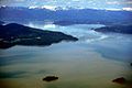
English: Media related to Lake Pend Oreille (pronounced: pond-o-ray), a lake in the northern Idaho Panhandle in Bonner and Kootenai counties in Idaho, United States, that is fed by the Clark Fork and the Pack River, and drains via the Pend Oreille River.
Subcategories
This category has the following 5 subcategories, out of 5 total.
Media in category "Lake Pend Oreille"
The following 34 files are in this category, out of 34 total.
-
 -IDAHO-C-0050- Lake Pend Oreille - Cape Horn (50810437438).jpg 1,251 × 1,987; 1.02 MB
-
 -IDAHO-C-0051- Lake Pend Oreille - Sandpoint (50811181326).jpg 2,024 × 1,236; 1.03 MB
-
 2011-365-197 Today's Hike is Brought to You By the Letter H (5948049210).jpg 2,376 × 1,584; 1.38 MB
-
 Advanced Electric Ship Demonstrator (cropped).jpg 2,101 × 1,394; 818 KB
-
 Advanced Electric Ship Demonstrator.jpg 2,464 × 1,632; 1.01 MB
-
 Aerial - Lake Pend Oreille, Idaho 01 (9967579334).jpg 4,288 × 2,848; 3.65 MB
-
 Aerial - Lake Pend Oreille, Idaho 01 - white balanced (9967578025).jpg 4,288 × 2,848; 5.45 MB
-
 Aerial - Lake Pend Oreille, Idaho 02 (9967555586).jpg 4,288 × 2,848; 4.98 MB
-
 Aerial - Lake Pend Oreille, Idaho 02 - white balanced (9967555224).jpg 4,288 × 2,848; 6.23 MB
-
 Aerial - Lake Pend Oreille, Idaho 03 (9967411425).jpg 4,288 × 2,848; 4.84 MB
-
 Aerial - Lake Pend Oreille, Idaho 03 - white balanced (9967483814).jpg 4,288 × 2,848; 6.05 MB
-
 Aerial - Lake Pend Oreille, Idaho 04 (9967370534).jpg 4,288 × 2,848; 4.07 MB
-
 Aerial - Lake Pend Oreille, Idaho 04 - white balanced (9967377965).jpg 4,288 × 2,848; 6.14 MB
-
 Aerial - Lake Pend Oreille, Idaho 05 (9967337106).jpg 4,288 × 2,848; 4.77 MB
-
 Aerial - Lake Pend Oreille, Idaho 05 - white balanced (9967446913).jpg 4,288 × 2,848; 7.66 MB
-
 Aerial - Northeast shore of Lake Pend Oreille, Idaho 01 (9967180635).jpg 4,288 × 2,848; 4.62 MB
-
 Aerial - Northeast shore of Lake Pend Oreille, Idaho 01 - white balanced (9967227605).jpg 4,288 × 2,848; 7.15 MB
-
 Best Chair for Reading (5953494864).jpg 2,592 × 1,936; 1.81 MB
-
 Bull trout sign at Lake Pend Oreille.jpg 1,600 × 1,200; 532 KB
-
 ClarkForkMouth.jpg 499 × 273; 64 KB
-
 International Selkirk Loop - Lions Club Train - NARA - 7719604.jpg 1,510 × 560; 134 KB
-
 Lake Pend Oreille (1771734946).jpg 1,088 × 755; 87 KB
-
 Lake Pend Oreille 2017-09-23 (1).jpg 8,523 × 2,679; 2.96 MB
-
 Lake Pend Oreille Fishing Report.jpg 800 × 1,067; 258 KB
-
 Lake Pend Oreille.jpg 1,500 × 1,001; 357 KB
-
 Sandpoint and Lake Pend Oreille and Elmo fire plume aerial.jpg 4,080 × 2,897; 3.03 MB
-
 Sandpoint Beach (7).JPG 450 × 600; 56 KB
-
 Sandpoint Bridge, 1912.jpg 918 × 617; 115 KB
-

-

-

-
 Sunset on the Lake - panoramio.jpg 1,600 × 1,200; 321 KB
-
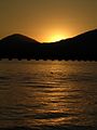 Sunset on the Lake 2 - panoramio.jpg 1,200 × 1,600; 335 KB
-
 U.S. Naval Training Staion (Lake Pend Oreille) Farragut, Idaho. - NARA - 195430.jpg 3,000 × 1,812; 3.17 MB
.jpg)
.jpg)
.jpg)
.jpg)

.jpg)
.jpg)
.jpg)
.jpg)
.jpg)
.jpg)
.jpg)
.jpg)
.jpg)
.jpg)
.jpg)
.jpg)
.jpg)


.jpg)


.JPG)

.jpg)
.jpg)
.jpg)


_Farragut,_Idaho._-_NARA_-_195430.jpg)
.jpg)