Category:Knaith
Jump to navigation
Jump to search
village and civil parish in Lincolnshire, United Kingdom  | |||||
| Upload media | |||||
| Instance of | |||||
|---|---|---|---|---|---|
| Location | West Lindsey, Lincolnshire, East Midlands, England | ||||
| Said to be the same as | Knaith (Wikimedia duplicated page, civil parish) | ||||
 | |||||
Media in category "Knaith"
The following 85 files are in this category, out of 85 total.
-
 A bend in the A156 - geograph.org.uk - 3533285.jpg 640 × 480; 61 KB
-
 A colour of red - geograph.org.uk - 1371914.jpg 640 × 427; 93 KB
-
 A156 Gainsborough Road - geograph.org.uk - 5192911.jpg 2,744 × 1,781; 1.97 MB
-
 A156 junction with Knaith Hill - geograph.org.uk - 3492386.jpg 1,806 × 1,179; 1.37 MB
-
 B1241 Kexby Lane - geograph.org.uk - 4655264.jpg 1,024 × 690; 112 KB
-
 B1241 towards Kexby - geograph.org.uk - 2985743.jpg 640 × 480; 44 KB
-
 B1241 Willingham Road - geograph.org.uk - 4655254.jpg 1,024 × 705; 136 KB
-
 Bend on Station Road - geograph.org.uk - 3283741.jpg 2,256 × 1,504; 1.38 MB
-
 Coal empties head south - geograph.org.uk - 1371906.jpg 640 × 446; 92 KB
-
 Crop field south of Knaith - geograph.org.uk - 3533292.jpg 640 × 480; 73 KB
-
 Crop field, Red Hill - geograph.org.uk - 3533290.jpg 640 × 480; 113 KB
-
 Cut Mark, Knaith Park, 91 Willingham Road - geograph.org.uk - 5245843.jpg 960 × 1,280; 293 KB
-
 Cut Mark, Knaith, 6 Knaith Hill - geograph.org.uk - 5245828.jpg 1,237 × 1,280; 413 KB
-
 Drain beside Kexby Lane - geograph.org.uk - 2985762.jpg 640 × 480; 108 KB
-
-
 Farm track off Station Road near Knaith - geograph.org.uk - 5781915.jpg 1,600 × 1,056; 666 KB
-
 Farm Track to Redhill - geograph.org.uk - 1336845.jpg 640 × 480; 37 KB
-
 Farmland and woodland off Kexby Lane - geograph.org.uk - 2985758.jpg 640 × 480; 78 KB
-
 Farmland near Knaith (1) - geograph.org.uk - 1738744.jpg 491 × 640; 154 KB
-
 Farmland near Knaith (2) - geograph.org.uk - 1738752.jpg 480 × 640; 137 KB
-
 Farmland near Knaith (3) - geograph.org.uk - 1738762.jpg 640 × 480; 143 KB
-
 Farmland near Siding Farm - geograph.org.uk - 2830195.jpg 640 × 527; 88 KB
-
 Farmland towards the River Trent - geograph.org.uk - 3533284.jpg 640 × 480; 67 KB
-
 Farmland, Knaith - geograph.org.uk - 3533286.jpg 640 × 480; 57 KB
-
 Farmland, Park Farm North - geograph.org.uk - 2830198.jpg 640 × 408; 46 KB
-
 Field near Park Farm South - geograph.org.uk - 3039061.jpg 1,024 × 768; 133 KB
-
 Fields towards Cottam Power station - geograph.org.uk - 1336874.jpg 640 × 308; 35 KB
-
 Footpath in Park Plantation - geograph.org.uk - 4500341.jpg 1,024 × 768; 284 KB
-
 Footpath to Kexby - geograph.org.uk - 5157367.jpg 1,024 × 768; 231 KB
-
 Gainsborough Road (A156) - geograph.org.uk - 3533288.jpg 640 × 480; 83 KB
-
 Gainsborough Road (A156) - geograph.org.uk - 3533293.jpg 640 × 480; 73 KB
-
 Gainsborough-Lincoln railway (3) - geograph.org.uk - 1739028.jpg 640 × 480; 155 KB
-
 Grotesque, St Mary's church, Knaith - geograph.org.uk - 5391574.jpg 1,600 × 1,060; 388 KB
-
 Kexby Lane (B1241) heading east - geograph.org.uk - 2985761.jpg 640 × 480; 52 KB
-
 Kexby Lane - geograph.org.uk - 3358403.jpg 640 × 427; 73 KB
-
 Kexby Lane - geograph.org.uk - 3358410.jpg 640 × 427; 92 KB
-
 Kexby Lane B1241 - geograph.org.uk - 2004902.jpg 640 × 480; 44 KB
-
 Knaith Hall - geograph.org.uk - 3158668.jpg 640 × 427; 238 KB
-
 Knaith Hall - geograph.org.uk - 3158672.jpg 640 × 427; 203 KB
-
 Knaith Hall overlooking the River Trent - geograph.org.uk - 5367569.jpg 800 × 560; 124 KB
-
 Knaith Hall seen across the Trent - geograph.org.uk - 2534284.jpg 1,024 × 768; 132 KB
-
 Knaith Hill heading west - geograph.org.uk - 3283734.jpg 2,256 × 1,504; 1.23 MB
-
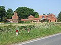 Knaith Park Hall - geograph.org.uk - 2004901.jpg 640 × 480; 95 KB
-
 Knaith Park, 91 Willingham Road - geograph.org.uk - 5245841.jpg 1,280 × 960; 354 KB
-
 Knaith, 6 Knaith Hill - geograph.org.uk - 5245815.jpg 1,280 × 960; 308 KB
-
 Knaith, aerial 2013 - geograph.org.uk - 3641109.jpg 640 × 427; 67 KB
-
 Knaith, Upton Road, rivet on a bridge - geograph.org.uk - 5280599.jpg 1,280 × 960; 548 KB
-
 Lea Marshes - geograph.org.uk - 1721886.jpg 640 × 426; 82 KB
-
 Lea Marshes - geograph.org.uk - 1726774.jpg 640 × 426; 97 KB
-
 Lea Marshes - geograph.org.uk - 4906317.jpg 1,024 × 683; 168 KB
-
 Lincolnshire countryside south of Tiger Holt wood - geograph.org.uk - 1701614.jpg 2,608 × 1,952; 1.98 MB
-
 Looking towards Moor House from Station Road - geograph.org.uk - 1838992.jpg 1,600 × 1,200; 227 KB
-
 Looking towards Park Plantation from Station Road - geograph.org.uk - 1839946.jpg 1,600 × 1,200; 278 KB
-
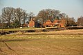 Park Farm North - geograph.org.uk - 3358418.jpg 640 × 427; 109 KB
-
 Poppy Field - geograph.org.uk - 1691498.jpg 3,506 × 2,260; 1.49 MB
-
 Railway towards Lincoln - geograph.org.uk - 2985738.jpg 640 × 480; 77 KB
-
 Red Hill - geograph.org.uk - 2534322.jpg 1,024 × 768; 191 KB
-
 Remote house south of Tiger Holt wood - geograph.org.uk - 1701618.jpg 2,608 × 1,952; 1.34 MB
-
 Ride in Park Plantation - geograph.org.uk - 5157438.jpg 1,024 × 768; 281 KB
-
 River Trent, 81km from somewhere, but where^ - geograph.org.uk - 5091188.jpg 3,072 × 1,728; 4.42 MB
-

-
 Spruce Walk - geograph.org.uk - 5157423.jpg 1,024 × 768; 126 KB
-
 Spruce Walk - geograph.org.uk - 5157434.jpg 1,024 × 768; 163 KB
-
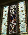
 St Mary's Church, Knaith - geograph.org.uk - 5893062.jpg 1,065 × 1,600; 358 KB
-
 St Mary's Church, Knaith - geograph.org.uk - 5893064.jpg 1,065 × 1,600; 476 KB
-
 St Mary's Church, Knaith - geograph.org.uk - 5893065.jpg 1,600 × 1,065; 424 KB
-
 St Mary's Church, Knaith - geograph.org.uk - 5893066.jpg 1,600 × 1,065; 504 KB
-
 St Mary's Church, Knaith - geograph.org.uk - 5893067.jpg 1,065 × 1,600; 454 KB
-
 St Mary's Church, Knaith - geograph.org.uk - 5893068.jpg 1,296 × 1,600; 883 KB
-
 St Mary's Church, Knaith - geograph.org.uk - 5893070.jpg 1,600 × 1,065; 766 KB
-
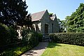 St Mary's, Knaith - geograph.org.uk - 5781923.jpg 1,600 × 1,065; 856 KB
-
 Station Road towards Knaith - geograph.org.uk - 5781908.jpg 1,600 × 1,097; 816 KB
-
 Stream entering the Trent - geograph.org.uk - 3158650.jpg 640 × 427; 232 KB
-
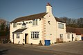 The Stag's Head - geograph.org.uk - 3358469.jpg 640 × 427; 69 KB
-
 The Stag's Head Pub, Knaith Park - geograph.org.uk - 3283745.jpg 2,256 × 1,504; 702 KB
-
 The Stags Head - geograph.org.uk - 2985741.jpg 640 × 480; 61 KB
-
 Track to Fox Covert - geograph.org.uk - 1336847.jpg 640 × 480; 39 KB
-
 Track to the Trent - geograph.org.uk - 4906321.jpg 1,024 × 683; 256 KB
-
 Upton Road at Knaith Park - geograph.org.uk - 5781900.jpg 1,600 × 1,102; 466 KB
-
 Victorian postbox - geograph.org.uk - 273985.jpg 427 × 640; 91 KB
-
 View from Kexby Lane - geograph.org.uk - 3041495.jpg 1,024 × 768; 196 KB
-
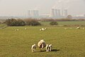
 View towards West Burton Power Station - geograph.org.uk - 2192750.jpg 1,024 × 768; 140 KB
-
 View towards West Burton power station - geograph.org.uk - 4500374.jpg 1,024 × 768; 129 KB
-
 Wild Flowers - geograph.org.uk - 1371909.jpg 640 × 427; 99 KB
-
 Willingham Road - geograph.org.uk - 3358453.jpg 640 × 427; 79 KB


_-_geograph.org.uk_-_1738744.jpg)
_-_geograph.org.uk_-_1738752.jpg)
_-_geograph.org.uk_-_1738762.jpg)


_-_geograph.org.uk_-_3533288.jpg)
_-_geograph.org.uk_-_3533293.jpg)
_-_geograph.org.uk_-_1739028.jpg)

_heading_east_-_geograph.org.uk_-_2985761.jpg)


