Category:Kinghorn
Jump to navigation
Jump to search

town and parish in Fife, Scotland, UK  | |||||
| Upload media | |||||
| Instance of | |||||
|---|---|---|---|---|---|
| Location |
| ||||
| Population |
| ||||
 | |||||
Subcategories
This category has the following 8 subcategories, out of 8 total.
B
- Kinghorn beach (15 F)
K
- Kinghorn Town Hall (2 F)
- Kinghorn war memorial (2 F)
L
- Kinghorn Loch (8 F)
P
R
- Kinghorn railway station (6 F)
S
Media in category "Kinghorn"
The following 163 files are in this category, out of 163 total.
-
 2016 - January Fife Walk (24254461266).jpg 4,928 × 3,264; 1.62 MB
-
 A gull looks down on Kinghorn - geograph.org.uk - 1982212.jpg 480 × 640; 110 KB
-
 A pier at Pettycur - geograph.org.uk - 2487254.jpg 640 × 394; 51 KB
-
 A921 Burntisland Road near the Bay Hotel - geograph.org.uk - 6420881.jpg 800 × 606; 117 KB
-
 Access Gate - geograph.org.uk - 5419284.jpg 640 × 425; 138 KB
-
 Across the A921 to the sands - geograph.org.uk - 3537344.jpg 640 × 427; 249 KB
-
 Alexander III monument along the A921 - geograph.org.uk - 6420878.jpg 800 × 543; 129 KB
-
 Alexander III Monument at Kinghorn - geograph.org.uk - 2370736.jpg 480 × 640; 99 KB
-
 Alexander III monument beside the A921 - geograph.org.uk - 6126769.jpg 1,600 × 1,138; 379 KB
-
 Alexander III Monument panel - geograph.org.uk - 2370731.jpg 640 × 486; 72 KB
-
 Alexander III Monument panels - geograph.org.uk - 2370714.jpg 480 × 640; 70 KB
-
 Alexander III Monument poem - geograph.org.uk - 2370739.jpg 640 × 482; 90 KB
-
 Alexander III Monument, Kinghorn - geograph.org.uk - 2370708.jpg 480 × 640; 59 KB
-
 Approaching Seafield Tower - geograph.org.uk - 6298217.jpg 640 × 480; 73 KB
-
 Banchory - geograph.org.uk - 75071.jpg 640 × 480; 281 KB
-
 Beach and harbour at Kinghorn - geograph.org.uk - 6225720.jpg 800 × 513; 106 KB
-
 Beach at Pettycur Bay - geograph.org.uk - 2487286.jpg 640 × 494; 64 KB
-
 Beach between Kinghorn and Burntisland - geograph.org.uk - 3821308.jpg 640 × 408; 231 KB
-
 Beach Cleaning Station - geograph.org.uk - 6298207.jpg 640 × 480; 100 KB
-
 Beach north of Kinghorn - geograph.org.uk - 2565953.jpg 640 × 413; 405 KB
-
 Beach west of Pettycur - geograph.org.uk - 3821317.jpg 640 × 480; 393 KB
-
 Boats at Pettycur - geograph.org.uk - 1982195.jpg 640 × 484; 109 KB
-
 Bridge across the railway line - geograph.org.uk - 6420897.jpg 800 × 537; 101 KB
-
 Burntisland from Pettycur Bay - geograph.org.uk - 3389954.jpg 3,264 × 2,448; 3.46 MB
-
 Church Hall and War Memorial - geograph.org.uk - 962479.jpg 640 × 480; 60 KB
-
 Coastal Fife , Kinghorn Parish Church - geograph.org.uk - 3519131.jpg 1,600 × 1,200; 273 KB
-
 Cranesbill on the Fife coast - geograph.org.uk - 1982222.jpg 640 × 480; 101 KB
-
 Crinoid Fossils - geograph.org.uk - 2565977.jpg 640 × 427; 482 KB
-
 Cross-bedding - geograph.org.uk - 2566128.jpg 640 × 426; 399 KB
-
 David the First Street, Kinghorn - geograph.org.uk - 1154166.jpg 640 × 480; 66 KB
-
 Dipping Strata - geograph.org.uk - 2565945.jpg 640 × 413; 377 KB
-
 East Bay Forth Rail Bridge.jpg 882 × 661; 186 KB
-
 Ecological allotments - geograph.org.uk - 5182587.jpg 2,560 × 1,920; 3.27 MB
-
 Edinburgh - Dundee railway - geograph.org.uk - 1480633.jpg 640 × 457; 71 KB
-
 Fault Breccia - geograph.org.uk - 2566060.jpg 418 × 640; 451 KB
-
 Fault in the Rocks - geograph.org.uk - 2566102.jpg 425 × 640; 412 KB
-
 Fields north of Kinghorn - geograph.org.uk - 5721652.jpg 3,264 × 2,448; 3.07 MB
-
 Fife coast at Kinghorn - geograph.org.uk - 5908376.jpg 1,024 × 768; 123 KB
-
 Fife coast east of Seafield - geograph.org.uk - 3877341.jpg 640 × 427; 371 KB
-
 Fife Coastal Path - geograph.org.uk - 3408378.jpg 1,600 × 1,132; 147 KB
-
 Fife Coastal Path, Kinghorn - geograph.org.uk - 1154192.jpg 640 × 480; 74 KB
-
 Fife coastal path, Kinghorn - geograph.org.uk - 1479719.jpg 640 × 480; 119 KB
-
 Fife Coastline - geograph.org.uk - 879867.jpg 640 × 425; 58 KB
-

-
 Flats, South Overgate - geograph.org.uk - 1474643.jpg 640 × 480; 93 KB
-
 Flooded cutting - geograph.org.uk - 1594868.jpg 640 × 359; 134 KB
-
 Foreshore near Kinghorn - geograph.org.uk - 2565842.jpg 640 × 425; 412 KB
-
 Foreshore near Linton Court - geograph.org.uk - 2566037.jpg 640 × 424; 449 KB
-
 Foreshore near Linton Court - geograph.org.uk - 2566076.jpg 640 × 420; 405 KB
-
 Former Kinghorn Primary School, Kinghorn.jpg 3,264 × 2,448; 2.9 MB
-
 Gateway to Grangehill - geograph.org.uk - 5419225.jpg 640 × 425; 108 KB
-
 Grangehill Farm - geograph.org.uk - 5419164.jpg 640 × 425; 103 KB
-
 Gravestone, Kinghorn Parish Church - geograph.org.uk - 3821597.jpg 480 × 640; 522 KB
-
 Harbour at Pettycur - geograph.org.uk - 3821416.jpg 640 × 413; 442 KB
-
 Harbour Kinghorn - geograph.org.uk - 6374605.jpg 1,024 × 683; 99 KB
-
 High Street , Kinghorn - geograph.org.uk - 1479715.jpg 640 × 480; 78 KB
-
 I Saw Three Ships - geograph.org.uk - 2565905.jpg 640 × 415; 368 KB
-
 Inch View at Pettycur - geograph.org.uk - 6420928.jpg 800 × 583; 113 KB
-
 Kiln Rocks - geograph.org.uk - 2565925.jpg 640 × 421; 410 KB
-
 Kiln Rocks - geograph.org.uk - 2565968.jpg 640 × 416; 424 KB
-
 Kinghorn (49595380357).jpg 4,958 × 2,271; 9.63 MB
-
Kinghorn (older, local).ogg 1.6 s; 30 KB
-
 Kinghorn - geograph.org.uk - 2566152.jpg 640 × 415; 408 KB
-
 Kinghorn - geograph.org.uk - 316681.jpg 640 × 424; 31 KB
-
 Kinghorn - geograph.org.uk - 423295.jpg 640 × 424; 54 KB
-
 Kinghorn - geograph.org.uk - 423311.jpg 640 × 516; 134 KB
-
 Kinghorn - geograph.org.uk - 423808.jpg 640 × 424; 52 KB
-
 Kinghorn - geograph.org.uk - 423836.jpg 640 × 424; 68 KB
-
 Kinghorn - geograph.org.uk - 423873.jpg 640 × 424; 52 KB
-
 Kinghorn - geograph.org.uk - 5427222.jpg 640 × 427; 368 KB
-
 Kinghorn and Pettycur from the air - geograph.org.uk - 2208901.jpg 2,592 × 1,451; 1.15 MB
-
 Kinghorn and the Fife Coast - geograph.org.uk - 3009940.jpg 3,264 × 2,448; 2.66 MB
-
 Kinghorn Bay - geograph.org.uk - 23959.jpg 640 × 480; 77 KB
-
 Kinghorn Bay - geograph.org.uk - 2571047.jpg 640 × 480; 84 KB
-
 Kinghorn Bay - geograph.org.uk - 310780.jpg 640 × 480; 67 KB
-
 Kinghorn Beach - geograph.org.uk - 5769107.jpg 5,706 × 3,475; 4.5 MB
-
 Kinghorn Beach - geograph.org.uk - 6298206.jpg 640 × 480; 78 KB
-
 Kinghorn beach at St James Place - geograph.org.uk - 6298209.jpg 640 × 480; 100 KB
-
 Kinghorn cottages - geograph.org.uk - 5182602.jpg 2,560 × 1,920; 871 KB
-
 Kinghorn from the air - geograph.org.uk - 4072041.jpg 480 × 640; 99 KB
-
 Kinghorn from the coastal path to the NE - geograph.org.uk - 2525859.jpg 2,592 × 1,944; 1.68 MB
-
 Kinghorn Harbour - geograph.org.uk - 2525885.jpg 2,592 × 1,944; 1.59 MB
-
 Kinghorn Harbour - geograph.org.uk - 3234364.jpg 3,648 × 2,736; 1.06 MB
-
 Kinghorn Harbour - geograph.org.uk - 3520788.jpg 3,264 × 2,448; 4.09 MB
-
 Kinghorn Harbour - geograph.org.uk - 3677252.jpg 1,024 × 768; 164 KB
-
 Kinghorn Harbour - geograph.org.uk - 6298203.jpg 640 × 480; 87 KB
-
 Kinghorn Harbour Holiday Park - geograph.org.uk - 4992178.jpg 640 × 317; 100 KB
-
 Kinghorn Harbour Holiday Park - geograph.org.uk - 4992181.jpg 640 × 324; 98 KB
-
 Kinghorn Harbour.jpg 2,288 × 1,712; 1.32 MB
-
 Kinghorn Ness from the air - geograph.org.uk - 2725508.jpg 640 × 381; 111 KB
-
 Kinghorn parish church - geograph.org.uk - 2508721.jpg 730 × 1,024; 104 KB
-
 Kinghorn Parish Church - geograph.org.uk - 316493.jpg 640 × 424; 43 KB
-
 Kinghorn Parish Church - geograph.org.uk - 3408338.jpg 1,600 × 1,062; 160 KB
-
 Kinghorn Parish Church - geograph.org.uk - 4992195.jpg 640 × 403; 129 KB
-
 Kinghorn Parish Church - geograph.org.uk - 4992199.jpg 640 × 384; 117 KB
-
 Kinghorn railway viaduct looking towards harbour.jpg 3,088 × 2,056; 1.34 MB
-
 Kinghorn Sailing Club - geograph.org.uk - 5769101.jpg 5,675 × 3,392; 3.71 MB
-
 Kinghorn Shoreline - geograph.org.uk - 2162090.jpg 640 × 333; 57 KB
-
 Kinghorn, from over the Firth of Forth - geograph.org.uk - 4547668.jpg 3,264 × 2,448; 3.4 MB
-
Kinghorn.ogg 0.8 s; 19 KB
-
 Kingswood Hotel - geograph.org.uk - 3988840.jpg 4,608 × 3,456; 3.32 MB
-

-
 Lifeboat Training - geograph.org.uk - 2566144.jpg 640 × 491; 393 KB
-
 Limestone Layers and Lava Lumps - geograph.org.uk - 2565868.jpg 640 × 413; 397 KB
-
 Little boats at Kinghorn - geograph.org.uk - 1016330.jpg 640 × 480; 46 KB
-

-
 Manure - geograph.org.uk - 42716.jpg 640 × 429; 59 KB
-
 Marine Transgression - geograph.org.uk - 2566007.jpg 410 × 640; 440 KB
-
 Minor road near Kinghorn - geograph.org.uk - 666358.jpg 640 × 464; 59 KB
-
 Minor road, Kinghorn - geograph.org.uk - 3821587.jpg 433 × 640; 375 KB
-
 Mixed Rocks - geograph.org.uk - 2565850.jpg 640 × 427; 451 KB
-
 Mooring lines - geograph.org.uk - 2569117.jpg 800 × 600; 186 KB
-
 Mysterious Artefacts - geograph.org.uk - 5419181.jpg 640 × 425; 107 KB
-
 New housing, Kinghorn - geograph.org.uk - 5864763.jpg 5,584 × 3,437; 4.04 MB
-
 North of the Kiln Rocks - geograph.org.uk - 2565916.jpg 640 × 414; 445 KB
-
 Ocean Guardian off Burntisland - geograph.org.uk - 4794367.jpg 640 × 430; 88 KB
-
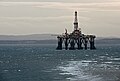
 Oil rig, Firth of Forth - geograph.org.uk - 1016312.jpg 640 × 475; 46 KB
-
 Old Cottage Ruin - geograph.org.uk - 5419193.jpg 640 × 425; 99 KB
-
 Old Cottage Ruins - geograph.org.uk - 5419173.jpg 640 × 425; 124 KB
-
 Old track to Kirkcaldy - geograph.org.uk - 1594871.jpg 640 × 359; 110 KB
-
 On The Fife Circle , Coastal Caravan Park At Kinghorn - geograph.org.uk - 3519031.jpg 1,600 × 1,200; 273 KB
-
 On The Fife Coast , Caravan Park At Kinghorn - geograph.org.uk - 3519041.jpg 1,600 × 1,200; 229 KB
-
 Pettycur Bay - geograph.org.uk - 4992295.jpg 640 × 336; 80 KB
-
 Pettycur Bay - geograph.org.uk - 4992302.jpg 640 × 376; 103 KB
-
 Pettycur Bay along the Fife coast - geograph.org.uk - 6420924.jpg 800 × 572; 125 KB
-
 Pettycur Harbour - geograph.org.uk - 5419137.jpg 640 × 425; 98 KB
-
 Pettycur Harbour and Bay - geograph.org.uk - 6420908.jpg 800 × 541; 132 KB
-
 Pettycur Pier,Kinghorn - geograph.org.uk - 2162128.jpg 640 × 298; 53 KB
-
 Pillow Lavas - geograph.org.uk - 2565834.jpg 640 × 427; 430 KB
-
 Playground, Kinghorn - geograph.org.uk - 1479718.jpg 640 × 480; 104 KB
-
 Ploughing, Craigencalt. - geograph.org.uk - 8770.jpg 640 × 480; 50 KB
-
 Poppies and thistles - geograph.org.uk - 1982201.jpg 640 × 484; 107 KB
-
 Public Footpath to Kinghorn - geograph.org.uk - 5721654.jpg 3,264 × 2,448; 2.68 MB
-
 Railway line near Kinghorn - geograph.org.uk - 6420889.jpg 800 × 512; 113 KB
-
 Railway line towards Kinghorn - geograph.org.uk - 6420893.jpg 800 × 593; 168 KB
-
 Rocks near Kinghorn - geograph.org.uk - 3609257.jpg 640 × 571; 79 KB
-
 Rocks on the shore at Seafield - geograph.org.uk - 1981348.jpg 1,600 × 1,211; 264 KB
-
 Rocks south of Kirkcaldy - geograph.org.uk - 3609261.jpg 640 × 486; 69 KB
-
 Rocky coastline - geograph.org.uk - 2508662.jpg 1,024 × 768; 172 KB
-
 Rocky foreshore below Seafield Tower - geograph.org.uk - 6298221.jpg 640 × 480; 81 KB
-
 Row of cottages - geograph.org.uk - 666886.jpg 640 × 426; 78 KB
-
 Ruin with outhouse - geograph.org.uk - 879850.jpg 640 × 422; 102 KB
-
 Sands east of Burntisland - geograph.org.uk - 3609241.jpg 1,024 × 600; 72 KB
-
 Sea front at Kinghorn - geograph.org.uk - 2840394.jpg 640 × 360; 216 KB
-
 Seafield Tower - geograph.org.uk - 2299871.jpg 1,600 × 1,600; 572 KB
-
 Seafield Tower - geograph.org.uk - 2301903.jpg 640 × 482; 104 KB
-
 Seafield Tower collapse - geograph.org.uk - 3373363.jpg 1,200 × 1,600; 992 KB
-
 Seals at Seafield - geograph.org.uk - 1981498.jpg 1,600 × 1,026; 347 KB
-
 Seals on a rock below Seafield Tower - geograph.org.uk - 6298218.jpg 640 × 480; 92 KB
-
 Sedimentary and Volcanic Rocks - geograph.org.uk - 2565871.jpg 640 × 427; 440 KB
-
 Shack (5441451996).jpg 1,267 × 1,928; 1.19 MB
-
 The Auld Hoose - geograph.org.uk - 1474638.jpg 640 × 480; 102 KB
-
 The beach on the west side of Kinghorn - geograph.org.uk - 3426125.jpg 640 × 472; 223 KB
-
 The Fife foreshore at Kiln Rocks - geograph.org.uk - 6298215.jpg 640 × 480; 88 KB
-
 The Fife foreshore at Kinghorn - geograph.org.uk - 6298212.jpg 640 × 480; 98 KB
-
 The Glory Hole - geograph.org.uk - 1479713.jpg 640 × 480; 96 KB
-

-
 The Kissing Trees - geograph.org.uk - 2162011.jpg 640 × 425; 85 KB
-
 The pier at Kinghorn - geograph.org.uk - 3408370.jpg 1,600 × 1,121; 167 KB
-
 The seafront near Kinghorn Harbour - geograph.org.uk - 2571054.jpg 640 × 480; 73 KB
-
 Triangulation Pillar - geograph.org.uk - 666355.jpg 640 × 426; 51 KB
-
 Unsafe pier - geograph.org.uk - 2299624.jpg 1,600 × 1,200; 437 KB
-
 Unusual graffiti - geograph.org.uk - 17437.jpg 640 × 480; 82 KB
.jpg)


.jpg)


.jpg)


