Category:King's Parade, New Brighton
Jump to navigation
Jump to search
| Object location | | View all coordinates using: OpenStreetMap |
|---|

King's Parade, New Brighton is a coastal route alongside Liverpool Bay and part of the A554 road. Linearly, it is a continuation westwards of Marine Promenade.
Subcategories
This category has the following 4 subcategories, out of 4 total.
Media in category "King's Parade, New Brighton"
The following 26 files are in this category, out of 26 total.
-
 'Art Deco' toilets-by-Steve--F.jpg 640 × 357; 58 KB
-
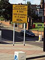 Benkid77 A554 crash warning sign 090809.JPG 2,736 × 3,648; 3.47 MB
-
 Benkid77 Roundabout, New Brighton 1 090809.JPG 3,648 × 2,736; 3.48 MB
-
 Building, Kings Parade, New Brighton - DSCF2297.JPG 4,000 × 3,000; 2.77 MB
-
 Building, New Brighton - IMG 1241.JPG 4,320 × 3,240; 2.25 MB
-
 Ebb & Flow Mermaid back.jpg 3,456 × 5,184; 9.62 MB
-
 Ebb & Flow Mermaid front.jpg 3,144 × 5,022; 8.73 MB
-
 Elvis Rides again! - by Peter Craine.jpg 640 × 480; 73 KB
-
 King's Parade, New Brighton.jpg 5,096 × 3,419; 21.01 MB
-
 Life Jacket at the top of the Slipway-by-Alison-Rawson.jpg 498 × 640; 75 KB
-
 Mounted Police on King's Parade-by-Sue-Adair.jpg 640 × 480; 57 KB
-
 New Brighton - by Gerald England.jpg 640 × 480; 45 KB
-
 New Brighton, Merseyside - 2012-09-22 (10).JPG 4,320 × 3,240; 3.59 MB
-
 New Brighton, Merseyside - 2012-09-22 (11).JPG 4,320 × 3,240; 2.9 MB
-
 New Brighton, Merseyside - 2012-09-22 (12).JPG 4,320 × 3,240; 2.89 MB
-
 New Brighton, Merseyside - 2012-09-22 (13).JPG 4,320 × 3,240; 3.57 MB
-
 New Brighton, Merseyside - 2012-09-22 (14).JPG 4,320 × 3,240; 4.06 MB
-
 New Brighton, Merseyside - 2012-09-22 (2).JPG 4,000 × 3,000; 2.81 MB
-
 New Brighton, Merseyside - 2012-09-22 (3).JPG 4,000 × 3,000; 2.83 MB
-
 New Brighton, Merseyside - 2012-09-22 (4).JPG 4,000 × 3,000; 2.79 MB
-
 New Brighton, Merseyside - 2012-09-22 (5).JPG 4,000 × 3,000; 2.83 MB
-
 New Brighton, Merseyside - 2012-09-22 (6).JPG 4,000 × 3,000; 2.99 MB
-
 New Brighton, Merseyside - 2012-09-22 (7).JPG 4,000 × 3,000; 2.92 MB
-
 Pedestrian crossing, Kings Parade, New Brighton - IMG 1236.JPG 4,320 × 3,240; 2.42 MB
-
 Roundabout at Harrison Drive new Brighton-by-Raymond-Knapman.jpg 640 × 479; 63 KB
-
 Roundabout, A554, New Brighton - IMG 1233.JPG 4,320 × 3,240; 2.53 MB


.JPG)
.JPG)
.JPG)
.JPG)
.JPG)
.JPG)
.JPG)
.JPG)
.JPG)
.JPG)
.JPG)


