Category:K-7 (Kansas highway)
Jump to navigation
Jump to search
 | number: | (seven) |
|---|---|---|
| State highways in Kansas: | 1 · 2 · 3 · 4 · 5 · 7 · 9 · 10 · 11 · 13 · 14 · 15 · 16 · 17 · 18 · 19 · 20 · 22 · 23 · 25 · 26 · 27 |
state highway in Kansas, United States  | |||||
| Upload media | |||||
| Instance of | |||||
|---|---|---|---|---|---|
| Location | |||||
| Transport network | |||||
| Owned by | |||||
| Maintained by | |||||
| Length |
| ||||
| Terminus | |||||
| Partially coincident with | |||||
| |||||
English: Media related to K-7 (Kansas highway), a 240.606-mile (387.218 km) state highway in Kansas, United States, that connects U.S. Route 69 in Oklahoma with 666th Avenue in Nebraska.
Subcategories
This category has only the following subcategory.
Media in category "K-7 (Kansas highway)"
The following 7 files are in this category, out of 7 total.
-
 K-10EBK-7JCT.png 3,840 × 2,387; 9.17 MB
-
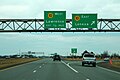 K-7 (Kansas highway) northbound at junction with K-10.jpg 1,200 × 800; 479 KB
-
 K-7 (Kansas highway) northbound sign.jpg 1,200 × 800; 454 KB
-
 K-7 southbound sign.jpg 1,200 × 800; 584 KB
-
 K-7.svg 600 × 600; 36 KB
-
 US 54 in Fort Scott, Kansas.jpg 1,885 × 1,414; 997 KB
-
 US69 K-7 South Signs near OK Border.jpg 3,600 × 2,400; 1.78 MB

_northbound_at_junction_with_K-10.jpg)
_northbound_sign.jpg)

