Category:Jumpinpin, Queensland
Jump to navigation
Jump to search
Tidal deep water channel in Queensland, Australia | |||||
| Upload media | |||||
| Instance of | |||||
|---|---|---|---|---|---|
| Location | Queensland, AUS | ||||
 | |||||
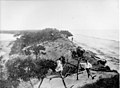
English: The Jumpinpin channel also known as The Pin lies between North Stradbroke Island and South Stradbroke Island. It has a fast moving tidal deep water Channel not appropriate for swimming but is popular with beach anglers.
Media in category "Jumpinpin, Queensland"
The following 3 files are in this category, out of 3 total.
-
 StateLibQld 1 110536 Cambus Wallace (ship).jpg 792 × 1,000; 127 KB
-
 StateLibQld 1 85908 Cambus Wallace (ship).jpg 1,000 × 985; 132 KB
-
.jpg)
.jpg)
