Category:Jolimont (BE)
Jump to navigation
Jump to search
| Object location | | View all coordinates using: OpenStreetMap |
|---|
English: The Jolimont is a ridge between Lake Biel and Lake Neuchâtel in the canton of Bern in Switzerland, with a maximum elevation of 603 m above sea level.
Deutsch: Der Jolimont ist ein Höhenzug zwischen dem Bieler- und dem Neuenburgersee in der Schweiz mit einer höchsten Erhebung von 603 m ü. M.
mountain in Switzerland  | |||||
| Upload media | |||||
| Instance of | |||||
|---|---|---|---|---|---|
| Location | Bern, Switzerland | ||||
| Mountain range | |||||
| Topographic prominence |
| ||||
| Elevation above sea level |
| ||||
 | |||||
Subcategories
This category has the following 4 subcategories, out of 4 total.
J
- Jolimont-Gut (4 F)
S
Media in category "Jolimont (BE)"
The following 10 files are in this category, out of 10 total.
-
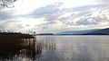 Bielersee bei Hagneckkanal.JPG 3,264 × 1,850; 2.2 MB
-
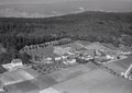 ETH-BIB-Tschugg, Jolimont-LBS H1-021770.tif 6,213 × 4,381; 77.91 MB
-
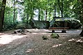
 Jolimont 03.JPG 2,816 × 2,112; 1.52 MB
-
 Jolimont 04.JPG 2,816 × 2,112; 1.72 MB
-
 Jolimont 05.JPG 2,816 × 2,112; 1.3 MB
-
 Jolimont BE.JPG 1,128 × 634; 405 KB
-
 Karl Scheurer Wohnhaus Staatsarchiv Bern FN Jost N 204.jpg 731 × 768; 64 KB
-
 Tuefelsburdi Jolimont 01 09.jpg 1,575 × 1,049; 1.37 MB
-
 Tüfelsburdi Jolimont.jpg 2,736 × 1,824; 2.33 MB
-
 Wegweiser Tüfelsburdi.jpg 2,736 × 1,824; 2.14 MB


