Category:Islands of British Columbia
Jump to navigation
Jump to search
Provinces and territories of Canada: Alberta · British Columbia · Manitoba · New Brunswick · Newfoundland and Labrador · Nova Scotia · Ontario · Prince Edward Island · Quebec · Saskatchewan · Northwest Territories · Nunavut · Yukon
Wikimedia category | |||||
| Upload media | |||||
| Instance of | |||||
|---|---|---|---|---|---|
| Category combines topics | |||||
| British Columbia | |||||
province of Canada  someja da satełite in disenbre     | |||||
| Instance of |
| ||||
| Named after |
| ||||
| Location | Canada | ||||
| Located in or next to body of water | |||||
| Capital | |||||
| Basic form of government |
| ||||
| Legislative body |
| ||||
| Executive body |
| ||||
| Official language | |||||
| Currency | |||||
| Head of state |
| ||||
| Head of government |
| ||||
| Inception |
| ||||
| Highest point |
| ||||
| Population |
| ||||
| Area |
| ||||
| Replaces |
| ||||
| Different from | |||||
| Maximum temperature record |
| ||||
| Minimum temperature record |
| ||||
| official website | |||||
 | |||||
Subcategories
This category has the following 30 subcategories, out of 30 total.
*
B
- Bonilla Island (1 F)
- Bonrick Island (1 F)
C
D
- Deadman's Island (6 F)
- Digby Island (2 F)
F
- Fin Island (3 F)
G
- Grant Island (Lake Okanagan) (2 F)
H
K
- Kaien Island (16 F)
- Kennedy Island (2 F)
L
- Lelu island, (1 F)
P
- Porcher Island (4 F)
R
S
V
W
Z
Media in category "Islands of British Columbia"
The following 62 files are in this category, out of 62 total.
-

-
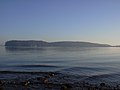
 A small island off the coast of East Sooke Regional Park, British Columbia, Canada 22.jpg 5,148 × 3,614; 11.1 MB
-
 AddenbrokeIsland.JPG 3,648 × 2,736; 1.31 MB
-
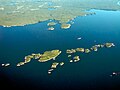
 Aerial photograph of Wolf Island and Cub Islets.jpg 5,464 × 3,640; 10.18 MB
-
 Anvil Island.jpg 2,193 × 1,035; 560 KB
-
 Arbutus grove (9365216683).jpg 4,000 × 3,000; 5.43 MB
-
 Big Rock (205445139).jpeg 2,048 × 1,536; 930 KB
-
 Boat Crossing (205446583).jpeg 2,048 × 1,536; 551 KB
-
 Bowyer Island.jpg 800 × 600; 53 KB
-
 Brandon Is Jesse Is Departure Bay.jpg 1,632 × 1,224; 783 KB
-
 Calvert Island, Denny Island, Hunter Island, and Campbell Island (227925417).jpg 1,704 × 2,272; 1.1 MB
-
 Canada IMG 5680 (211349206).jpg 1,280 × 960; 179 KB
-
 Canada IMG 5686 (211349242).jpg 1,280 × 960; 146 KB
-
 Canada IMG 5691 (211349279).jpg 1,280 × 960; 140 KB
-
 Carte baie Knight.png 1,332 × 869; 349 KB
-

-
 Chatham Sound.jpg 2,327 × 1,446; 1.29 MB
-
 Chrome Island Light 2.jpg 1,926 × 1,188; 1.52 MB
-
 Chrome island light.jpg 1,600 × 1,200; 1.03 MB
-
 Clayoquot Sound - Vargas Island.jpg 2,450 × 1,481; 1.1 MB
-
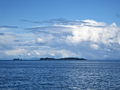
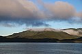
 Clouds over Pooley Island.jpg 6,000 × 4,000; 6.51 MB
-
 Coast Mountains and forested islets along Queen Charlotte Strait.jpg 4,692 × 3,128; 3.6 MB
-
 Cormorant Island forest.jpg 3,456 × 2,304; 1.29 MB
-
 Courtenay final 31.jpg 1,600 × 1,200; 830 KB
-
 Defence Island.jpg 3,008 × 2,000; 2.19 MB
-
 Dusk, Flores Island.jpg 2,272 × 1,704; 651 KB
-
 Flores island bc.jpg 400 × 218; 37 KB
-
 Georgia strait pano 10.jpg 20,288 × 1,640; 16.51 MB
-
 Haddington Island BC Canada.JPG 837 × 266; 41 KB
-
 Iona Beach Regional Park.jpg 2,160 × 1,440; 1.04 MB
-
 ISLOTES EN LA COSTA DE COLUMBIA BRITANICA - panoramio.jpg 4,288 × 2,848; 3.1 MB
-
 Kitson Island as seen from the southwest.jpg 4,608 × 3,456; 2.45 MB
-
 Kumealon Island, on the north side of the entrance of the inlet.png 3,725 × 2,794; 46.92 MB
-
 Lennard Island off Tofino BC (5946415024).jpg 4,752 × 3,168; 4.01 MB
-
 Little Shell Island Beach.jpg 4,000 × 3,000; 6.73 MB
-
 Locmap-BanksIsland.png 331 × 251; 34 KB
-
 Locmap-GilIsland.PNG 301 × 236; 25 KB
-
 Locmap-PorcherIsland.png 400 × 303; 82 KB
-
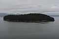
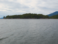
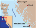 Locmap-PriceIsland.png 301 × 236; 35 KB
-

-
 LouiseIsland.JPG 2,747 × 2,035; 912 KB
-
 Lucy Islands of Chatham Sound, BC - panoramio.jpg 2,327 × 1,446; 1.29 MB
-
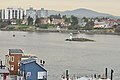
 Nanaimo aerial 1.jpg 1,597 × 1,065; 1.5 MB
-
 Nanaimo aerial 2.jpg 1,600 × 1,200; 1.17 MB
-
 Newcastle Is from Departure Bay.jpg 1,632 × 1,224; 884 KB
-
 North side of Kitson Island in Chatham Sound, British Columbia.png 4,608 × 3,456; 70.99 MB
-
 Northeast of Nigei Island, Queen Charlotte Strait.jpg 2,552 × 1,912; 2.5 MB
-
 Numas Islands - panoramio.jpg 2,566 × 1,551; 1.44 MB
-
 San Juan Islands map without border.png 784 × 861; 541 KB
-
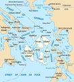 San Juan Islands map.png 784 × 861; 504 KB
-
 Sangster.jpg 2,818 × 1,074; 2.66 MB
-
 Smuggler Cove Marine Provincial Park 06.jpg 5,472 × 3,648; 17.71 MB
-
 Southern Side of Lucy Islands in Chatham Sound.webp 4,608 × 3,456; 784 KB
-
 Southwestward sides of the Rachael Islands in Chatham Sound.jpg 4,608 × 3,456; 2.88 MB
-
 SummerSooke.jpg 3,062 × 2,198; 1.29 MB
-
 SwindleIsland.jpg 5,472 × 3,648; 1.28 MB
-

-
 Victoria, BC - islet with wind sock in Middle Harbour 01 (20396395420).jpg 4,288 × 2,848; 6.08 MB
-
 Victoria, BC - Kenmore Air floatplane touching down 01 (20397623509).jpg 4,288 × 2,848; 5.05 MB
-
 West Vancouver (349773755).jpg 2,048 × 1,536; 251 KB
-
 Yorke Island, Johnstone Strait.jpg 1,024 × 768; 188 KB
-
 Yorke OCT2011.pdf 1,275 × 1,650; 21 KB


.jpg)
.jpeg)
.jpeg)


.jpg)
.jpg)
.jpg)
.jpg)

.jpg)


.jpg)


.jpg)


.jpg)
.jpg)
.jpg)
.jpg)
