Category:Insolation maps of the United States
Jump to navigation
Jump to search
Countries of North America: The Bahamas · Belize · Canada · Costa Rica · Cuba · Dominican Republic · El Salvador · Guatemala · Haiti · Honduras · Jamaica · Mexico · Nicaragua · Panama · Trinidad and Tobago‡ · United States of America‡
Other territories: Puerto Rico
‡: partly located in North America
Other territories: Puerto Rico
‡: partly located in North America
Subcategories
This category has only the following subcategory.
P
Media in category "Insolation maps of the United States"
The following 13 files are in this category, out of 13 total.
-
 CSP prospects for the SW USA (3% slopes).jpg 1,583 × 1,211; 1.43 MB
-
 Direct normal solar radiation 2004.jpg 1,501 × 1,164; 286 KB
-
 July map new.png 604 × 448; 343 KB
-
 NREL USA CSP map hi-res 2008.jpg 8,800 × 6,800; 8.71 MB
-
 NREL USA CSP map lo-res 2008.jpg 792 × 612; 112 KB
-
 NREL USA PV map hi-res 2008.jpg 8,800 × 6,800; 5.63 MB
-
 NREL USA PV map lo-res 2008.jpg 792 × 612; 111 KB
-
 SolarGIS-Solar-map-USA-en.png 1,200 × 872; 1 MB
-

-
 Us pv annual may2004.jpg 1,501 × 1,164; 263 KB
-
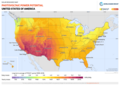
 USA DNI mid-size-map 220x156mm-300dpi v20191206.png 2,598 × 1,842; 2.13 MB
-
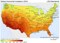
 USA GHI mid-size-map 220x156mm-300dpi v20191206.png 2,598 × 1,842; 2.12 MB
-
 USA PVOUT mid-size-map 220x156mm-300dpi v20191206.png 2,598 × 1,842; 2.18 MB
.jpg)


_capacity_and_direct_normal_solar_irradiance_(48048933443).png)


