Category:Images by Rodney Burton
Jump to navigation
Jump to search

Media in category "Images by Rodney Burton"
The following 200 files are in this category, out of 1,476 total.
(previous page) (next page)-

-

-

-
-
 61 Gt Eastern St, Shoreditch, EC2A - geograph.org.uk - 141916.jpg 640 × 480; 326 KB
-

-

-
 A1 dual carriageway, Astwick, Beds - geograph.org.uk - 190347.jpg 640 × 480; 333 KB
-
 A14 road and farmland, Oakington, Cambs - geograph.org.uk - 89368.jpg 640 × 480; 293 KB
-
 A14 road, Girton, Cambridge - geograph.org.uk - 87874.jpg 640 × 480; 240 KB
-
 A14 south Cambridgeshire - geograph.org.uk - 90043.jpg 640 × 480; 212 KB
-
 A507 Shefford By-pass, Beds - geograph.org.uk - 63238.jpg 600 × 450; 204 KB
-
 A6 speed camera, Wilstead, Beds - geograph.org.uk - 190882.jpg 640 × 480; 308 KB
-
 A600 High Road, Cotton End, Beds - geograph.org.uk - 190888.jpg 640 × 480; 251 KB
-
 A605 Wisbech Road, Whittlesey, Cambs - geograph.org.uk - 549599.jpg 640 × 480; 313 KB
-
 Abandoned farmland, Frampton Marsh, Lincs - geograph.org.uk - 196499.jpg 640 × 480; 336 KB
-
 Abbey Farm drive, Swineshead, Lincs - geograph.org.uk - 132450.jpg 640 × 480; 506 KB
-
 Abbotsley Brook, Abbotsley, Cambs - geograph.org.uk - 401462.jpg 640 × 482; 144 KB
-
 Across the Medway, East Farleigh, Kent - geograph.org.uk - 187913.jpg 640 × 480; 345 KB
-
-
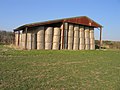
 Airship hangars, Cardington, Beds - geograph.org.uk - 386264.jpg 640 × 480; 247 KB
-
 Alder swamp, Broad Fen, Dilham, Norfolk - geograph.org.uk - 315278.jpg 640 × 480; 463 KB
-
-
 All Saints' church, Upper Stondon, Beds - geograph.org.uk - 193364.jpg 640 × 480; 263 KB
-
 All Saints' Church, Clifton, Beds - geograph.org.uk - 53259.jpg 640 × 480; 266 KB
-
 All Saints' Church, Eyeworth, Beds - geograph.org.uk - 53039.jpg 640 × 459; 264 KB
-
 All Saints' church, Helhoughton, Norfolk - geograph.org.uk - 123710.jpg 640 × 480; 323 KB
-
 All Saints' church, Sutton, Beds - geograph.org.uk - 174991.jpg 640 × 480; 377 KB
-
 All Saints' Hall, Cottenham, Cambs - geograph.org.uk - 176551.jpg 640 × 480; 288 KB
-

-

-

-
 Allotments, Biggleswade, Beds - geograph.org.uk - 190349.jpg 640 × 480; 348 KB
-
 Allotments, Silsoe, Beds. - geograph.org.uk - 50041.jpg 640 × 463; 346 KB
-
 Ancient Earthworks below Pulloxhill, Beds - geograph.org.uk - 64354.jpg 600 × 450; 300 KB
-
 Approach to Ashton, Peterborough - geograph.org.uk - 106300.jpg 640 × 480; 341 KB
-
 Approach to Chapel End, Cardington, Beds - geograph.org.uk - 386609.jpg 640 × 480; 253 KB
-
 Approaching Biggleswade, Beds - geograph.org.uk - 52426.jpg 640 × 480; 264 KB
-
 Arbury Court, Cambridge - geograph.org.uk - 62338.jpg 640 × 480; 385 KB
-

-
-
 Ashby by Partney parish church, Lincs - geograph.org.uk - 86060.jpg 600 × 406; 300 KB
-
 Ashby-de-la-Zouch Canal, Dadlington, Leics - geograph.org.uk - 84525.jpg 600 × 450; 256 KB
-
 Ashton, Peterborough, village sign - geograph.org.uk - 106298.jpg 640 × 480; 339 KB
-
 Ashwell & Morden Station.jpg 640 × 480; 300 KB
-
 B1093 Benwick Road, Whittlesey, Cambs - geograph.org.uk - 548242.jpg 640 × 480; 266 KB
-
 Bainton Green level crossing, Peterborough - geograph.org.uk - 87492.jpg 640 × 480; 258 KB
-
 Bainton parish church, Peterborough - geograph.org.uk - 94753.jpg 640 × 480; 442 KB
-
 Bales of wheat straw, Laughton, Lincs - geograph.org.uk - 227505.jpg 640 × 480; 295 KB
-
 Bales of wheat straw, Sutton, Cambs - geograph.org.uk - 227322.jpg 640 × 480; 287 KB
-
 Baptist Chapel, Stondon, Beds - geograph.org.uk - 217331.jpg 640 × 480; 162 KB
-
 Baptist Church, Maulden, Beds - geograph.org.uk - 190360.jpg 640 × 480; 289 KB
-
 Barbridge Farmhouse, Swineshead, Lincs - geograph.org.uk - 132796.jpg 640 × 480; 334 KB
-

-
 Barton parish church, Cambs - geograph.org.uk - 63202.jpg 600 × 450; 291 KB
-
 Baston Fen Nature Reserve, Lincs - geograph.org.uk - 106144.jpg 640 × 480; 256 KB
-
 Baston, Hudsons Mill.jpg 640 × 480; 307 KB
-

-

-
 Benwick Goods Railway.jpg 640 × 480; 277 KB
-
 Benwick Road, Whittlesey, Cambs - geograph.org.uk - 548464.jpg 640 × 480; 271 KB
-
 Biggleswade Cemetery, Beds - geograph.org.uk - 175001.jpg 640 × 480; 325 KB
-
 Biggleswade railway station, Beds - geograph.org.uk - 172173.jpg 640 × 480; 327 KB
-
 St Andrew's, Biggleswade.jpg 640 × 480; 297 KB
-
 Black Drove Farm, Baston Fen, Lincs - geograph.org.uk - 106152.jpg 640 × 480; 282 KB
-
-

-
 Black Horse public house, Maulden, Beds - geograph.org.uk - 190381.jpg 640 × 464; 243 KB
-
 Black House Farm, Bourne South Fen, Lincs - geograph.org.uk - 453415.jpg 640 × 480; 307 KB
-

-
 Blunham Road, Chalton, Beds - geograph.org.uk - 386794.jpg 640 × 451; 315 KB
-
 Bog oaks, Woodwalton Fen, Cambs - geograph.org.uk - 257736.jpg 640 × 480; 287 KB
-
 Boneashe Lane, Platt, Kent - geograph.org.uk - 239796.jpg 640 × 480; 396 KB
-
 Boston Grammar School, Lincs - geograph.org.uk - 64374.jpg 600 × 450; 248 KB
-
-
 Bridge Farm, Drayton, Somerset - geograph.org.uk - 133846.jpg 640 × 463; 237 KB
-

-
-
 Bridge over the counter drain at Tongue End.jpg 640 × 480; 267 KB
-

-

-
 Bridge over the Welland, Spalding, Lincs - geograph.org.uk - 132836.jpg 640 × 480; 288 KB
-

-
 Brook Farmhouse, Swineshead, Beds - geograph.org.uk - 1553639.jpg 640 × 480; 279 KB
-
 Brown's Drove, Swineshead, Lincs - geograph.org.uk - 132215.jpg 640 × 480; 343 KB
-

-
 Holy Cross parish church, Bury, Cambs - geograph.org.uk - 153256.jpg 640 × 480; 253 KB
-

-
 Cainhoe Manor Farm, Gravenhurst, Beds - geograph.org.uk - 194242.jpg 640 × 480; 278 KB
-
 Cambers Drove, Whittlesey, Cambs - geograph.org.uk - 153209.jpg 640 × 480; 272 KB
-
 Cambridge Crematorium - geograph.org.uk - 90044.jpg 640 × 480; 403 KB
-

-
 Cat's Water Drain.jpg 640 × 480; 393 KB
-
 Chequers pub, Sutton, Cambs - geograph.org.uk - 226940.jpg 640 × 480; 246 KB
-

-
 Cherry Tree Cottage, Maxey, Peterborough - geograph.org.uk - 243928.jpg 640 × 480; 298 KB
-
 Chesterton Road and River Cam, Cambridge - geograph.org.uk - 95785.jpg 640 × 480; 276 KB
-

-
 Church and War Memorial, Silsoe, Beds - geograph.org.uk - 50076.jpg 640 × 480; 275 KB
-
 Church End Road, Haynes, Beds - geograph.org.uk - 174973.jpg 640 × 480; 323 KB
-
 Church Green, Ramsey, Cambs - geograph.org.uk - 153254.jpg 640 × 480; 300 KB
-
 Church of St Andrew, Ufford, Peterborough - geograph.org.uk - 94741.jpg 640 × 480; 230 KB
-
 Church of St Helena, Willoughby, Lincs - geograph.org.uk - 49744.jpg 640 × 480; 359 KB
-
-

-
 Church St Lopen.jpg 640 × 480; 319 KB
-
 Clay Lake road junction, Spalding, Lincs - geograph.org.uk - 172640.jpg 640 × 480; 323 KB
-
 Clophill village green and High St, Beds - geograph.org.uk - 64559.jpg 600 × 450; 207 KB
-
 Clough Bridge, Gosberton Clough, Lincs - geograph.org.uk - 259146.jpg 640 × 480; 397 KB
-
 Colkirk St Mary parish church, Norfolk - geograph.org.uk - 123698.jpg 640 × 480; 341 KB
-

-
 College Farm, Swineshead, Lincs - geograph.org.uk - 132206.jpg 640 × 480; 286 KB
-
 Common Farm, Comberton, Cambs - geograph.org.uk - 98689.jpg 640 × 480; 237 KB
-

-
-
 Converted oast houses, Comp, Offham, Kent - geograph.org.uk - 258769.jpg 640 × 480; 304 KB
-
 Cople Road, Cardington, Beds - geograph.org.uk - 386625.jpg 640 × 480; 87 KB
-
 Corrugated metal roof, Rampton, Cambs - geograph.org.uk - 176181.jpg 640 × 480; 265 KB
-
-
 Cottage on Mill Road, Stanford, Beds - geograph.org.uk - 171204.jpg 640 × 442; 411 KB
-
-
 Cottages, Eyeworth, Beds - geograph.org.uk - 168483.jpg 640 × 480; 284 KB
-
 Cottages, Haynes Church End, Beds - geograph.org.uk - 174140.jpg 640 × 480; 295 KB
-
 Cotton Hall, Frampton, Lincs - geograph.org.uk - 195582.jpg 640 × 480; 294 KB
-
 Council Houses, Surfleet, Lincs - geograph.org.uk - 172655.jpg 640 × 480; 294 KB
-

-
 Country road, Weasenham St Peter, Norfolk - geograph.org.uk - 123717.jpg 640 × 480; 244 KB
-
 Covenham St Bartholomew church, Lincs - geograph.org.uk - 49097.jpg 640 × 480; 336 KB
-
 Cowage Wood, Hilmarton, Wilts - geograph.org.uk - 698320.jpg 640 × 480; 503 KB
-
 Cowbit village sign - geograph.org.uk - 132944.jpg 640 × 480; 276 KB
-
 Cowbit Wash Barrier Bank, Lincs - geograph.org.uk - 51870.jpg 640 × 480; 189 KB
-
 Cowbit windmill, Lincs - geograph.org.uk - 172561.jpg 640 × 480; 302 KB
-
 Crafts Way, Bar Hill, Cambs - geograph.org.uk - 89336.jpg 640 × 480; 333 KB
-

-

-

-
 Croyland Abbey, Crowland, Lincs - geograph.org.uk - 51869.jpg 640 × 480; 231 KB
-
 Croyland Benedictine Abbey, Lincs - geograph.org.uk - 51868.jpg 480 × 640; 227 KB
-

-

-

-
 Derelict pub, Baston Fen, Lincs - geograph.org.uk - 106163.jpg 640 × 480; 249 KB
-

-

-
 Detail of village sign, Swineshead, Lincs - geograph.org.uk - 645946.jpg 480 × 640; 387 KB
-
 Distributary of the River Welland - geograph.org.uk - 87497.jpg 640 × 480; 402 KB
-

-
 Donington High Bridge, Donington, Lincs - geograph.org.uk - 227333.jpg 640 × 480; 262 KB
-
 Donington South Ing, Donington, Lincs - geograph.org.uk - 217008.jpg 640 × 480; 193 KB
-
 Dover Street, Maidstone, Kent - geograph.org.uk - 236648.jpg 640 × 480; 314 KB
-
 Downing House, Lower Road, Croydon, Cambs - geograph.org.uk - 219290.jpg 640 × 480; 294 KB
-
 Dowsby Fen Pumping Station, Lincs - geograph.org.uk - 243939.jpg 640 × 480; 318 KB
-

-

-
-
-

-
 Earthworm stone mounds - geograph.org.uk - 724985.jpg 640 × 480; 478 KB
-
 East coast main line, Biggleswade, Beds - geograph.org.uk - 168486.jpg 640 × 480; 357 KB
-
 East coast main line, Tallington, Lincs - geograph.org.uk - 94811.jpg 640 × 480; 277 KB
-
 East Raynham to Colkirk road, Norfolk - geograph.org.uk - 123694.jpg 640 × 480; 279 KB
-
 Eastville parish church, Lincs - geograph.org.uk - 86061.jpg 600 × 409; 270 KB
-

-
 Eaudike Road, Donington Eaudike, Lincs - geograph.org.uk - 700995.jpg 640 × 480; 310 KB
-
-
 Electricity sub-station, Histon, Cambs - geograph.org.uk - 95750.jpg 640 × 480; 334 KB
-
-
 Elsworth Mill, Elsworth, Cambs - geograph.org.uk - 402244.jpg 640 × 480; 349 KB
-
 Emery Lane, Boston, Lincs - geograph.org.uk - 597747.jpg 480 × 640; 307 KB
-
 Entering Swineshead, Beds - geograph.org.uk - 1553634.jpg 640 × 480; 420 KB
-

-
 Entrance to Cottenham, Cambs - geograph.org.uk - 175802.jpg 640 × 480; 280 KB
-
 Entrance to Deadman's Cross, Haynes, Beds - geograph.org.uk - 174989.jpg 640 × 480; 275 KB
-
 Entrance to Ickleton village, Cambs - geograph.org.uk - 153268.jpg 640 × 480; 250 KB
-
 Entrance to Ramsey Mereside, Cambs - geograph.org.uk - 153232.jpg 640 × 480; 241 KB
-
-

-

-
 Eye parish church, Peterborough - geograph.org.uk - 84455.jpg 600 × 450; 138 KB
-

-
 Farm track and ditch, Moulton Fen, Lincs - geograph.org.uk - 1480517.jpg 640 × 480; 371 KB
-

-

-
 Farmland in West Clyst north of Exeter - geograph.org.uk - 725006.jpg 640 × 480; 415 KB
-
 Farmland near Bicker Bar, Lincs - geograph.org.uk - 84502.jpg 600 × 421; 323 KB
-
 Farmland S of Hardwick, Cambs - geograph.org.uk - 98757.jpg 640 × 480; 301 KB
-
-
 Farmland view towards Higham Gobion, Beds - geograph.org.uk - 194206.jpg 640 × 480; 293 KB
-
 Farmland view, Wendy, Cambs - geograph.org.uk - 104725.jpg 640 × 474; 322 KB
-
 Farmland, Baston Fen, Lincs - geograph.org.uk - 106158.jpg 640 × 480; 305 KB
-
 Farmland, Comberton, Cambs - geograph.org.uk - 98739.jpg 640 × 480; 281 KB
-
 Farmland, Grunty Fen, Cambs - geograph.org.uk - 231447.jpg 640 × 480; 280 KB
-
 Farmland, New Road, Melbourn, Cambs - geograph.org.uk - 53050.jpg 640 × 480; 277 KB
-
 Fen Bridge, Crowland, Lincs - geograph.org.uk - 155153.jpg 640 × 470; 288 KB
-
 Fen Drove, Hubbert's Bridge, Lincs - geograph.org.uk - 227572.jpg 640 × 480; 294 KB
-
 Fishmere End Road, Kirton, Lincs - geograph.org.uk - 172970.jpg 640 × 480; 313 KB
-
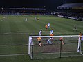 Floodlit match, Abbey Stadium, Cambridge - geograph.org.uk - 52722.jpg 640 × 480; 286 KB
-

-

-


