Category:Imabetsu, Aomori
Jump to navigation
Jump to search
日本語: 日本国青森県東津軽郡今別町に関するカテゴリ。
town in Higashitsugaru district, Aomori prefecture, Japan   Imatge de la bandera  Imatge del segell  | |||||
| Upload media | |||||
| Instance of | |||||
|---|---|---|---|---|---|
| Location | Higashitsugaru District, Aomori Prefecture, Japan | ||||
| Located in or next to body of water | |||||
| Legal form |
| ||||
| Inception |
| ||||
| Population |
| ||||
| Area |
| ||||
| Replaces |
| ||||
| official website | |||||
 | |||||
Subcategories
This category has the following 8 subcategories, out of 8 total.
I
- Imabetsu Station (9 F)
- Imabetsu Town Bus (2 F)
M
- Michinoeki Imabetsu (13 F)
O
- Ōkawadai Station (8 F)
- Okutsugaru-Imabetsu Station (57 F)
S
T
- Tsugaru-Futamata Station (27 F)
- Tsugaru-Hamana Station (12 F)
Media in category "Imabetsu, Aomori"
The following 65 files are in this category, out of 65 total.
-
 Aomori-Kita high school Imabetsu branch school 180915.jpg 1,600 × 1,200; 567 KB
-
 Bengala Akanesawa red rock IMG 5829.jpg 2,304 × 1,728; 1.18 MB
-
 Bengala Akanesawa red rock IMG 5840.jpg 4,608 × 3,456; 4.7 MB
-
 Bengala Akanesawa red rock MG 5831.jpg 4,608 × 3,456; 4.05 MB
-
 Bridge at the tip of Takanosaki P5161435.jpg 6,149 × 4,072; 5.41 MB
-
 Darumataki imabetsu aomori Japan P3160014 stitch.jpg 3,800 × 2,424; 4.29 MB
-
 Emblem of Imabetsu, Aomori.svg 320 × 319; 1 KB
-
 Flag of Imabetsu Aomori.JPG 321 × 254; 16 KB
-
 Flag of Imabetsu Aomori.svg 2,560 × 1,707; 4 KB
-
 Higashitsugaru District in Aomori Prefecture.png 1,081 × 801; 38 KB
-
 Horoduki Kaiundou Syakadou 20190630 P6302466.jpg 2,400 × 1,603; 1.19 MB
-
 Horoduki West P9011085 stitch.jpg 4,800 × 2,602; 3.64 MB
-
 Horozuki kaigan 201902 P2230058 stitch6.jpg 2,400 × 1,588; 1.5 MB
-
 Horozuki Kauindou Syakadou Horozuki Syarihama P3090049 stitch x8.JPG 3,800 × 1,739; 2.75 MB
-
 Horozuki-Kaikan 200919.jpg 1,600 × 1,200; 628 KB
-
 Imabetsu Aomori chapter.JPG 183 × 175; 11 KB
-
 Imabetsu elementary school.jpg 1,600 × 1,200; 671 KB
-
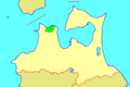
 Imabetsu in Aomori Prefecture Ja.svg 800 × 770; 30 KB
-
 Imabetsu in Aomori Prefecture.png 1,081 × 801; 38 KB
-
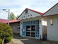
 Imabetsu junior high school.jpg 1,600 × 1,200; 662 KB
-
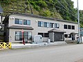
 Imabetsu town hall.JPG 4,000 × 2,001; 1.81 MB
-
 Imabetsu town, Aomori prefecture Japan.svg 779 × 755; 17 KB
-
 Imabetsutown.PNG 328 × 241; 7 KB
-
 Ippongi Horouki Imabetsu Aomori Japan P4131209 stitch.JPG 6,000 × 2,283; 4.63 MB
-
 JP-Network Imabetsu-84068.jpg 2,048 × 1,536; 630 KB
-
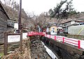
 JR津軽線津軽浜名駅周辺 - panoramio.jpg 1,600 × 1,200; 638 KB
-
 Kaikyo Line between Tappi-Kaitei Station and Tsugaru-Imabetsu Station.jpg 2,592 × 1,944; 1,023 KB
-
 M solitarius Nest 20200621 Isohiyodori.JPG 2,672 × 2,000; 1.6 MB
-
 Onidomari Iwayakannon Imabetsu Town Aomori Prif IMG 5855 stitch.jpg 10,142 × 5,856; 12.97 MB
-
 Onidomari Iwayakannondo Imabetsu Aomori Jp P4070791.jpg 3,000 × 1,900; 2.88 MB
-
 Pellet Corvus corone P2090313.jpg 4,000 × 2,672; 3.75 MB
-
 Population distribution of Imabetsu, Aomori, Japan.svg 512 × 256; 22 KB
-
 R280 By Pass Imabetsu.JPG 2,560 × 1,920; 1.91 MB
-
 Red Iron Oxide Akanesawa Imabetsu Aomori Japan P3090038.JPG 2,000 × 1,336; 1.39 MB
-
Sea foam Naminohana PB060782.ogv 28 s, 1,920 × 1,080; 7.14 MB
-
 Seikan tonneru aomori.JPG 1,280 × 960; 302 KB
-
 Seikan Tunnel Entrance Honshu side.jpg 1,236 × 1,004; 603 KB
-
 Seikan tunnel nameplate.JPG 1,728 × 1,152; 1.1 MB
-
 Shiosai&nagisa brigde.jpg 3,648 × 2,736; 3.31 MB
-
 Shouin kuguri Imabetu Aomori Jp 20190930 P9300231.JPG 4,000 × 2,672; 3.22 MB
-
 Shouin kuguri Imabetu Aomori Jp 20190930 P9300234.jpg 2,000 × 1,336; 2.86 MB
-
 Shouin kuguri Imabetu Aomori Jp 20190930 P9300283.jpg 3,800 × 2,773; 8.46 MB
-
 Strange rock Takoiwa Imabetsu Aomori Japan P5161207 stitch.jpg 4,016 × 2,908; 2.89 MB
-
 Syaribuishi P7280203.JPG 4,000 × 2,672; 5.55 MB
-
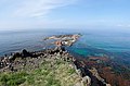
 Takanosaki imabetsu Aomori Japan.jpg 1,920 × 1,132; 384 KB
-
 West side Takanosaki Imabetsu Aomori Japan P5161284.jpg 5,095 × 3,755; 3.36 MB
-
 トンネル神社 P1130390.jpg 2,268 × 1,606; 1.04 MB
-
 三厩湾 - panoramio.jpg 1,600 × 1,200; 640 KB
-
 今別駅付近の風景 - panoramio.jpg 5,406 × 3,550; 10.97 MB
-
 地図-青森県今別町-2006.png 389 × 260; 7 KB
-
 地層 海岸段丘 礫 P2170609.jpg 2,000 × 1,336; 1.12 MB
-
 大礫 P2230007.jpg 2,000 × 1,336; 1.2 MB
-
 春先に見られる芝生の到るところに現れる盛り土 P2230047.jpg 2,000 × 1,336; 1.59 MB
-
 気泡 岩石 溶岩P3210446.jpg 2,000 × 1,336; 1.16 MB
-
 津軽線からの風景 - panoramio.jpg 4,752 × 3,168; 1.6 MB
-
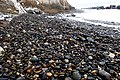 海岸の水摩礫 20190202 P2020067.jpg 2,000 × 1,336; 1.39 MB
-
 海岸段丘 青森県今別町P2030143.JPG 1,336 × 2,000; 1.23 MB
-
 砂礫層 P2030161.jpg 2,000 × 1,336; 1.67 MB
-
 細礫 P2030197.jpg 2,000 × 1,336; 1.37 MB
-
 脆い地層 海岸段丘 礫 波による侵食 消波ブロック P3020202 stitch x12.JPG 5,310 × 3,784; 5.8 MB
-
 舎利石の産地 青森県今別町舎利浜 P3210492 stitch.jpg 10,200 × 4,191; 12.35 MB
-
 袰月海雲洞釈迦堂 津軽三十三所21番 P3160089 stitch.JPG 4,000 × 2,843; 4.77 MB
-
 青函トンネルの手前 (2494397653).jpg 1,280 × 853; 484 KB
-
 青函トンネル入口広場 トンネル神社 P1261002.JPG 4,000 × 2,672; 4.97 MB
-
 青森県今別町一本木漁港西岸の磯と祠 P3210513 stitch.JPG 7,066 × 3,925; 11.47 MB


.jpg)

