Category:Houses in the East Riding of Yorkshire
Jump to navigation
Jump to search
Ceremonial counties of England: Bedfordshire · Berkshire · Buckinghamshire · Cambridgeshire · Cheshire · Cornwall · Cumbria · Derbyshire · Devon · Dorset · Durham · East Riding of Yorkshire · East Sussex · Essex · Gloucestershire · Greater London · Greater Manchester · Hampshire · Herefordshire · Hertfordshire · Isle of Wight · Kent · Lancashire · Leicestershire · Lincolnshire · Merseyside · Norfolk · North Yorkshire · Northamptonshire · Northumberland · Nottinghamshire · Oxfordshire · Rutland · Shropshire · Somerset · South Yorkshire · Staffordshire · Suffolk · Surrey · Tyne and Wear · Warwickshire · West Midlands · West Sussex · West Yorkshire · Wiltshire · Worcestershire
City-counties: Bristol · City of London
Former historic counties: Huntingdonshire · Westmorland ·
Other former counties:
City-counties: Bristol · City of London
Former historic counties: Huntingdonshire · Westmorland ·
Other former counties:
Wikimedia category | |||||
| Upload media | |||||
| Instance of | |||||
|---|---|---|---|---|---|
| |||||
Subcategories
This category has the following 40 subcategories, out of 40 total.
*
B
C
D
- Houses in Driffield (40 F)
E
- Ellerby railway station (4 F)
F
- Faxfleet Grange (5 F)
- Houses in Flamborough (55 F)
H
M
P
- Houses in Pocklington (16 F)
S
- Swine railway station (5 F)
T
- The Old Rectory, Walkington (2 F)
W
- Houses in Wilberfoss (82 F)
- Houses in Withernsea (309 F)
Media in category "Houses in the East Riding of Yorkshire"
The following 200 files are in this category, out of 2,544 total.
(previous page) (next page)-
 "Main Street", Saltmarshe - geograph.org.uk - 256844.jpg 640 × 480; 102 KB
-
 'Bainton' Roundabout - geograph.org.uk - 110593.jpg 640 × 480; 149 KB
-
 'Ridgmont', Burstwick 1865 (archive ref DDX1713-1) (29122663726).jpg 816 × 592; 147 KB
-
 'The Villa', Sledmere - geograph.org.uk - 1012164.jpg 640 × 400; 60 KB
-
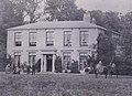
 CS p3.050 - Brantingham Thorpe, Yorkshire - Morris's County Seats, 1879.jpg 2,204 × 1,552; 816 KB
-
 4 Church Lane.jpg 6,016 × 4,016; 15.76 MB
-
 40mh zone reminder sign on Park Lane (geograph 4399918).jpg 1,600 × 1,062; 735 KB
-
 50049 "Defiance" Common Lane, Welton LC 221222.jpg 2,149 × 1,102; 523 KB
-
 50049 Defiance Welton LC 221222.jpg 3,973 × 2,025; 1.4 MB
-
 8 Church Lane Vicarage.jpg 6,016 × 4,016; 17.93 MB
-
 92, Riplingham Road (geograph 3764592).jpg 640 × 480; 60 KB
-
 A boat slipway at Hook, East Riding of Yorkshire.jpg 480 × 640; 92 KB
-
 A building to the north of Harpham.jpg 640 × 469; 488 KB
-
 A corner house in Southburn - geograph.org.uk - 1052826.jpg 640 × 427; 477 KB
-
 A Dwelling House, Walkington - geograph.org.uk - 679416.jpg 640 × 468; 86 KB
-
 A Ford in Lockington - geograph.org.uk - 709585.jpg 640 × 324; 134 KB
-
 A glimpse of Thornton Church (14743365732).jpg 4,137 × 2,109; 7.43 MB
-
 A house and a pub in Church Street Kilham.jpg 640 × 488; 211 KB
-
 A House in Londesborough Village - geograph.org.uk - 632245.jpg 640 × 462; 100 KB
-
 A house in Milldale - geograph.org.uk - 1215571.jpg 640 × 405; 361 KB
-
 A house on Breighton Road, Gunby - geograph.org.uk - 807472.jpg 640 × 480; 255 KB
-
 A house on Meaux Lane, Routh - geograph.org.uk - 803912.jpg 640 × 351; 132 KB
-
 A house on Rudston Road, Burton Agnes - geograph.org.uk - 803485.jpg 640 × 474; 223 KB
-
 A house on Trandy Lane, Laxton - geograph.org.uk - 859233.jpg 640 × 480; 242 KB
-
 A Kirkella Road - geograph.org.uk - 126574.jpg 640 × 405; 82 KB
-
 A little shop in Wawne, East Yorks. - geograph.org.uk - 803845.jpg 640 × 576; 218 KB
-
 A new house in Leconfield - geograph.org.uk - 799246.jpg 640 × 454; 191 KB
-
 A nice house in Laxton - geograph.org.uk - 858671.jpg 640 × 508; 210 KB
-
 A path leading to Birchwood Avenue, Anlaby (geograph 3313397).jpg 800 × 600; 127 KB
-
 A path leading to Springhead Avenue, Anlaby (geograph 3309156).jpg 800 × 600; 133 KB
-
 A path leading to Springhead Avenue, Anlaby (geograph 3309159).jpg 800 × 600; 154 KB
-
 A path leading towards Wolferton Road, Anlaby (geograph 3314282).jpg 800 × 600; 279 KB
-
 A private residence, Brantingham - geograph.org.uk - 787041.jpg 640 × 480; 167 KB
-
 A ride past North Ferriby church (geograph 4975716).jpg 640 × 427; 92 KB
-
 A room with a view? (geograph 1981667).jpg 800 × 600; 210 KB
-
 A snake of daffodils (geograph 5326049).jpg 600 × 800; 165 KB
-
-
 A terrace in Holme on the Wolds.jpg 640 × 427; 154 KB
-
 A terrace in Main Street, South Dalton - geograph.org.uk - 809484.jpg 640 × 465; 160 KB
-
 A walk along the River Hull No8 (geograph 1998059).jpg 800 × 600; 265 KB
-
 A walk along the River Hull No9 (geograph 1998063).jpg 800 × 600; 249 KB
-
 A walk from Hessle Square No17 (geograph 2006180).jpg 800 × 600; 213 KB
-
 A White House - geograph.org.uk - 821201.jpg 640 × 427; 69 KB
-
 A white house Hutton Cranswick.jpg 640 × 434; 286 KB
-
 A1033 main road in Camerton.jpg 546 × 640; 118 KB
-
 A1033 road at Hollym.jpg 640 × 480; 58 KB
-
 A1033 Ryehill - geograph.org.uk - 1472632.jpg 640 × 480; 36 KB
-
 A1033 to Hollym (geograph 6909437).jpg 1,024 × 683; 511 KB
-
 A1034 towards South Cave - geograph.org.uk - 1602099.jpg 640 × 480; 102 KB
-
 A1035 Beverley Bypass.jpg 640 × 480; 86 KB
-
 A1174 towards Hull - geograph.org.uk - 1527893.jpg 640 × 480; 47 KB
-
 A163 - B1248 Junction, south of Bainton - geograph.org.uk - 1013153.jpg 640 × 427; 167 KB
-
 A163 At Harlthorpe.jpg 640 × 480; 102 KB
-
 A163 Harlthorpe - geograph.org.uk - 1299354.jpg 640 × 480; 60 KB
-
 A164 (geograph 5355889).jpg 640 × 426; 63 KB
-
 A164 Cranswick - geograph.org.uk - 149707.jpg 640 × 480; 92 KB
-
 A164 entering Beverley (geograph 3802130).jpg 2,744 × 1,850; 3.5 MB
-
 A164 entering Cranswick.jpg 640 × 427; 275 KB
-
 A164 Victoria Road, Beverley (geograph 5923859).jpg 1,024 × 746; 137 KB
-
 A165 at Beeford looking north - geograph.org.uk - 1483359.jpg 640 × 480; 67 KB
-
 A614 near Holme - geograph.org.uk - 1600743.jpg 640 × 480; 73 KB
-
 A614 Through Haisthorpe.jpg 640 × 480; 42 KB
-
 A614 towards Howden (geograph 2024000).jpg 640 × 480; 54 KB
-
 A63 Gilberdyke ,Looking East - geograph.org.uk - 235957.jpg 640 × 426; 119 KB
-
 A63 towards Hull (geograph 2324932).jpg 1,600 × 1,200; 582 KB
-
 A63 westbound (geograph 5658077).jpg 640 × 480; 46 KB
-
 Access road to Beech Farm.jpg 640 × 480; 76 KB
-
 All Saints Church Adlingfleet.jpg 640 × 484; 130 KB
-
 Adlingfleet - All Saints Church - geograph.org.uk - 1740857.jpg 640 × 480; 89 KB
-
 Adlingfleet - geograph.org.uk - 251390.jpg 640 × 480; 101 KB
-
 Adlingfleet from Cow Lane - geograph.org.uk - 1235094.jpg 640 × 480; 57 KB
-
 Adlingfleet Old Smithy - geograph.org.uk - 1330465.jpg 640 × 480; 88 KB
-
 Adlingfleet.jpg 640 × 482; 85 KB
-
 Aerodrome Footpath - geograph.org.uk - 688280.jpg 640 × 479; 103 KB
-
 Aike - geograph.org.uk - 1497186.jpg 640 × 480; 59 KB
-
 Aike East Riding of Yorkshire.jpg 1,600 × 1,200; 358 KB
-
 Aike Grange Stud.jpg 640 × 480; 95 KB
-
 Aike village street.jpg 4,000 × 3,000; 3 MB
-
 Airmyn Clock Tower Sunset.jpg 680 × 1,024; 243 KB
-
 Airmyn Clock Tower.jpg 640 × 480; 97 KB
-
 Airmyn, North End - geograph.org.uk - 412827.jpg 640 × 480; 108 KB
-
 Airmyn, South End - geograph.org.uk - 412787.jpg 640 × 480; 91 KB
-

-
 Aldbrough (Mount Pleasant) No Parking! - geograph.org.uk - 239850.jpg 640 × 480; 128 KB
-
 Aldbrough - geograph.org.uk - 1260485.jpg 640 × 428; 76 KB
-
 Aldbrough Road, Withernwick (geograph 2199315).jpg 800 × 600; 246 KB
-
 Aldbrough Road, Withernwick (geograph 5260848).jpg 1,200 × 799; 241 KB
-
 All Saint's Church, Lund - geograph.org.uk - 206657.jpg 640 × 480; 74 KB
-
 All Saints C. of E., Mappleton - geograph.org.uk - 1206998.jpg 640 × 427; 300 KB
-
 All Saints Church Londesborough 6.jpg 640 × 477; 60 KB
-
 All Saints Church, Bubwith - geograph.org.uk - 807981.jpg 480 × 640; 238 KB
-
 All Saints Church, Easington - geograph.org.uk - 1472544.jpg 640 × 480; 98 KB
-
 All Saints Church, Nafferton. - geograph.org.uk - 530195.jpg 640 × 473; 63 KB
-
 All Saints Church, Preston - geograph.org.uk - 723150.jpg 640 × 503; 203 KB
-
 All Saints Church, Preston.jpg 640 × 477; 85 KB
-
 All Saints Mappleton - geograph.org.uk - 1801509.jpg 4,000 × 3,000; 2.82 MB
-
 All Saints Parish Church, Tunstall - geograph.org.uk - 45860.jpg 640 × 480; 102 KB
-
 All Saints' Church - geograph.org.uk - 1521884.jpg 640 × 426; 67 KB
-
 All Saints' Church, Brough - geograph.org.uk - 754488.jpg 640 × 480; 107 KB
-
 All Saints' Youth Hall, Brough - geograph.org.uk - 754467.jpg 640 × 462; 66 KB
-
 All Saints, Goodmanham - geograph.org.uk - 1567947.jpg 640 × 458; 96 KB
-
 All Saints, Rudston- the churchyard.JPG 2,048 × 1,536; 654 KB
-
 Allerthorpe village - geograph.org.uk - 1407806.jpg 640 × 480; 126 KB
-
 Amicable House - geograph.org.uk - 595059.jpg 640 × 427; 48 KB
-
 Anlaby Avenue Anlaby Common.jpg 595 × 446; 204 KB
-
 Anlaby Road, Hull - geograph.org.uk - 401410.jpg 624 × 416; 215 KB
-
 Another Pit For Tractors - geograph.org.uk - 251652.jpg 640 × 480; 103 KB
-

-
 Approaching Asselby (geograph 4505921).jpg 800 × 533; 149 KB
-
 Approaching Beverley Parks Crossing (geograph 4448818).jpg 1,280 × 954; 852 KB
-
 Approaching Leconfield - geograph.org.uk - 1497255.jpg 640 × 480; 53 KB
-
 Approaching Sober Hill - geograph.org.uk - 253256.jpg 640 × 480; 103 KB
-
 Approaching Sproatley Grange - geograph.org.uk - 1572486.jpg 440 × 640; 194 KB
-
 Approaching Yapham (geograph 3763562).jpg 640 × 427; 85 KB
-
 Arnold Manor, Arnold.jpg 640 × 480; 124 KB
-
 Arram - geograph.org.uk - 85732.jpg 640 × 480; 112 KB
-
 Arram Village.JPG 2,272 × 1,704; 1.04 MB
-
 Art beside the track at Spring Lane Farm (geograph 5600804).jpg 5,376 × 3,024; 3.62 MB
-
 Atwick - geograph.org.uk - 261203.jpg 640 × 480; 85 KB
-
 Atwick Cross.jpg 640 × 480; 78 KB
-
 Atwick Road - geograph.org.uk - 261814.jpg 640 × 480; 78 KB
-
 Atwick.jpg 640 × 480; 67 KB
-
 Autherd Garth, Walkington - geograph.org.uk - 614454.jpg 640 × 480; 179 KB
-
 Autherd Garth, Walkington - geograph.org.uk - 699852.jpg 640 × 480; 104 KB
-
 Autumnal Trees - geograph.org.uk - 285388.jpg 640 × 426; 158 KB
-
 B1230 towards North Cave - geograph.org.uk - 1603735.jpg 640 × 480; 91 KB
-
 B1230 towards Walkington - geograph.org.uk - 1733145.jpg 800 × 600; 118 KB
-
 B1242 Skipsea Lane (geograph 6908108).jpg 1,024 × 683; 453 KB
-
 B1244 towards Hornsea - geograph.org.uk - 1463750.jpg 640 × 480; 86 KB
-
 B1246, Warter (geograph 7046539).jpg 800 × 600; 142 KB
-
 Back Lane Elstronwick.jpg 640 × 458; 91 KB
-
 Back Lane Langtoft - geograph.org.uk - 1078000.jpg 640 × 480; 52 KB
-
 Back Street, Fridaythorpe - geograph.org.uk - 1374857.jpg 640 × 480; 63 KB
-
 Bainton Road, Tibthorpe - geograph.org.uk - 1046373.jpg 640 × 427; 418 KB
-
 Bales along Newlands Road (geograph 5565417).jpg 800 × 476; 100 KB
-
 Balk Lane Arnold.jpg 640 × 480; 180 KB
-
 Balk Lane, Arnold - geograph.org.uk - 1468273.jpg 640 × 480; 60 KB
-
 Balkholme.jpg 640 × 480; 194 KB
-
 Ballhall Lane at West Farm - geograph.org.uk - 1299220.jpg 640 × 480; 70 KB
-
 Bank (middle section) - geograph.org.uk - 457689.jpg 640 × 480; 119 KB
-
 Bank (top end) - geograph.org.uk - 457691.jpg 640 × 480; 116 KB
-
 Barclays Bank - geograph.org.uk - 540144.jpg 640 × 427; 79 KB
-
 Barley Field and Kilpin - geograph.org.uk - 202587.jpg 640 × 480; 102 KB
-
 Barley field to New Cottages - geograph.org.uk - 1328958.jpg 640 × 480; 55 KB
-
 Barmby - geograph.org.uk - 202867.jpg 640 × 479; 51 KB
-
 Barmby Moor Post Office - geograph.org.uk - 361021.jpg 640 × 480; 80 KB
-
 Barmby Moor Village.jpg 640 × 519; 114 KB
-
 Barmby on the Marsh - geograph.org.uk - 202870.jpg 640 × 479; 52 KB
-
 Barmbyfield House - geograph.org.uk - 1048873.jpg 640 × 474; 79 KB
-
 Barn House, 29 Cowgate, Welton - geograph.org.uk - 529242.jpg 640 × 481; 134 KB
-
 Barren Hill, Mappleton - geograph.org.uk - 615540.jpg 640 × 463; 116 KB
-
 Battleburn.jpg 640 × 482; 126 KB
-
 Beach (geograph 4101977).jpg 1,024 × 683; 142 KB
-
 Beacon Road, north towards Great Givendale (geograph 2325613).jpg 800 × 600; 168 KB
-
 Beck Lane Keyingham.jpg 640 × 473; 144 KB
-
 Beck Side from Spout Hall - geograph.org.uk - 1053408.jpg 640 × 405; 394 KB
-
 Beck Street, Easington - geograph.org.uk - 981853.jpg 640 × 477; 99 KB
-
 Beech Grove - geograph.org.uk - 664648.jpg 640 × 480; 112 KB
-
 Beech View, Hutton Cranswick (geograph 5947791).jpg 1,600 × 1,064; 446 KB
-
 Beech View, Hutton Cranswick (geograph 5947925).jpg 1,600 × 1,043; 462 KB
-
 Beech View, Hutton Cranswick (geograph 5947936).jpg 1,600 × 1,064; 458 KB
-
 Beech View, Hutton Cranswick (geograph 5947947).jpg 1,600 × 1,064; 407 KB
-
 Beeford - geograph.org.uk - 100563.jpg 640 × 427; 87 KB
-
 Beeford - geograph.org.uk - 73577.jpg 640 × 480; 99 KB
-
 Beeford Footpath - geograph.org.uk - 252324.jpg 640 × 480; 130 KB
-
 Beeford Store and Post Office - geograph.org.uk - 1222542.jpg 640 × 427; 312 KB
-
-
 Beevers Bridge - geograph.org.uk - 288932.jpg 640 × 480; 52 KB
-
 Belby Cottage.jpg 640 × 443; 78 KB
-
 Bellcroft Lane, Thorngumbald - geograph.org.uk - 295658.jpg 466 × 640; 101 KB
-
 Bempton Level Crossing - geograph.org.uk - 294275.jpg 640 × 480; 121 KB
-
 Bempton, East Riding of Yorkshire - geograph.org.uk - 1317081.jpg 640 × 481; 66 KB
-
 Bench and phone box, Kirk Ella (geograph 6889570).jpg 768 × 1,024; 1.37 MB
-
 Bend in the Ouse - geograph.org.uk - 1522051.jpg 640 × 426; 204 KB
-
 Bennetland Lane.jpg 640 × 480; 102 KB
-
 Benningholme Hall.jpg 800 × 600; 273 KB
-
 Bentley, eastern end - geograph.org.uk - 577229.jpg 640 × 578; 162 KB
-
 Beswick - South - geograph.org.uk - 78066.jpg 640 × 480; 107 KB
-
 BethellsBridge Reeds.jpg 1,210 × 768; 153 KB
-
 Between Great and Little Kelk - geograph.org.uk - 106621.jpg 640 × 480; 91 KB
-
 Beverley & Barmston Drain (geograph 5235653).jpg 1,200 × 799; 338 KB
-
 Beverley & Barmston Drain at Dunswell (geograph 5235661).jpg 1,200 × 799; 449 KB
-
 Beverley (33822041190).jpg 4,000 × 3,000; 2.62 MB
-
 Beverley (33822051640).jpg 4,000 × 3,000; 2.21 MB
-
 Beverley (34075466981).jpg 3,000 × 4,000; 2.66 MB
-
 Beverley and Barmston Drain - geograph.org.uk - 730443.jpg 640 × 480; 86 KB
-
 Beverley bypass under construction (geograph 3851751).jpg 4,000 × 3,000; 3.49 MB
-
 Beverley NE Bypass - geograph.org.uk - 59959.jpg 640 × 480; 119 KB
-
 Beverley Parklands (geograph 6350697).jpg 4,528 × 3,072; 2.95 MB
-
 Beverley Parks Crossing (geograph 5386521).jpg 486 × 640; 53 KB
-
 Beverley Parks level crossing (geograph 6116048).jpg 1,024 × 768; 141 KB
-

-
 Beverley Road (A164) (geograph 5253574).jpg 640 × 480; 57 KB
-
 Beverley Road into Kirk Ella (geograph 5756511).jpg 2,940 × 2,114; 2.56 MB
-
 Beverley Road Kirk Ella (geograph 5756517).jpg 3,812 × 2,847; 3.19 MB
-

-
 Beverley Road, Dunswell (geograph 5235469).jpg 1,200 × 799; 304 KB
-
 Beverley Road, Dunswell (geograph 6104300).jpg 800 × 494; 78 KB
-
 Beverley Road, Kirk Ella (geograph 5194550).jpg 1,600 × 1,065; 706 KB
-
 Beverley Road, Kirk Ella (geograph 5194898).jpg 1,600 × 1,065; 695 KB


_(29122663726).jpg)


.jpg)


.jpg)


.jpg)


.jpg)
.jpg)
.jpg)
.jpg)

.jpg)
.jpg)
.jpg)


.jpg)
.jpg)
.jpg)


.jpg)


.jpg)

.jpg)

.jpg)


.jpg)

.jpg)
.jpg)


_No_Parking!_-_geograph.org.uk_-_239850.jpg)

.jpg)
.jpg)


,_Woodmansey_(geograph_4355274).jpg)
.jpg)
.jpg)


.jpg)


.jpg)


.jpg)

.jpg)


.jpg)


_-_geograph.org.uk_-_457689.jpg)
_-_geograph.org.uk_-_457691.jpg)


.jpg)


.jpg)
.jpg)
.jpg)
.jpg)


_(25566389874).jpg)


.jpg)


.jpg)
.jpg)
.jpg)
.jpg)
.jpg)

.jpg)

.jpg)
.jpg)
.jpg)

_(geograph_5253574).jpg)
.jpg)
.jpg)

.jpg)
.jpg)
.jpg)
.jpg)
.jpg)