Category:Hoogstraat (Rotterdam)
Jump to navigation
Jump to search
| Camera location | | View all coordinates using: OpenStreetMap |
|---|
Nederlands: Afbeeldingen van de Hoogstraat (Rotterdam) in de Stadsdriehoek in het stadskwartier centrum van Rotterdam in de gemeente Rotterdam in de provincie Zuid-Holland in het westen van Nederland
Nederlands: Hoogstraat (Rotterdam), Rotterdam Centrum, Rotterdam, Rotterdam (gemeente), Zuid-Holland, Nederland
street in Rotterdam, the Netherlands  | |||||
| Upload media | |||||
| Instance of | |||||
|---|---|---|---|---|---|
| Location | Rotterdam, South Holland, Netherlands | ||||
| Street address |
| ||||
| Inception |
| ||||
 | |||||
Subcategories
This category has the following 14 subcategories, out of 14 total.
B
C
D
- De Slegte Rotterdam (3 F)
E
- Everyone is dead except us (6 F)
G
H
- Hudson's Bay Rotterdam (5 F)
- Huf building (Rotterdam) (12 F)
P
R
T
- Telekoder (2 F)
V
- Vroom & Dreesman, Rotterdam (17 F)
Media in category "Hoogstraat (Rotterdam)"
The following 66 files are in this category, out of 66 total.
-
 1503 Hoogstraat en Laurenskerk vanaf Binnenrotte, Rotterdam 106.jpg 4,988 × 2,270; 1.62 MB
-
 Plan tot verbetering van de verkeerswegen in de binnenstad van Rotterdam, 1913.jpg 1,233 × 1,403; 259 KB
-

-
 De besneeuwde Hoogstraat en Sint-Laurenskerk vanaf de Grotemarkt (2021).jpg 4,096 × 3,072; 2.6 MB
-
 De Hoogstraat en omgeving, Rotterdam, NG-2006-24-14.jpg 5,516 × 4,344; 3.48 MB
-
 Gaza rally Rotterdam 2023 15.jpg 4,032 × 3,024; 4.66 MB
-
 Gaza rally Rotterdam 2023 16.jpg 4,032 × 3,024; 4.74 MB
-
 Gaza rally Rotterdam 2023 17.jpg 4,032 × 3,024; 5.69 MB
-
 Gaza rally Rotterdam 2023 2.jpg 4,032 × 3,024; 3.19 MB
-
 GraphyArchy - Wikipedia 00220.jpg 4,500 × 3,000; 12.8 MB
-
 GraphyArchy - Wikipedia 00221.jpg 4,500 × 3,000; 9.83 MB
-
 GraphyArchy - Wikipedia 00376.jpg 5,250 × 3,500; 13.89 MB
-
 GraphyArchy - Wikipedia 00663.jpg 7,500 × 5,000; 33.87 MB
-
 Hoogstraat (ouest) St Laurent.jpg 2,592 × 1,944; 1.22 MB
-
 Hoogstraat (Rotterdam) 005.JPG 4,000 × 3,000; 4.53 MB
-
 Hoogstraat (Rotterdam) 008.JPG 4,000 × 3,000; 4.54 MB
-
 Hoogstraat (Rotterdam) DSCF0567.JPG 2,816 × 2,112; 2.62 MB
-
 Hoogstraat (Rotterdam) DSCF0954.JPG 2,816 × 1,864; 1.28 MB
-
 Hoogstraat (Rotterdam) DSCF3529.jpg 2,816 × 1,864; 2.49 MB
-
 Hoogstraat (Rotterdam) DSCF3534.jpg 2,816 × 1,864; 2.51 MB
-
 Hoogstraat (Rotterdam) I73064 - kopie - kopie.jpg 3,264 × 2,448; 1.88 MB
-
 Hoogstraat (Rotterdam) P1360798.jpg 4,000 × 2,672; 5.57 MB
-
 Hoogstraat (Rotterdam) P1360799.jpg 4,000 × 2,672; 5.67 MB
-
 Hoogstraat (Rotterdam) P1360800.jpg 4,000 × 2,672; 5.79 MB
-
 Hoogstraat (Rotterdam) P1360801.jpg 4,000 × 2,672; 5.61 MB
-
 Hoogstraat (Rotterdam) P1360805.jpg 4,000 × 2,672; 5.73 MB
-
 Hoogstraat (Rotterdam) P1360817.jpg 4,000 × 2,672; 5.67 MB
-
 Hoogstraat (Rotterdam) P1360818.jpg 4,000 × 2,672; 5.8 MB
-
 Hoogstraat neighborhood number Rotterdam (2020).jpg 3,264 × 1,840; 2.08 MB
-
 Hoogstraat Rotterdam DSCF0568.JPG 2,816 × 2,112; 2.62 MB
-
 Hoogstraat Rotterdam DSCF0570.JPG 2,816 × 2,112; 2.66 MB
-
 Hoogstraat Rotterdam DSCF0571.JPG 2,816 × 2,112; 2.74 MB
-
 Hoogstraat Rotterdam DSCF0948.JPG 2,816 × 1,864; 1.34 MB
-
 Hoogstraat Rotterdam DSCF0953.JPG 2,816 × 1,864; 1.28 MB
-
 Hoogstraat Rotterdam I75761copy.jpg 3,264 × 2,448; 1.63 MB
-
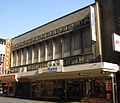
 Hoogstraat Rotterdam with Thalia Cinema.jpg 800 × 521; 128 KB
-
 Korte Hoogstraat, Rotterdam, 2005.jpg 3,264 × 2,448; 768 KB
-

-
-

-

-

-
 Markthal Rotterdam DSCF0949.JPG 2,816 × 1,864; 1.3 MB
-
 Markthal Rotterdam, géolococ.jpg 872 × 505; 108 KB
-
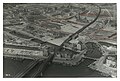
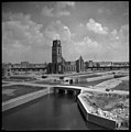
 NIMH - 2011 - 0446 - Aerial photograph of Rotterdam, The Netherlands - 1920 - 1940.jpg 3,500 × 2,535; 2.7 MB
-

-
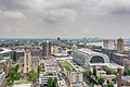 Panoramaopname vanaf dak WTC toegankelijk met Rotterdamse Dakendagen, 2016.jpg 2,953 × 1,969; 3.3 MB
-
 Reuzenrad Rotterdam P1360802.jpg 2,672 × 4,000; 5.66 MB
-
 Reuzenrad Rotterdam P1360808.jpg 2,672 × 4,000; 5.41 MB
-
 Rotterdam (45).jpg 7,296 × 5,472; 5.56 MB
-
 Rotterdam (47).jpg 7,296 × 5,472; 5.31 MB
-
 Rotterdam (48).jpg 7,296 × 5,472; 7.54 MB
-
 Rotterdam - Blokker (1).jpg 5,184 × 3,456; 7.12 MB
-
 Rotterdam - Blokker.jpg 5,184 × 3,456; 6.94 MB
-
 Rotterdam hoogstraat196.jpg 2,400 × 2,054; 480 KB
-
 Rotterdam, NL Jan 2020 - 06.jpg 5,184 × 3,888; 4.66 MB
-
 Rotterdam, NL Jan 2020 - 07.jpg 5,184 × 3,888; 5.78 MB
-
 Rotterdam, NL Jan 2020 - 08.jpg 5,184 × 3,888; 4.74 MB
-
 Schaalmodel van de sluis in de Nauwe Kerkstraat Hoogstraat, objectnr 36416.JPG 3,872 × 2,592; 2.64 MB
-
 Søstrene Grene in Rotterdam.jpg 3,024 × 3,024; 2.05 MB
-
 Terras Hoogstraat (Rotterdam) P1360804.jpg 4,000 × 2,672; 6.01 MB
-
 Zicht Markthal DSCF0946.JPG 2,816 × 1,864; 1.3 MB
-

-

-
-


.jpg)


_St_Laurent.jpg)
_005.JPG)
_008.JPG)
_DSCF0567.JPG)
_DSCF0954.JPG)
_DSCF3529.jpg)
_DSCF3534.jpg)
_I73064_-_kopie_-_kopie.jpg)
_P1360798.jpg)
_P1360799.jpg)
_P1360800.jpg)
_P1360801.jpg)
_P1360805.jpg)
_P1360817.jpg)
_P1360818.jpg)
.jpg)


.jpg)
.jpg)
.jpg)
.jpg)


_P1360804.jpg)


