Category:Historical maps of Yemen
Jump to navigation
Jump to search
Historical maps of Yemen
Subcategories
This category has the following 3 subcategories, out of 3 total.
M
- Maps of Aden Protectorate (17 F)
- Maps of Colony of Aden (14 F)
O
Media in category "Historical maps of Yemen"
The following 24 files are in this category, out of 24 total.
-
 Anglo-Turkish Boundary Commission map of Cape Bab el-Mandeb.jpg 1,731 × 2,905; 2.93 MB
-
 1972年北葉門南葉門邊界衝突.png 2,560 × 1,544; 352 KB
-
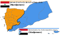
 Aden Colony dependencies.png 515 × 507; 143 KB
-
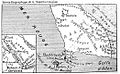
 Aden map War Office 1948 (cropped).jpg 265 × 195; 33 KB
-
 Aden map War Office 1948.jpg 1,000 × 526; 136 KB
-
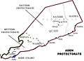 Aden Protectorate (British).jpg 740 × 537; 86 KB
-
 British Aden 1922.jpg 2,816 × 2,112; 803 KB
-
 Cape Bab el-Mandeb Anglo-Turkish Demarcation Line.jpg 1,385 × 1,441; 435 KB
-
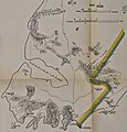
 Carte Cheik-Said.jpg 1,041 × 639; 294 KB
-
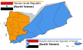
 Divided Yemen (ru).svg 1,210 × 730; 44 KB
-
 Divided Yemen ar.svg 1,210 × 730; 44 KB
-
 Divided Yemen da.svg 1,210 × 730; 44 KB
-
 Divided Yemen de.svg 1,210 × 730; 44 KB
-
 Divided Yemen es.svg 1,210 × 730; 44 KB
-
 Divided Yemen fr.svg 1,210 × 730; 44 KB
-
 Divided Yemen pt.svg 1,210 × 730; 44 KB
-
 Divided Yemen uk.svg 1,210 × 730; 45 KB
-
 Divided Yemen zh.svg 1,210 × 730; 44 KB
-
 Divided Yemen-ko.svg 1,210 × 730; 44 KB
-
 Divided Yemen.svg 1,210 × 730; 71 KB
-
 Map of the MENA region in 1798.svg 1,543 × 1,006; 528 KB
-
 Territoire de Cheikh Saïd.jpg 1,569 × 1,342; 873 KB
-
 Yemen Topography.png 1,636 × 1,178; 1.7 MB
-
 خريطة سلاطين القبائل في اليمن الجنوبي و جنوب اليمن.jpg 800 × 584; 118 KB


.jpg)

.jpg)


.svg)


