Category:Historical maps of Spitsbergen
Jump to navigation
Jump to search
Media in category "Historical maps of Spitsbergen"
The following 75 files are in this category, out of 75 total.
-
 "Spitsberga." (22242643282).jpg 3,511 × 2,735; 1.31 MB
-
 1598 map of the Polar Regions by Willem Barentsz.jpg 13,719 × 10,160; 30.66 MB
-
 1663 map Pieter Goos northsea norwegian sea.jpg 6,950 × 5,989; 4.1 MB
-
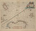
 Spitsberga - Atlas Maior, vol 1, map 4 - Joan Blaeu, 1667 - BL 114.h(star).1.(4).jpg 4,000 × 3,421; 1.67 MB
-
 172 of 'Adventurous Boat Voyages, etc' (11168599016).jpg 1,279 × 1,959; 515 KB
-

-
 (1867) p050 BEEREN EILAND.jpg 956 × 1,060; 358 KB
-

-

-

-
-

-

-

-

-

-

-

-

-

-

-
 Admiralty Chart No 2282 Arctic Ocean and Greenland Sea, Published 1872.jpg 15,062 × 12,375; 19.49 MB
-
 AMH-6739-NA Map of several islands near Spitsbergen.jpg 2,400 × 1,658; 583 KB
-
 Amsterdamer eiland.jpg 637 × 371; 25 KB
-

-
 Atlas Van der Hagen-KW1049B10 004-SPITSBERGA.jpeg 5,500 × 4,322; 1.73 MB
-
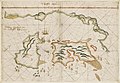
 Barents third voyage.jpg 2,000 × 1,511; 965 KB
-
 Barentskartet, 1598 (12068020364).jpg 2,842 × 2,091; 3.85 MB
-
 Barentsz arctic map.jpg 650 × 517; 102 KB
-
 Barentsz Full Map.jpg 1,000 × 742; 258 KB
-

-

-

-
 Carte du Spits-Berg Suivant les Hollandois - (Bellin) - btv1b530412601.jpg 3,203 × 3,670; 1.61 MB
-

-

-

-
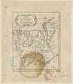
 EB9 Spitzbergen - Map.jpg 1,255 × 1,193; 367 KB
-
 FMIB 39771 Edge's Map of Greenland (Really Spitzbergen, circa 1611).jpeg 549 × 948; 102 KB
-
 Forminsket utgave av Barentskartet - no-nb krt 00487.jpg 4,418 × 3,449; 3.45 MB
-

-

-
 Kaart van Spitsbergen, 1596 delineatio Spitsbergiae (titel op object), RP-P-OB-80.208.jpg 2,500 × 1,973; 1.46 MB
-
 Karte Dampfer Helgoland Spitzbergen 1898.jpg 2,116 × 2,704; 2.51 MB
-
 Le Spitzberghe.jpg 2,278 × 3,068; 1.37 MB
-
 Map of Spitsbergen (1720).jpg 600 × 397; 29 KB
-
 Map of Spitsbergen c. 1873.jpg 1,170 × 1,500; 940 KB
-
 MAP SMEERENBURG.gif 960 × 720; 144 KB
-
 Mouillage de la baie Advent - Spitzberg ice fiord - btv1b53198660s.jpg 8,334 × 6,474; 5.13 MB
-

-
-

-

-

-
-

-
-

-

-

-

-

-
 Plan de la baie de la Madeleine au Spitzberg - btv1b531986562.jpg 11,608 × 8,306; 10.11 MB
-

-

-
 Pontanus 1611 Arctic Map.jpg 2,852 × 2,142; 802 KB
-
 Reproducció d'un mapa de les illes Spitzbergen.jpeg 468 × 768; 79 KB
-

-

-
 Spitsbergen (1).jpg 948 × 864; 318 KB
-
 Spitsbergen 1758.jpg 800 × 586; 163 KB
-
 Spitsbergen, Amsterdam Island.jpg 1,336 × 896; 455 KB
-
 Spitzbergen Nordost 1864 Karte.png 1,347 × 1,700; 4.16 MB
-
 UBBasel Map Spitzbergen 1618 Kartenslg Mappe 247-58.tif 5,740 × 3,059, 2 pages; 50.26 MB
-
 UBBasel Map Spitzbergen Europäisches Nordmeer 1685-1686 Kartenslg Mappe 247-56.tif 3,720 × 3,681, 2 pages; 39.2 MB
.jpg)


.1.(4).jpg)
.jpg)
.jpg)
_p050_BEEREN_EILAND.jpg)
.jpg)
.jpg)
.jpg)
.jpg)
.jpg)
.jpg)
.jpg)
.jpg)
.jpg)
.jpg)
_-_by_J.W._Norie,_Hydrographer_;_J...._-_btv1b5970641k.jpg)
_(14596834098).jpg)
_(14760487496).jpg)
_(14783135852).jpg)


_(14594118238).jpg)


.jpg)


_dans_les_glaces_quatre_fr%C3%A9gates_du_Roi_en_juillet_1693_pour_aller_%C3%A0_la_baie_de_Beersbay_pour_y..._-_btv1b84438248.jpg)
_-_btv1b530412601.jpg)
,_de_R._Wallace_(en_Malaisie)_et_du_pandit_(au_Thibet)_et_pour_celle_du_voyage_de_M._G._Lejean_(en_Albanie.)..._-_btv1b84467132.jpg)


.jpeg)


_door_Willem_Barendsz_(titel_op_object),_NG-800.jpg)
,_RP-P-OB-80.208.jpg)


.jpg)


_Gerard_van_Keulen..._-_btv1b59726149.jpg)

,_met_alle_desselfs_geleegentheden_in%27t_grood_-_btv1b530279589.jpg)

_-_btv1b5970637p.jpg)
_-_btv1b530402703.jpg)


_-_Nouvelle_Zemble_-_lev%C3%A9_et_dress%C3%A9_par_M.M._de_Langle,_Gennet,_Pacini..._(et_al.)_%C3%A0_bord_de_la_Recherche_command%C3%A9_par_M._Fabvre_-_btv1b53198653q.jpg)
_%C3%A0_bord_de_la_Recherche_command%C3%A9_par_M._Fabvre_-_btv1b531986545.jpg)

_command%C3%A9e_par_M._Fabvre,_Lieutenant_de_Vaisseau_;_grav%C3%A9_par_Chassant_-_btv1b53198655m.jpg)

_;_grav%C3%A9_par_Chassant_-_btv1b53198657h.jpg)


.jpg)


