Category:Hetton-le-Hole
Jump to navigation
Jump to search
town in the City of Sunderland in Tyne and Wear, England  | |||||
| Upload media | |||||
| Instance of | |||||
|---|---|---|---|---|---|
| Location | Hetton, Sunderland, Tyne and Wear, North East England, England | ||||
| official website | |||||
 | |||||
Hetton-le-Hole is a town and civil parish situated in the City of Sunderland in Tyne and Wear, England. It is on the A182 between Houghton-le-Spring and Easington. It is located on the southwest corner of Sunderland on the A182, off A690 close to the A1(M). It has a population of 14,402.
Subcategories
This category has the following 2 subcategories, out of 2 total.
H
- Hetton railway station (2 F)
Media in category "Hetton-le-Hole"
The following 27 files are in this category, out of 27 total.
-
 Aged Miners' homes Hetton Le Hole - geograph.org.uk - 259840.jpg 640 × 480; 88 KB
-
 Allotments at Hetton-le-Hole - geograph.org.uk - 314158.jpg 640 × 480; 84 KB
-
 Caroline Street railway crossing, Hetton-le-Hole (26771698530).jpg 1,046 × 785; 158 KB
-
 Eighth Row, Brickgarth, Easington Lane (25916513113).jpg 988 × 749; 208 KB
-
-
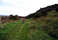
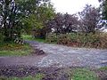
 Footpath following disused railway track - geograph.org.uk - 1004009.jpg 640 × 480; 162 KB
-
 Footpath junction - geograph.org.uk - 1004003.jpg 640 × 480; 103 KB
-
 Footpath leaving Moorsley Road - geograph.org.uk - 1004010.jpg 467 × 640; 141 KB
-
 Footpath, Coalfield Way - geograph.org.uk - 1004005.jpg 640 × 480; 89 KB
-
 Four Lane Ends, Hetton-le-Hole (26568627151).jpg 1,046 × 737; 155 KB
-
 Great North Forest Trail - geograph.org.uk - 1003998.jpg 640 × 480; 122 KB
-
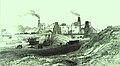 Hetton Coal Company.jpg 1,852 × 1,016; 810 KB
-
 Hetton Silver Band - geograph.org.uk - 314150.jpg 640 × 480; 56 KB
-
 Junction of footpath and disused railway - geograph.org.uk - 1004006.jpg 640 × 480; 153 KB
-
 Life on the Brickgarth housing estate, Easington Lane (26489399141).jpg 1,004 × 791; 206 KB
-
 Moorsley Road - geograph.org.uk - 1003996.jpg 640 × 480; 96 KB
-
 Moorsley Road - geograph.org.uk - 1004011.jpg 640 × 480; 92 KB
-
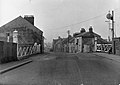
 Moorsley Road, Hetton-le-Hole - geograph.org.uk - 314107.jpg 640 × 480; 59 KB
-
 Robin House Wood - geograph.org.uk - 1004001.jpg 640 × 436; 65 KB
-
 Sand quarry at Hetton-le-Hole - geograph.org.uk - 314211.jpg 640 × 480; 80 KB
-
 Sand quarry at Hetton-le-Hole - geograph.org.uk - 314212.jpg 640 × 480; 83 KB
-
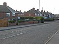
 Station Road, Hetton-le-Hole - geograph.org.uk - 314121.jpg 640 × 480; 61 KB
-
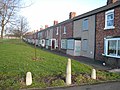
 Summerson Street, Hetton-le-Hole - geograph.org.uk - 314151.jpg 640 × 480; 58 KB
-
 The Downs, Hetton-le-Hole - geograph.org.uk - 314152.jpg 640 × 480; 69 KB
-

-
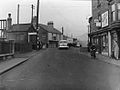
 North Road, Hetton-le-Hole - geograph.org.uk - 314099.jpg 640 × 480; 58 KB
-
 Thomas Street, Hetton-le-Hole - geograph.org.uk - 314154.jpg 640 × 480; 76 KB


.jpg)
.jpg)


.jpg)


.jpg)


