Category:Hessay
Jump to navigation
Jump to search
village in United Kingdom  | |||||
| Upload media | |||||
| Instance of | |||||
|---|---|---|---|---|---|
| Location | City of York, North Yorkshire, Yorkshire and the Humber, England | ||||
| Said to be the same as | Hessay (Wikimedia duplicated page, civil parish) | ||||
 | |||||
English: Hessay is a village and civil parish in the unitary authority of the City of York in North Yorkshire, England about west of York.
Subcategories
This category has the following 3 subcategories, out of 3 total.
Media in category "Hessay"
The following 30 files are in this category, out of 30 total.
-
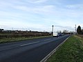
 A59 by Longfield Grange - geograph.org.uk - 3348442.jpg 640 × 448; 44 KB
-
 A59 heading west - geograph.org.uk - 2720759.jpg 640 × 480; 49 KB
-
 Boundary - geograph.org.uk - 184509.jpg 359 × 480; 31 KB
-
 Church of St. John the Baptist - geograph.org.uk - 6342840.jpg 2,000 × 1,295; 2.58 MB
-
 Farm Road to Longfield Grange - geograph.org.uk - 177479.jpg 640 × 480; 110 KB
-
 Field with emerging crop... and standing water - geograph.org.uk - 6342868.jpg 2,000 × 1,500; 2.36 MB
-
 Hessay Methodist Church - geograph.org.uk - 5450552.jpg 1,600 × 1,200; 450 KB
-
 Main Street heading west - geograph.org.uk - 2720771.jpg 640 × 480; 52 KB
-
 Main Street, Hessay - geograph.org.uk - 3646505.jpg 800 × 600; 109 KB
-
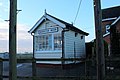 Marston Moor Signal Box (geograph 5250645).jpg 1,600 × 1,067; 299 KB
-
 Mill Lane towards Hessay - geograph.org.uk - 3646498.jpg 800 × 600; 92 KB
-

-
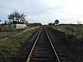 Railway towards York - geograph.org.uk - 2720764.jpg 640 × 480; 67 KB
-
 Shed, High Moor - geograph.org.uk - 5233338.jpg 640 × 426; 45 KB
-
 Shirbutt Closes - geograph.org.uk - 5233351.jpg 640 × 426; 54 KB
-
 Shirbutt Lane level crossing - geograph.org.uk - 3458962.jpg 1,024 × 768; 218 KB
-
 Shirbutts - geograph.org.uk - 5233345.jpg 640 × 308; 30 KB
-
 Shirbutts - geograph.org.uk - 5252440.jpg 640 × 363; 40 KB
-

-
 Station House, Hessay - geograph.org.uk - 2720761.jpg 640 × 480; 76 KB
-
 Stream between fields - geograph.org.uk - 3789739.jpg 1,500 × 1,000; 1.44 MB
-
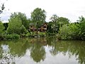
 The Foss - geograph.org.uk - 2720775.jpg 640 × 480; 105 KB
-
 The Hessay Methodist Church - geograph.org.uk - 3646516.jpg 800 × 600; 124 KB
-
 Footpath and farm road off Marston Lane - geograph.org.uk - 769977.jpg 640 × 480; 117 KB
-
 Glebe Farm - geograph.org.uk - 177488.jpg 640 × 480; 80 KB
-
 Green Lane, Moor Monkton parish - geograph.org.uk - 769971.jpg 480 × 640; 115 KB
-
 Holly House Farm - geograph.org.uk - 177490.jpg 640 × 480; 66 KB
-
 North of England ClayTarget Centre - geograph.org.uk - 178822.jpg 600 × 450; 98 KB
-
 Rose Lodge Cattery - geograph.org.uk - 177485.jpg 640 × 480; 82 KB
-
 The Willows - geograph.org.uk - 177444.jpg 640 × 480; 92 KB


.jpg)

.jpg)


