Category:Hatfield Heath (civil parish)
Jump to navigation
Jump to search
English: Hatfield Heath is a civil parish in the county of Essex, England, with a population of approximately 1500 people. Hatfield Heath, which is approximately 3 miles both north-south and east-west, sits close to the border between Hertfordshire with Essex and is within close proximity to the towns of Bishop's Stortford and Chelmsford. Stansted Airport lies approximately 5 miles to the north. The parish includes Hatfield Heath village, which is just north-west of the centre of Hatfield Heath, and the Down Hall country house and estate, one mile away from the village to the south. Pincey Brook, a tributary of the River Stort, flows through Hatfield Heath and forms part of its parish boundary with Hatfield Broad Oak.

civil parish in Uttlesford, Essex, England, UK | |||||
| Upload media | |||||
| Instance of | |||||
|---|---|---|---|---|---|
| Location | Uttlesford, Essex, East of England, England | ||||
 | |||||
Subcategories
This category has the following 6 subcategories, out of 6 total.
Media in category "Hatfield Heath (civil parish)"
The following 66 files are in this category, out of 66 total.
-
 Across Pincey Brook to Down Hall estate, in Hatfield Heath, Essex, England 01.jpg 2,333 × 3,500; 7.7 MB
-
 Across Pincey Brook to Down Hall estate, in Hatfield Heath, Essex, England 02.jpg 2,333 × 3,500; 8.44 MB
-
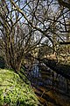
 Along Pincey Brook west from Matching Road, Hatfield Heath, Essex, England 01.jpg 2,333 × 3,500; 10.31 MB
-
 Along Pincey Brook west from Matching Road, Hatfield Heath, Essex, England 02.jpg 2,333 × 3,500; 10.13 MB
-
 Bridge over Pincey Brook on Chelmsford Road, Hatfield Heath, Essex, England.jpg 5,472 × 3,648; 33.25 MB
-
 Bridge over Pincey Brook on Matching Road, Hatfield Heath, Essex, England 01.jpg 3,500 × 2,333; 9.74 MB
-
 Bridge over Pincey Brook on Matching Road, Hatfield Heath, Essex, England 02.jpg 3,500 × 2,333; 8.55 MB
-
 Bridge over Pincey Brook on Matching Road, Hatfield Heath, Essex, England 03.jpg 3,500 × 2,333; 6.99 MB
-
 Lesser celandine on Pincey Brook, Chelmsford Road, Hatfield Heath, Essex 01.jpg 3,500 × 2,333; 8.37 MB
-
 Lesser celandine on Pincey Brook, Chelmsford Road, Hatfield Heath, Essex 02.jpg 2,333 × 3,500; 8.25 MB
-
 Lesser celandine on Pincey Brook, Chelmsford Road, Hatfield Heath, Essex 03.jpg 3,500 × 2,333; 9.02 MB
-
 Narcissus and nettles at Pincey Brook on Matching Road, Hatfield Heath, Essex, England.jpg 2,500 × 2,500; 3.97 MB
-
 Pincey Brook bridge coping stones on Matching Road, Hatfield Heath, Essex, England.jpg 3,500 × 1,750; 5.92 MB
-
 Pincey Brook footpath off Matching Road, Hatfield Heath, Essex, England.jpg 3,500 × 2,333; 10.56 MB
-
 Pincey Brook looking west from Matching Road, Hatfield Heath, Essex, England.jpg 2,333 × 3,500; 9.84 MB
-
 Pincey Brook north from Chelmsford Road, Hatfield Heath, Essex, England.jpg 2,333 × 3,500; 8.44 MB
-
 Pincey Brook south from Chelmsford Road, Hatfield Heath, Essex 01.jpg 2,333 × 3,500; 10.33 MB
-
 Pincey Brook south from Chelmsford Road, Hatfield Heath, Essex 02.jpg 3,500 × 2,333; 9.48 MB
-
 Pincey Brook south from Chelmsford Road, Hatfield Heath, Essex 03.jpg 2,333 × 3,500; 12.2 MB
-
 Pincey Brook south from Chelmsford Road, Hatfield Heath, Essex 04.jpg 2,333 × 3,500; 10.66 MB
-
 Agricultural chemicals by Sparrow's Lane - geograph.org.uk - 3535435.jpg 640 × 480; 107 KB
-
 B183 to Hatfield Broad Oak and Takeley (geograph 4302825).jpg 640 × 480; 174 KB
-
 B183 towards Hatfield Heath (geograph 3535695).jpg 640 × 480; 151 KB
-
 Bend on Dunmow Road, B183 (geograph 4295064).jpg 640 × 480; 129 KB
-
 Blocks, east of Hatfield Heath, Essex - geograph.org.uk - 217617.jpg 640 × 480; 102 KB
-
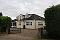
 Bungalow on Matching Road, Ardley End - geograph.org.uk - 6213787.jpg 1,920 × 1,280; 1.07 MB
-
 Bungalow on Matching Road, Ardley End - geograph.org.uk - 6363265.jpg 1,920 × 1,280; 951 KB
-
 Chelmsford Road, Hatfield Heath (geograph 4594890).jpg 640 × 480; 151 KB
-
 Dunmow Road, Hatfield Heath - geograph.org.uk - 5604924.jpg 2,048 × 1,536; 914 KB
-
 Dunmow Road, Hatfield Heath - geograph.org.uk - 5604925.jpg 1,976 × 1,436; 736 KB
-
 Entrance to Down Hall - geograph.org.uk - 4238085.jpg 3,760 × 2,823; 3.87 MB
-
 Farm track off Matching Road, Ardley End - geograph.org.uk - 6213788.jpg 1,920 × 1,280; 1.22 MB
-
 Field beside Pincey Brook - geograph.org.uk - 5913608.jpg 1,600 × 1,067; 403 KB
-
 Field by Old Street Hill, Hatfield Broad Oak - geograph.org.uk - 5608402.jpg 2,048 × 1,536; 1 MB
-
 Field entrance on Old Street Hill, Hatfield Broad Oak - geograph.org.uk - 5604922.jpg 2,048 × 1,536; 1.54 MB
-
 Field entrance on Old Street Hill, Hatfield Broad Oak - geograph.org.uk - 5604923.jpg 1,990 × 1,454; 1.29 MB
-
 Footbridge - geograph.org.uk - 242762.jpg 480 × 640; 162 KB
-
 Friars farmhouse near Hatfield Heath, Essex (geograph 4908566).jpg 640 × 480; 73 KB
-
 Friars Lane - geograph.org.uk - 3535673.jpg 640 × 480; 139 KB
-
 Front of house - geograph.org.uk - 4238094.jpg 4,608 × 3,456; 3.62 MB
-
 Frosty field - geograph.org.uk - 4302927.jpg 640 × 480; 130 KB
-
 Hatfield Grange from the air - geograph.org.uk - 4670470.jpg 640 × 480; 95 KB
-
 Hatfield Heath - geograph.org.uk - 5913602.jpg 1,600 × 1,067; 455 KB
-
 Hatfield Heath - geograph.org.uk - 6363262.jpg 1,906 × 1,260; 1.24 MB
-
 Hatfield Heath - geograph.org.uk - 6363264.jpg 1,906 × 1,260; 1.17 MB
-
 Hatfield Heath Primary School - geograph.org.uk - 5604926.jpg 2,048 × 1,536; 1.52 MB
-

-
 Layby on Old Street Hill, Hatfield Broad Oak - geograph.org.uk - 5604921.jpg 2,048 × 1,536; 1.51 MB
-
 Matching Road, Ardley End - geograph.org.uk - 6363266.jpg 1,890 × 1,236; 1.24 MB
-
 Pond in the fields - geograph.org.uk - 3535368.jpg 480 × 640; 160 KB
-
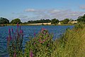 Reservoir Near Ardley End - geograph.org.uk - 515539.jpg 640 × 426; 119 KB
-
 Ryes Lane (geograph 4302847).jpg 640 × 480; 143 KB
-
 Sparrow's Lane - geograph.org.uk - 259331.jpg 640 × 480; 95 KB
-
 The entrance to Down Hall Hotel - geograph.org.uk - 6210052.jpg 1,892 × 1,236; 1.58 MB
-
 The Round House (geograph 4295044).jpg 640 × 480; 179 KB
-
 The Round Lodge - geograph.org.uk - 242764.jpg 640 × 480; 110 KB
-
 Tree near Sparrow Lane - geograph.org.uk - 3535318.jpg 640 × 480; 115 KB
-
 Two horsepower carriage - geograph.org.uk - 3535663.jpg 640 × 480; 203 KB
-
 Two horsepower on Matching Road - geograph.org.uk - 3536264.jpg 640 × 480; 147 KB
-

-

-
 Where's the path^ - geograph.org.uk - 3535401.jpg 640 × 480; 123 KB
-
 Woods by Matching Road, Ardley End - geograph.org.uk - 6213789.jpg 1,920 × 1,280; 1.87 MB
-
 Friars, Hatfield Heath, Essex - geograph.org.uk - 217612.jpg 640 × 453; 99 KB
-

-
 The A1060 at Hatfield Heath, Essex - geograph.org.uk - 217609.jpg 640 × 480; 87 KB


.jpg)
.jpg)
.jpg)


.jpg)


.jpg)


.jpg)


.jpg)


.jpg)


