Category:Harbledown
Jump to navigation
Jump to search
English: Harbledown is a village to the west of Canterbury, Kent in England, now contiguous with the city, although still a separate village. It forms part of the civil parish of Harbledown and Rough Common. The High Street is a conservation area with many fascinating colloquial buildings either side of a sharp climb towards the city. There is also a good Georgian terrace on the south side.
village in Kent, United Kingdom  | |||||
| Upload media | |||||
| Instance of | |||||
|---|---|---|---|---|---|
| Location | Harbledown and Rough Common, Canterbury, Kent, South East England, England | ||||
 | |||||
Subcategories
This category has the following 6 subcategories, out of 6 total.
Media in category "Harbledown"
The following 66 files are in this category, out of 66 total.
-
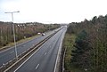 A2 West of Canterbury - geograph.org.uk - 1133151.jpg 640 × 430; 58 KB
-

-
 Apple orchard near Harbledown - geograph.org.uk - 983911.jpg 640 × 430; 67 KB
-

-

-
 Canterbury Centenary Walk on Church Hill - geograph.org.uk - 1588423.jpg 640 × 427; 102 KB
-
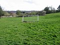 Cheyney Field, Upper Harbledown - geograph.org.uk - 770549.jpg 640 × 480; 192 KB
-
 Church Hill, Harbledown (geograph 3757803).jpg 3,488 × 2,616; 2.24 MB
-
 Church Hill, Harbledown - geograph.org.uk - 1225907.jpg 640 × 480; 93 KB
-
 Coppiced trees, Stock Wood - geograph.org.uk - 1133259.jpg 640 × 430; 131 KB
-

-
 Faulkners Lane meets the A2050 - geograph.org.uk - 1588433.jpg 640 × 427; 100 KB
-

-
 Golden Hill, Harbledown - geograph.org.uk - 1588358.jpg 640 × 427; 88 KB
-
 Hall Place Enterprise Centre - geograph.org.uk - 1588412.jpg 640 × 427; 78 KB
-
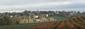 Harbledown Ben W Bell 31 10 2004.jpg 1,023 × 356; 49 KB
-
 Harbledown Church Hall - geograph.org.uk - 1588371.jpg 640 × 427; 70 KB
-
 Harbledown village sign - geograph.org.uk - 1225836.jpg 456 × 640; 73 KB
-
 Harbledown Village Sign - geograph.org.uk - 1502230.jpg 480 × 640; 59 KB
-
 Houses on Church Hill, Harbledown - geograph.org.uk - 1502223.jpg 640 × 427; 94 KB
-
 Interesting buildings in Harbledown - geograph.org.uk - 1291639.jpg 640 × 481; 78 KB
-

-
 Kent and Canterbury Hospital, Harbledown, Kent. Line engravi Wellcome V0012734.jpg 3,172 × 2,660; 3.6 MB
-

-

-

-

-

-

-
 Railway bridge and pond - geograph.org.uk - 778712.jpg 640 × 480; 289 KB
-

-

-

-
 Road junction on the A2050 - geograph.org.uk - 1588454.jpg 640 × 427; 70 KB
-
 Rough Common Road - geograph.org.uk - 1588968.jpg 640 × 427; 62 KB
-
 Small Stream, Stock Wood (2) - geograph.org.uk - 1133275.jpg 430 × 640; 127 KB
-
 Small Stream, Stock Wood - geograph.org.uk - 1133273.jpg 640 × 430; 139 KB
-
 St Dunstan's Terrace - geograph.org.uk - 527193.jpg 640 × 478; 143 KB
-
 St Nicholas Hospital, Harbledown - geograph.org.uk - 1588397.jpg 640 × 427; 88 KB
-

-
 The A2050 heading towards Canterbury - geograph.org.uk - 1588378.jpg 640 × 427; 81 KB
-
 The Barn, Harbledown - geograph.org.uk - 1588401.jpg 640 × 427; 100 KB
-
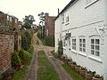 The Mint, Harbledown - geograph.org.uk - 1225886.jpg 640 × 480; 86 KB
-
 The Old Coach & Horses, Harbledown (geograph 3757807).jpg 2,861 × 2,464; 2.03 MB
-
 The Old Rectory, Harbledown - geograph.org.uk - 1076016.jpg 640 × 480; 105 KB
-

-

-
 Track to coppice area in Stock Wood - geograph.org.uk - 1588470.jpg 640 × 427; 110 KB
-
 View from the Bench on Golden Hill - geograph.org.uk - 1588340.jpg 640 × 427; 84 KB
-
 A2 West of Canterbury (2) - geograph.org.uk - 1133161.jpg 640 × 430; 51 KB
-
 Denstead Farm - geograph.org.uk - 156505.jpg 640 × 426; 125 KB
-
 Dry stream in Upper Harbledown - geograph.org.uk - 408164.jpg 480 × 640; 171 KB
-
 Farm at Petty France - geograph.org.uk - 156502.jpg 640 × 426; 72 KB
-

-

-
 Houses on the A290 Whitstable Road - geograph.org.uk - 755648.jpg 640 × 480; 191 KB
-
 In Bigbury Wood on the Pilgrims Way - geograph.org.uk - 156494.jpg 640 × 426; 145 KB
-

-
 Motel on the A2 - geograph.org.uk - 408089.jpg 640 × 480; 85 KB
-
 Orchard near Petty France - geograph.org.uk - 156504.jpg 640 × 426; 62 KB
-
 Orchard on Denstead Lane - geograph.org.uk - 156510.jpg 640 × 426; 72 KB
-

-
 Roman Road, Upper Harbledown - geograph.org.uk - 408140.jpg 480 × 640; 105 KB
-

-

-


.jpg)


_-_geograph.org.uk_-_1133275.jpg)


.jpg)


_-_geograph.org.uk_-_1133161.jpg)


