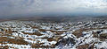
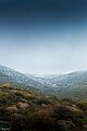
Category:Har Amasa (mountain)
Jump to navigation
Jump to search
| Object location | | View all coordinates using: OpenStreetMap |
|---|
mountain in Israel | |||||
| Upload media | |||||
| Instance of | |||||
|---|---|---|---|---|---|
| Location | Southern District, Israel | ||||
| Elevation above sea level |
| ||||
 | |||||
עברית: הר עמשא
Media in category "Har Amasa (mountain)"
The following 8 files are in this category, out of 8 total.
-
 Har Amasa (21806780031) (2).jpg 2,048 × 949; 625 KB
-
 IHM הר עמשא 1.jpeg 1,600 × 1,067; 577 KB
-
 IHM הר עמשא 3.jpeg 1,600 × 1,067; 669 KB
-
 IHM הר עמשא 4.jpeg 1,067 × 1,600; 570 KB
-
 IHM הר עמשא.jpeg 1,600 × 1,067; 384 KB
-
 הר עמשא מרכז.jpg 960 × 720; 138 KB
-
 הר עמשא שביל.jpg 960 × 720; 53 KB
-
 הר עמשא.jpg 960 × 720; 84 KB
_(2).jpg)


