Category:Greek divisions
Jump to navigation
Jump to search
Media in category "Greek divisions"
The following 24 files are in this category, out of 24 total.
-
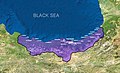
 Christians in the Black Sea region (1896).JPG 956 × 636; 67 KB
-
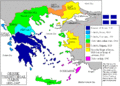
 Great Greece Map Claimed by Venizelos at Paris Peace Conference 1919.jpg 2,038 × 1,574; 676 KB
-
 Greek history from 1832-ar.png 868 × 624; 93 KB
-
 Greek history from 1832.GIF 868 × 624; 29 KB
-
 GuerrasBalcánicasLondresYBucarest.svg 1,027 × 1,242; 901 KB
-
 GuerrasBalcánicasLondresYBucarest2 de.svg 965 × 1,455; 1,008 KB
-
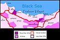
 Historical Lazona-Lazeti-Lazistan map.jpg 1,258 × 765; 1.05 MB
-
 Ionia within Greece (1919).svg 728 × 614; 126 KB
-
 Map Greece expansion 1832-1947 ja.jpg 2,000 × 2,621; 399 KB
-
 Map Greece expansion 1832-1947 ja.svg 2,000 × 2,621; 3.37 MB
-
 Map Greece expansion 1832-1947-da.svg 734 × 962; 113 KB
-
 Map Greece expansion 1832-1947-de.png 990 × 836; 181 KB
-
 Map Greece expansion 1832-1947-es.svg 734 × 962; 981 KB
-
 Map Greece expansion 1832-1947-eu.png 457 × 599; 87 KB
-
 Map Greece expansion 1832-1947-fr.svg 734 × 962; 475 KB
-
 Map Greece expansion 1832-1947-he.svg 734 × 623; 132 KB
-
 Map Greece expansion 1832-1947-zhcn.svg 734 × 962; 109 KB
-
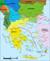
 Map of Pontus.jpg 3,289 × 2,122; 1.03 MB
-
 Map of Pontus.png 640 × 290; 141 KB
-
 Minia Enoz Line.jpg 694 × 469; 70 KB
-
 ParisPeace-Venizelos-Map.png 912 × 631; 242 KB
-
 Pontus.png 1,500 × 1,200; 1.2 MB
-
 Republic of Pontus map.svg 760 × 491; 111 KB
-
 Territorial Expansion of Greece from 1832–1947.gif 868 × 624; 49 KB
.JPG)


.svg)


