Category:Grasberg Mine
Jump to navigation
Jump to search
mine located in the province of Central Papua in Indonesia  | |||||
| Upload media | |||||
| Instance of | |||||
|---|---|---|---|---|---|
| Industry | |||||
| Location | Papua, Indonesia | ||||
| Owned by | |||||
| Operator | |||||
| Inception |
| ||||
 | |||||
Subcategories
This category has only the following subcategory.
S
Media in category "Grasberg Mine"
The following 33 files are in this category, out of 33 total.
-
 37 Moths of Grasberg Grasberg Mine Papua-Indonesia.jpg 3,333 × 2,500; 2.67 MB
-
 Disc Filter Paste Plant, Big Gossan Mine PTFI.jpg 902 × 602; 167 KB
-
-
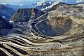
 Grasberg Mine aerial 2012.jpg 672 × 408; 98 KB
-
 Grasberg mine.jpg 640 × 480; 137 KB
-
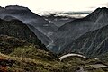
 Grasberg pano (3200491589) (cropped).jpg 2,958 × 918; 2.95 MB
-
 Grasberg pano (3200491589).jpg 3,100 × 1,033; 2.76 MB
-
 Grasberg view (3198297424).jpg 1,024 × 685; 275 KB
-
 Grasberg wastewater in Ajkwa river - 20030529 - photomap-fr.jpg 2,175 × 3,833; 2.9 MB
-
 Grasberg wastewater in Ajkwa river - 20030529 - photomap-fr.svg 2,175 × 3,833; 4.45 MB
-
 Itu kabut kah, ( Richard Erari ) di Surface Mine PT. Freeport Indonesia.jpg 2,800 × 1,867; 2.35 MB
-
 Kunjungan Dubes Donovan ke Timika (44049107965).jpg 3,456 × 2,304; 3.3 MB
-
 Kunjungan Dubes Donovan ke Timika (44241876444).jpg 3,456 × 2,304; 3.25 MB
-
 Landsat 29may03 28m Freeport named.jpg 1,273 × 3,587; 838 KB
-
 Landsat carstenz 29may03 28 Ajkwa.jpg 333 × 700; 54 KB
-
 Lorentz National Park map-de.svg 1,943 × 1,948; 1.57 MB
-
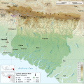 Lorentz National Park map-en.svg 1,943 × 1,948; 1.45 MB
-
 Lorentz National Park map-fr.svg 1,943 × 1,948; 1.58 MB
-
 Lorentz National Park map-id.svg 1,943 × 1,948; 1.39 MB
-
 Menikmati keindahan Alam Papua yang luar biasa.jpg 2,800 × 1,867; 2.92 MB
-
 Papuan ethno-political conflict- causes, contexts, and policy implication (IA papuethnopolitic109451634).pdf 1,275 × 1,650, 96 pages; 542 KB
-
 PT.FREEPORT INDONESIA EMPLOYEE.jpg 4,068 × 2,844; 6.27 MB
-
 Puncak Jaya (NASA astronaut photograph).jpg 1,280 × 764; 108 KB
-
 Puncak Jaya topographic map-fr.svg 1,280 × 915; 1.22 MB
-
 Puncak Jaya topographic map-hu.svg 1,280 × 915; 868 KB
-
 Puncak Jaya topographic map-id.svg 1,280 × 915; 1.17 MB
-
 Puncak Jaya topographic map-mk.svg 1,280 × 915; 1.49 MB
-
 Richard Erari @Palm Shop Area, GBT Open Pit Mine Backgroung Photos.jpg 2,800 × 1,867; 2.54 MB
-
 Richard Erari dan Keindahan Alam Papua.jpg 2,800 × 1,732; 2.36 MB
-
 Surface Mine PTFI ( Erari Richard ).jpg 2,052 × 2,364; 1.05 MB
-
 Tambang Grasberg Freeport.jpg 800 × 531; 214 KB
-
 The Pyramids of the Equator.jpg 4,032 × 2,268; 3.59 MB
-
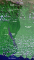
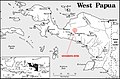 West Papua - Grasberg Mine loc map.jpg 550 × 362; 68 KB


.jpg)


_di_Surface_Mine_PT._Freeport_Indonesia.jpg)
.jpg)
.jpg)


.jpg)


.jpg)


_(cropped).jpg)
.jpg)