Category:Grade II* listed buildings in Northamptonshire
Jump to navigation
Jump to search
Ceremonial counties of England: Bedfordshire · Berkshire · Buckinghamshire · Cambridgeshire · Cheshire · Cornwall · Cumbria · Derbyshire · Devon · Dorset · Durham · East Riding of Yorkshire · East Sussex · Essex · Gloucestershire · Greater London · Greater Manchester · Hampshire · Herefordshire · Hertfordshire · Kent · Lancashire · Leicestershire · Lincolnshire · Merseyside · Norfolk · North Yorkshire · Northamptonshire · Northumberland · Nottinghamshire · Oxfordshire · Rutland · Shropshire · Somerset · South Yorkshire · Staffordshire · Suffolk · Surrey · Tyne and Wear · Warwickshire · West Midlands · West Sussex · West Yorkshire · Wiltshire · Worcestershire
City-counties: Bristol · City of London
Former historic counties: Westmorland ·
Other former counties:
City-counties: Bristol · City of London
Former historic counties: Westmorland ·
Other former counties:
Wikimedia category | |||||
| Upload media | |||||
| Instance of | |||||
|---|---|---|---|---|---|
| Category contains | |||||
| |||||
Subcategories
This category has the following 31 subcategories, out of 31 total.
*
7
- 78 Derngate (7 F)
A
- Althorp Stables (14 F)
- Astrop House (4 F)
B
- Brackley Town Hall (30 F)
- Brockhall Hall (3 F)
C
- Charwelton packhorse bridge (4 F)
- County Hall, Northampton (2 F)
D
- Dairy Farm Dovecote (6 F)
G
J
- Jesus Hospital, Rothwell (20 F)
M
- Manor Farm Dovecote, Furtho (3 F)
- The Menagerie, Hackleton (2 F)
- Montagu Hospital, Weekley (3 F)
N
P
R
- Rockingham Castle walls (11 F)
S
- Solomon's Bridge, Cosgrove (9 F)
- Stables of Harlestone House (2 F)
T
- The Falls, Harrington (29 F)
Media in category "Grade II* listed buildings in Northamptonshire"
The following 26 files are in this category, out of 26 total.
-
 100119 Paine's Almshouses West Street Oundle 4-10-20.jpg 3,264 × 2,448; 1.97 MB
-
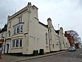 2 Sheaf Street, Daventry.jpeg 1,600 × 1,200; 335 KB
-
 27 High Street Daventry Geograph-1788961-by-In-Depth.jpg 497 × 640; 128 KB
-
 36 High Street, Daventry Geograph-1789013-by-In-Depth.jpg 426 × 640; 101 KB
-
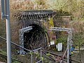
 Airshafts above Kilsby Tunnel - geograph.org.uk - 44396.jpg 640 × 480; 56 KB
-
 Althorp, Northamptonshire - geograph.org.uk - 908598.jpg 640 × 480; 51 KB
-
 Ashby St Ledgers Manor House - geograph.org.uk - 918183.jpg 640 × 480; 63 KB
-
 Brockhall Manor Geograph-2490632-by-Oast-House-Archive.jpg 640 × 480; 89 KB
-
 Cromwell House, Northampton.jpg 4,000 × 3,000; 5.23 MB
-

-
 Daventry-Sheaf Street - geograph.org.uk - 304034.jpg 640 × 480; 107 KB
-
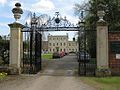 Harrowden Hall (geograph 1834508).jpg 1,024 × 768; 155 KB
-
 Kilsby - geograph.org.uk - 89249.jpg 640 × 480; 88 KB
-
 Kilsby Tunnel - geograph.org.uk - 86403.jpg 640 × 480; 127 KB
-
 Kilsby Tunnel Airshaft - geograph.org.uk - 1607010.jpg 640 × 480; 81 KB
-
 Manor House, Kings Sutton (geograph 3308197).jpg 1,024 × 768; 185 KB
-
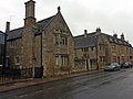
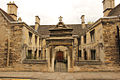 Parson Lathams Hospital (geograph 4116346).jpg 1,024 × 683; 229 KB
-
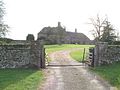 Purston Manor - geograph.org.uk - 338651.jpg 640 × 480; 77 KB
-
 Rockingham Castle Wall Geograph-4469864-by-Richard-Humphrey.jpg 4,608 × 3,456; 5.06 MB
-
 Sparsholt - Lainston House Hotel (geograph 1849146).jpg 640 × 392; 116 KB
-
 Stoneacre, Blisworth (geograph 6847093).jpg 4,032 × 3,024; 2.62 MB
-
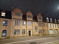
 The Hint viešbutis Velingbore.jpg 4,032 × 3,024; 3.15 MB
-
 Ventilation shafts - geograph.org.uk - 6751.jpg 640 × 480; 184 KB
-
 Weedon Bec Ordnance Depot (geograph 1951981).jpg 640 × 480; 60 KB
-

-


.jpg)


.jpg)
.jpg)


.jpg)
.jpg)


.jpg)
_(geograph_4468305).jpg)
_(geograph_4468311).jpg)