Category:Goathurst
Jump to navigation
Jump to search
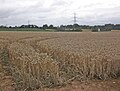
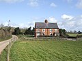
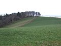
English: Goathurst is a small village and civil parish in the English county of Somerset, around 3 miles from the town of Bridgwater. The parish includes the hamlet of Andersfield.
village in Somerset, UK  | |||||
| Upload media | |||||
| Instance of | |||||
|---|---|---|---|---|---|
| Location | Sedgemoor, Somerset, South West England, England | ||||
 | |||||
Media in category "Goathurst"
The following 131 files are in this category, out of 131 total.
-
 Ancient survivor - geograph.org.uk - 4603248.jpg 1,024 × 768; 176 KB
-
 Bend at Lovedere Farm - geograph.org.uk - 1195430.jpg 640 × 480; 128 KB
-
 Boundary wall and outbuildings, at Sherwood - geograph.org.uk - 2508081.jpg 1,024 × 768; 191 KB
-
 Clump of trees, Rooks Castle - geograph.org.uk - 1833908.jpg 640 × 411; 81 KB
-
 Cottages, Goathurst - geograph.org.uk - 2508112.jpg 1,024 × 768; 209 KB
-

-

-

-
 Enmore Memorial Hall - geograph.org.uk - 2884971.jpg 640 × 480; 213 KB
-
 Field by 'The Thickets' - geograph.org.uk - 2255282.jpg 640 × 303; 42 KB
-
 Field of maize - geograph.org.uk - 4601668.jpg 1,024 × 768; 176 KB
-
 Fields at Huntstile - geograph.org.uk - 1508537.jpg 640 × 480; 127 KB
-
 Fields near Hill Barn (2) - geograph.org.uk - 1240313.jpg 640 × 480; 122 KB
-
 Fleabane - geograph.org.uk - 4602631.jpg 1,024 × 768; 199 KB
-
 Former almshouses, Goathurst - geograph.org.uk - 4603297.jpg 1,024 × 768; 191 KB
-
 Gate onto footpath, Chantry Wood - geograph.org.uk - 1835594.jpg 640 × 480; 124 KB
-
 Gate to The Thickets - geograph.org.uk - 2444286.jpg 3,280 × 2,232; 926 KB
-
 Goathurst village - geograph.org.uk - 5464656.jpg 3,456 × 2,304; 921 KB
-
 Goathurst, St. Edward's Church, Anne Halswell floor brass - geograph.org.uk - 6286049.jpg 5,604 × 3,736; 5.95 MB
-
 Goathurst, St. Edward's Church, Bench end - geograph.org.uk - 6285993.jpg 6,094 × 4,063; 5.99 MB
-

-

-

-

-

-

-

-

-

-

-
-

-

-
 Goathurst, St. Edward's Church, Part of the churchyard - geograph.org.uk - 6285869.jpg 6,442 × 4,295; 6.56 MB
-

-

-

-

-

-

-

-

-
 Goathurst, St. Edward's Church, Sir John Tynte memorial 1 - geograph.org.uk - 6285902.jpg 6,576 × 4,384; 7.55 MB
-

-

-

-

-

-

-

-

-
 Goathurst, St. Edward's Church, South aisle chapel entrance - geograph.org.uk - 6285966.jpg 7,345 × 4,896; 6.39 MB
-
 Goathurst, St. Edward's Church, South western aspect - geograph.org.uk - 6285865.jpg 7,176 × 4,784; 7.74 MB
-
 Goathurst, St. Edward's Church, Stained glass window - geograph.org.uk - 6286010.jpg 3,966 × 5,949; 3.72 MB
-
 Goathurst, St. Edward's Church, Stained glass window - geograph.org.uk - 6286011.jpg 4,378 × 6,566; 4.19 MB
-
 Goathurst, St. Edward's Church, Stained glass window - geograph.org.uk - 6286014.jpg 4,260 × 6,390; 3.78 MB
-
 Goathurst, St. Edward's Church, The chancel - geograph.org.uk - 6286053.jpg 6,653 × 4,436; 7.24 MB
-
 Goathurst, St. Edward's Church, The nave - geograph.org.uk - 6285875.jpg 7,466 × 4,977; 6.41 MB
-

-

-

-
 Great Thorns - geograph.org.uk - 1833986.jpg 640 × 480; 149 KB
-
 Great Willowherb - geograph.org.uk - 4602626.jpg 1,024 × 768; 301 KB
-
 Green lane beside Chantry Wood - geograph.org.uk - 3146875.jpg 640 × 480; 335 KB
-
 Halswell House - geograph.org.uk - 5464660.jpg 3,456 × 2,304; 1,011 KB
-
 Harmony Ends Here - geograph.org.uk - 2444395.jpg 3,316 × 2,232; 991 KB
-
 Haswell House - geograph.org.uk - 4602638.jpg 1,024 × 768; 178 KB
-
 Huntstile - geograph.org.uk - 3146890.jpg 640 × 480; 261 KB
-
 Huntstile Farm - geograph.org.uk - 2508073.jpg 1,024 × 768; 191 KB
-
 Lane at Andersfield - geograph.org.uk - 1835744.jpg 640 × 480; 109 KB
-
 Lane near Goathurst - geograph.org.uk - 1835644.jpg 640 × 408; 88 KB
-
 Lane near Lovedere Farm - geograph.org.uk - 1835611.jpg 640 × 488; 123 KB
-
 Lane north of Goathurst - geograph.org.uk - 1835602.jpg 640 × 452; 103 KB
-
 Lockyers, cottages near Goathurst - geograph.org.uk - 1235322.jpg 640 × 480; 262 KB
-
 Lovedere Business Park - geograph.org.uk - 4601622.jpg 1,024 × 768; 149 KB
-
 Lovedere Farm - geograph.org.uk - 4601534.jpg 1,024 × 768; 142 KB
-
 Millwood Stream - geograph.org.uk - 1835660.jpg 640 × 480; 98 KB
-
 Minor road to Goathurst - geograph.org.uk - 4603268.jpg 768 × 1,024; 238 KB
-
 Muddy Field - geograph.org.uk - 1195424.jpg 640 × 480; 131 KB
-
 Oakenford Farm - geograph.org.uk - 1834101.jpg 640 × 390; 56 KB
-
 Oakenford Farm - geograph.org.uk - 1834210.jpg 640 × 443; 73 KB
-

-
 Old School House, Goathurst - geograph.org.uk - 2508570.jpg 1,024 × 768; 213 KB
-
 Ordnance Survey Cut Mark - geograph.org.uk - 5617531.jpg 640 × 410; 111 KB
-
 Painted panels from the first half of the eighteenth century - geograph.org.uk - 6285881.jpg 5,923 × 3,949; 4.75 MB
-
 Patcombe Farm - geograph.org.uk - 4603232.jpg 1,024 × 768; 213 KB
-
 Path near Rooks Castle Farm - geograph.org.uk - 2255285.jpg 640 × 480; 70 KB
-
 Path to Rhode Lane - geograph.org.uk - 4601658.jpg 1,024 × 768; 223 KB
-
 Pea crop, Haswell Estate - geograph.org.uk - 4603213.jpg 1,024 × 768; 293 KB
-
 Pig, Huntstile - geograph.org.uk - 3146899.jpg 640 × 480; 250 KB
-
 Pond near Rhode - geograph.org.uk - 1834224.jpg 640 × 480; 135 KB
-
 Power lines, near Durleigh - geograph.org.uk - 4601596.jpg 1,024 × 774; 141 KB
-
 Pylon on the hill - geograph.org.uk - 373725.jpg 480 × 640; 63 KB
-
 Rabbit proof fence - geograph.org.uk - 3146883.jpg 640 × 480; 258 KB
-
 Ridge road near Rooks Castle Farm - geograph.org.uk - 1833946.jpg 480 × 640; 139 KB
-
 Rooks Castle Farm - geograph.org.uk - 1833893.jpg 640 × 480; 132 KB
-
 Rotunda, Halswell park - geograph.org.uk - 4510804.jpg 800 × 531; 149 KB
-
 Secret Valley Activity Centre, Enmore - geograph.org.uk - 2508673.jpg 1,024 × 768; 160 KB
-
 Sedgemoor , Countryside Scenery - geograph.org.uk - 4840384.jpg 6,000 × 4,000; 6.52 MB
-
 Sedgemoor , Grassy Field - geograph.org.uk - 4840378.jpg 6,000 × 4,000; 5.11 MB
-
 Sedgemoor , Grassy Field - geograph.org.uk - 4840385.jpg 6,000 × 4,000; 5.27 MB
-
 Sedgemoor , Rhode Lane - geograph.org.uk - 4840379.jpg 6,000 × 4,000; 7.03 MB
-
 Sorrel in Halswell Park - geograph.org.uk - 2457230.jpg 1,956 × 1,368; 1.3 MB
-
 St Edward's Church, Goathurst - geograph.org.uk - 4603327.jpg 782 × 1,024; 152 KB
-
 Telephone box, Goathurst - geograph.org.uk - 2508408.jpg 1,024 × 768; 275 KB
-
 Temple of Harmony, Goathurst - geograph.org.uk - 5046960.jpg 1,600 × 1,200; 448 KB
-
 The Thickets - geograph.org.uk - 2444302.jpg 3,780 × 2,232; 1.12 MB
-
 Track above Andersfield - geograph.org.uk - 1835766.jpg 640 × 437; 75 KB
-
 Track at Great Thorns - geograph.org.uk - 1833977.jpg 640 × 448; 90 KB
-
 Track to Huntstile - geograph.org.uk - 1834002.jpg 640 × 462; 97 KB
-
 Track to Huntstile - geograph.org.uk - 1834041.jpg 640 × 480; 165 KB
-
 Tracks above Huntstile - geograph.org.uk - 1834004.jpg 640 × 464; 93 KB
-
 Trees near Oakenford Farm - geograph.org.uk - 1834086.jpg 480 × 640; 135 KB
-
 View beyond Goathurst to the Mendips - geograph.org.uk - 4144511.jpg 3,968 × 2,976; 2.89 MB
-
 View from The Thickets - geograph.org.uk - 2444317.jpg 3,632 × 2,196; 1.48 MB
-
 View towards The Thickets - geograph.org.uk - 2298647.jpg 1,024 × 768; 196 KB
-
 Well cover, Halswell house - geograph.org.uk - 4510906.jpg 531 × 800; 142 KB
-
 Wheat field at Haswell Estate - geograph.org.uk - 4602647.jpg 1,024 × 768; 253 KB
-
 Wheat field near Lexworthy Farm - geograph.org.uk - 4601579.jpg 1,024 × 779; 223 KB
-
 Wheat field, near Lovedere Farm - geograph.org.uk - 4601557.jpg 1,024 × 766; 294 KB
-
 Barns - geograph.org.uk - 157355.jpg 640 × 426; 124 KB
-
 Black Barn - geograph.org.uk - 366467.jpg 640 × 480; 74 KB
-
 Blue Door Barn - geograph.org.uk - 157360.jpg 640 × 426; 134 KB
-
 Copse by Rook's Castle Farm - geograph.org.uk - 366503.jpg 640 × 480; 94 KB
-
 Farm-workers' cottages - geograph.org.uk - 366480.jpg 640 × 480; 80 KB
-
 Hill Barn - geograph.org.uk - 373728.jpg 640 × 480; 82 KB
-
 Oakenford Farm - geograph.org.uk - 284296.jpg 640 × 425; 82 KB
-
 Pasture above The Thickets - geograph.org.uk - 373739.jpg 640 × 480; 47 KB
-
 Somerset countryside - geograph.org.uk - 373747.jpg 640 × 480; 107 KB
-
 The Thickets - geograph.org.uk - 366492.jpg 640 × 480; 71 KB
-
 View east from Hill Barn - geograph.org.uk - 373735.jpg 640 × 480; 75 KB


_-_geograph.org.uk_-_1240313.jpg)


_-_geograph.org.uk_-_6285896.jpg)


,_tester_(1690-1700)_-_geograph.org.uk_-_6285984.jpg)


