Category:German-language maps of the Balkans
Jump to navigation
Jump to search
Media in category "German-language maps of the Balkans"
The following 57 files are in this category, out of 57 total.
-
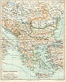
 1821 map - Der Europäische Theil des Türkischen Reichs.jpg 9,956 × 7,615; 17.44 MB
-
 1846 map - Europaeische Türkey, Griechenland und die Ionischen Inseln.tif 5,398 × 6,323; 80.02 MB
-

-
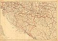
 1876 - General-Karte von Bosnien, der Hercegovina, von Serbien und Montenegro.jpg 23,376 × 15,604; 94.48 MB
-

-
 1880 - Geologische Übersichtskarte von Bosnien-Hercegovina. Erster Entwurf.jpg 8,660 × 8,088; 12.85 MB
-
 1909 map - Königreich Bulgarien und Türkisch Thrakien.jpg 22,041 × 16,720; 93.56 MB
-

-
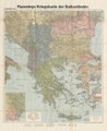
 1913 map - Königreich Bulgarien und die zentralen Balkanländer zwischen Adria und Pontus.jpg 26,268 × 16,847; 107.81 MB
-
 1913 topographic map of Austria-Hungary and the Balkan peninsula.jpg 6,492 × 4,901; 4.75 MB
-
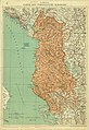 1914-G. Freytag's Karte des Fürstentums Albanien.jpg 5,680 × 8,272; 7.51 MB
-
 1915 map - Flemmings Kriegskarte von Serbien und Mazedonien mit den Nachbargebieten.tif 7,650 × 10,302; 41.61 MB
-

-
 1916 map - Flemmings Kriegskarte von Griechenland.tif 10,149 × 8,218; 37.18 MB
-
 1918 map of the Balkans - Flemmings Kriegskarte der Balkanländer.tif 8,311 × 10,149; 40.64 MB
-
 27-Serbien und Mazedonien (1915).png 9,917 × 13,300; 200.54 MB
-
 Albanien BV042751239.jpg 4,491 × 7,373; 4.08 MB
-
 Albanien BV042751251.jpg 7,750 × 4,488; 3.94 MB
-
 Alfios.png 1,200 × 940; 1.15 MB
-
 Balkan topo de.jpg 1,400 × 1,278; 755 KB
-
 Balkan-Halbinsel (Doppelseitige Farbkarte).jpg 800 × 994; 367 KB
-
 Balkan-Halbinsel, Ungarn, Europaeische Türkey und Griechenland.tif 3,360 × 4,125; 39.69 MB
-
 Balkangebirge Balkan topo de.jpg 869 × 516; 164 KB
-
 Bosnien-ethnisch-1991.png 1,023 × 1,000; 53 KB
-
 Bulgar-Morava-map.jpg 2,855 × 3,200; 1.6 MB
-
 Ethnographic map of Epirus, based on P. AravandinosPocesta 1878.jpg 2,696 × 3,101; 3.95 MB
-
 Flemmings Kriegskarte Nr. 32 - Rumänien und Nachbargebiete.jpg 17,407 × 21,495; 111.64 MB
-
 G. Freytags Karte des Fürstentums Albanien - btv1b8445837h.jpg 7,966 × 11,298; 13.75 MB
-
 GR-Attika.png 1,004 × 826; 269 KB
-
 GR-Ion-Ins.png 1,004 × 826; 269 KB
-
 GR-Kreta.png 1,004 × 826; 269 KB
-
 GR-Maked.png 1,004 × 826; 267 KB
-
 GR-Pelop.png 1,004 × 826; 268 KB
-
 GR-Thess.png 1,004 × 826; 268 KB
-
 GR-Thrak.png 1,004 × 826; 269 KB
-
 GR-Ägäis-Ins.png 1,004 × 826; 268 KB
-
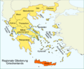
 GreeceRegionsGerman.png 620 × 513; 30 KB
-
 Hrvatske etnije-de.png 546 × 600; 15 KB
-
 Iskar Balkan topo de.jpg 590 × 450; 81 KB
-
 Italien, Europaeische Türkey, Griechenland, und die Jonischen Inseln.jpg 2,667 × 2,256; 2.06 MB
-
 Jovan Cvijic 1912 Der Zugang Serbiens zur Adria.jpg 2,826 × 3,842; 16.37 MB
-
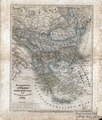
 Karte von Griechenland und der europäischen Türkei 1829.JPG 3,656 × 4,184; 2.63 MB
-
 Kikinda pos.png 400 × 471; 39 KB
-
 Kosmet Ethnizitäten.png 2,188 × 1,642; 64 KB
-
 Kroatien BV042770291.jpg 2,353 × 1,745; 1.24 MB
-
 Map of the Balkans in 1791 by Reilly 001b.jpg 1,104 × 834; 451 KB
-
 Midia-enos-map.jpg 1,575 × 1,581; 901 KB
-

-
 Neueste Special & Kriegs-Karte der Europäischen Türkey in IV Blättern - Western Balkan.jpg 11,510 × 9,082; 22.51 MB
-
 Postkurs-Karte von Bosnien und der Herzegovina.jpg 3,878 × 4,766; 2.64 MB
-
 Southwestern Balkans 1890.JPG 2,985 × 2,124; 2.47 MB
-
 Srpske enklave.png 972 × 1,173; 17 KB
-
 Stieler, Adolf. Das Mittellandische Meer Und Nord-Afrika. 1875 FC.jpg 1,979 × 2,409; 1.4 MB
-

-
 Walnys Verkehrskarte von Bosnien-Hercegovina und den angrenzenden Ländern.jpg 9,484 × 6,663; 12.41 MB
-
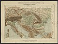
 Westermanns Neuer Schulatlas 1928 (20) Balkan-Halbinsel.jpg 4,514 × 6,649; 11.7 MB
-
 Bilder-Conversations-Lexikon fur das deutsche Volk Bd. 2 1838 (132848969).jpg 4,343 × 3,621; 19.43 MB


%27_(11233734294).jpg)


.png)


.jpg)


_Balkan-Halbinsel.jpg)
.jpg)