Category:Geology of Tennessee
Jump to navigation
Jump to search
overview of the geology of the U.S. state of Tennessee | |||||
| Upload media | |||||
| Subclass of | |||||
|---|---|---|---|---|---|
| |||||
States of the United States: Alabama · Alaska · Arizona · Arkansas · California · Colorado · Connecticut · Delaware · Florida · Georgia (U.S. state) · Hawaii · Idaho · Illinois · Indiana · Iowa · Kansas · Kentucky · Louisiana · Maine · Maryland · Massachusetts · Michigan · Minnesota · Mississippi (state) · Missouri · Montana · Nebraska · Nevada · New Hampshire · New Jersey · New Mexico · New York (state) · North Carolina · North Dakota · Ohio · Oklahoma · Oregon · Pennsylvania · Rhode Island · South Carolina · South Dakota · Tennessee · Texas · Utah · Vermont · Virginia · Washington (state) · West Virginia · Wisconsin · Wyoming – the District of Columbia: Washington, D.C.
the insular areas of the United States: American Samoa · Guam · the Northern Mariana Islands · Puerto Rico · the United States Virgin Islands – the United States Minor Outlying Islands: Bajo Nuevo Bank · Baker Island · Howland Island · Jarvis Island · Johnston Atoll · Kingman Reef · Midway Atoll · Navassa Island · Palmyra Atoll · Serranilla Bank · Wake Island
the insular areas of the United States: American Samoa · Guam · the Northern Mariana Islands · Puerto Rico · the United States Virgin Islands – the United States Minor Outlying Islands: Bajo Nuevo Bank · Baker Island · Howland Island · Jarvis Island · Johnston Atoll · Kingman Reef · Midway Atoll · Navassa Island · Palmyra Atoll · Serranilla Bank · Wake Island
Subcategories
This category has the following 42 subcategories, out of 42 total.
*
+
B
C
D
- Doe Mountain Anticlinorium (3 F)
E
F
G
- Geohazards in Tennessee (1 F)
L
M
O
P
R
- Rock samples from Tennessee (3 F)
S
T
W
- Wells Creek crater (4 F)
Media in category "Geology of Tennessee"
The following 15 files are in this category, out of 15 total.
-
 Burgess-falls-gorge-tn1.jpg 2,848 × 4,288; 9.48 MB
-
 Central-Tennessee-fossil-roadcut.jpg 600 × 515; 56 KB
-
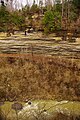
 Doe Mountain Anticlinorium (northeastern tip of Tennessee, USA) 1.jpg 4,000 × 3,000; 8.34 MB
-
 Doe Mountain Anticlinorium (northeastern tip of Tennessee, USA) 3.jpg 4,000 × 3,000; 9.71 MB
-
 Dripstone3653 (7234423658).jpg 800 × 600; 339 KB
-
 General soil map, Meigs County, Tennessee LOC 83693503.jpg 5,083 × 3,262; 2.11 MB
-
 Grassy Cove Sinkhole elevation map.jpg 16,200 × 16,200; 166 MB
-
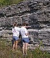 OrdOutcropTN.JPG 700 × 818; 279 KB
-

-
 PSM V69 D084 Landslide scarps near reelfoot lake tenn.png 1,567 × 1,220; 599 KB
-
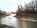 Reverie ms river n.jpg 640 × 480; 125 KB
-
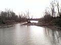 Reverie ms river s.jpg 640 × 480; 151 KB
-
 Rockstrata3435.JPG 300 × 225; 28 KB
-

-


_1.jpg)
_3.jpg)
.jpg)


_1_(36640552420).jpg)


.jpg)
.jpg)