Category:Geological maps of Switzerland
Jump to navigation
Jump to search
Countries of Europe: Albania · Andorra · Armenia‡ · Austria · Azerbaijan‡ · Belgium · Bosnia and Herzegovina · Bulgaria · Croatia · Cyprus‡ · Czech Republic · Denmark · Estonia · Finland · France‡ · Georgia‡ · Germany · Greece · Hungary · Iceland · Republic of Ireland · Italy · Kazakhstan‡ · Latvia · Liechtenstein · Lithuania · Luxembourg · Moldova · Montenegro · Netherlands‡ · Norway · Poland · Portugal‡ · Romania · Russia‡ · Serbia · Slovakia · Slovenia · Spain‡ · Sweden · Switzerland · Turkey‡ · Ukraine · United Kingdom
Specific status: Svalbard
‡: partly located in Europe
Specific status: Svalbard
‡: partly located in Europe
Subcategories
This category has the following 3 subcategories, out of 3 total.
*
G
Media in category "Geological maps of Switzerland"
The following 31 files are in this category, out of 31 total.
-

-
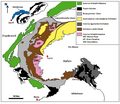
 Alps geology map en.jpg 3,338 × 1,607; 1.86 MB
-
 Alps geology map.jpg 3,338 × 1,607; 1.84 MB
-
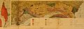 Berichte der Naturforschenden Gesellschaft zu Freiburg i. Br (1904) (20340443006).jpg 3,780 × 1,314; 1.45 MB
-
 Dora-Maira-Massiv.png 595 × 518; 76 KB
-
 ETH-BIB-Flöschhorn-Niederhorn, Karte der alten Kohlestollen-Dia 247-Z-00239.tif 2,541 × 3,033; 22.07 MB
-
 ETH-BIB-Gasterntal-Einbruch, geolog. Karte-Dia 247-Z-00031.tif 3,608 × 2,861; 29.69 MB
-
 ETH-BIB-Geologische Karte der Schweiz-Dia 247-Z-00002.tif 3,648 × 2,849; 29.87 MB
-
 ETH-BIB-Geologische Wandkarte der Schweiz (W. Staub)-Dia 247-F-00767.tif 3,758 × 3,004; 10.87 MB
-
 ETH-BIB-Tekton Karte, Sion Simplon-Dia 247-Z-00260.tif 3,651 × 2,884; 30.25 MB
-
 France geological map-fr.svg 1,636 × 1,753; 3.27 MB
-
 French Hercynian massifs BR.svg 850 × 590; 274 KB
-
 French Hercynian massifs EN.svg 850 × 590; 274 KB
-
 Geognostische Karte der Schweiz.JPG 2,126 × 1,299; 171 KB
-
 Geologie massif du Jura.svg 882 × 1,170; 178 KB
-
 Geologische Karte des Engadiner Fensters.png 1,809 × 1,130; 354 KB
-

-
 Graupensandrinne Hegau Schwäbische Alb1.jpg 1,800 × 1,200; 635 KB
-
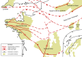
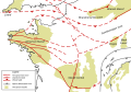
 Map of Alpine Glaciations.png 1,026 × 657; 1.43 MB
-
 Montblanc-Massiv.png 4,137 × 3,417; 3.73 MB
-
 Moosfluh slope instability ESA372872.jpg 4,955 × 3,511; 4.29 MB
-
 Nw europe grav plot 2.png 742 × 841; 880 KB
-
 Nw europe grav plot.png 475 × 548; 318 KB
-
 Ovaille verticale.jpg 1,440 × 1,995; 3.47 MB
-
 Paléogéo. Callovien sup..jpg 950 × 665; 103 KB
-
 Rhinegraben fessenheim.png 1,235 × 1,740; 8.72 MB
-
 Schema tettonico delle Alpi.jpg 1,250 × 833; 532 KB
-
 Schéma des 2 marges continentales des alpes.png 705 × 454; 127 KB
-
 Situationsplan von Zug und Umgebung.jpg 6,958 × 3,995; 8.93 MB
-
 Suisse-regions.png 1,179 × 793; 486 KB
-
 Upper Rhine plain with Fessenheim location - photomap-fr.svg 1,237 × 1,742; 1.05 MB
.jpg)


_(20340443006).jpg)