Category:Geography of San Bernardino County, California
Jump to navigation
Jump to search
Counties of California: Alameda · Alpine · Amador · Butte · Calaveras · Colusa · Contra Costa · Del Norte · El Dorado · Fresno · Glenn · Humboldt · Imperial · Inyo · Kern · Kings · Lake · Lassen · Los Angeles · Madera · Marin · Mariposa · Mendocino · Merced · Modoc · Mono · Monterey · Napa · Nevada · Orange · Placer · Plumas · Riverside · Sacramento · San Benito · San Bernardino · San Diego · San Joaquin · San Luis Obispo · San Mateo · Santa Barbara · Santa Clara · Santa Cruz · Shasta · Sierra · Siskiyou · Solano · Sonoma · Stanislaus ·Sutter · Tehama · Trinity · Tulare · Tuolumne · Ventura · Yolo · Yuba – Consolidated city-county: San Francisco
Wikimedia category | |||||
| Upload media | |||||
| Instance of | |||||
|---|---|---|---|---|---|
| Category combines topics | |||||
| San Bernardino County | |||||
county in California, United States     | |||||
| Instance of | |||||
| Part of | |||||
| Named after | |||||
| Location | California, Pacific States Region | ||||
| Capital | |||||
| Inception |
| ||||
| Highest point | |||||
| Population |
| ||||
| Area |
| ||||
| official website | |||||
 | |||||
Subcategories
This category has the following 22 subcategories, out of 22 total.
*
A
- Amboy Crater (31 F)
B
- Black Metal Wash (10 F)
C
- 2008 Chino Hills earthquake (4 F)
D
- Dumont Dunes (36 F)
L
- Lucy Bell Lane Marker (1 F)
M
R
S
- San Timoteo Canyon (53 F)
T
- Trona Pinnacles (113 F)
Media in category "Geography of San Bernardino County, California"
The following 57 files are in this category, out of 57 total.
-
 San bernardino County.png 200 × 231; 12 KB
-
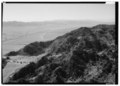
 180403-FS-SanBernardino-UNK-001 (41502731182).jpg 1,763 × 849; 182 KB
-
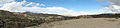 3 mar morongo.jpg 7,135 × 1,678; 2 MB
-
 Amboy Salt Flats - San Bernardino County, California, USA - August 1995 01.jpg 5,000 × 7,500; 19.98 MB
-
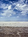 Amboy Salt Flats - San Bernardino County, California, USA - August 1995 02.jpg 4,261 × 5,647; 33.06 MB
-
 Amboy volcanic field - strandlines on basalt flow.JPG 3,712 × 2,088; 3.4 MB
-
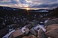 BBL SUNSET 1-16-16-2.jpg 5,599 × 3,733; 11.07 MB
-
 Big Bear City.jpg 400 × 266; 154 KB
-
 Calico Ghost Town2016 (6).JPG 3,264 × 4,912; 4.25 MB
-

-

-
 Cano3.jpg 6,000 × 3,368; 3.45 MB
-
 Chino Creek downstream from Central Avenue.jpeg 320 × 240; 28 KB
-
 Chino-hills-skyline.jpg 741 × 504; 399 KB
-
 City View of Barstow, California from Barstow Road (2013-12-08).jpg 1,557 × 1,167; 1.96 MB
-
 CroneseCat.JPG 3,648 × 2,432; 3.8 MB
-
-
 Fawnskin CA.jpg 750 × 160; 151 KB
-
 Garlock Fault.jpg 600 × 450; 31 KB
-
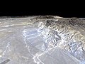
 Hector-Mine-earthquake-1999-Oct-16-USGS-map.jpg 461 × 548; 74 KB
-
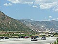 I15Victor.JPG 1,408 × 1,060; 518 KB
-
 Inland empire within southern california.png 342 × 308; 160 KB
-
 Joshua-Tree-NP-TF.jpg 4,800 × 2,700; 3.39 MB
-
 Kelbaker Road.jpg 2,000 × 3,008; 5.07 MB
-
 Kramer Hills, CA.jpg 1,124 × 1,280; 138 KB
-
 Lime stone quarry, Oro Grande, San Bernardino County, California. (CHS-1784).jpg 5,176 × 3,988; 1.4 MB
-
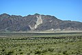
 MarbleMts SBCA.jpg 1,800 × 1,118; 432 KB
-
 Mojave River 031013.JPG 3,872 × 2,592; 7.61 MB
-
 Morongo Valley (30845280834).jpg 4,928 × 3,264; 7.16 MB
-
 OldRoute66PavementMark.jpg 800 × 600; 55 KB
-
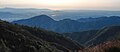
 Panorama view of Mount San Antonio as seen from Chino Hills.jpg 5,635 × 1,059; 2.06 MB
-
 Parker Valley facing S.jpg 2,040 × 1,044; 364 KB
-
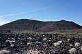 Pisgah Crater (25-10-2014).JPG 4,912 × 3,264; 6.06 MB
-

-
 San Bernardino Valley, San Gabriel, SB Mountains, I-215 (cropped).jpg 3,123 × 1,380; 5.34 MB
-
 San Bernardino Valley, San Gabriel, SB Mountains, I-215.jpg 3,123 × 1,584; 5.4 MB
-
 San Bernardino Valley.jpg 2,592 × 1,120; 1.48 MB
-
 Santa-ana-river-new.jpg 2,695 × 2,048; 3.81 MB
-
 SAR Map.jpg 1,230 × 930; 570 KB
-
 Santa Ana River, Seven Oaks Dam, Mill Creek, and Slide Peak.jpg 1,904 × 1,512; 1.28 MB
-
 SodaMts81.jpg 899 × 555; 133 KB
-
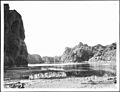 The Colorado River entering Mojave Canyon, California, 1900-1950 (CHS-3442).jpg 5,105 × 3,899; 1.51 MB
-
-

-

-

-

-
 California county map (Inland Empire highlighted) Gold color.svg 650 × 800; 258 KB
-
 California county map (Inland Empire highlighted).svg 650 × 800; 258 KB
-
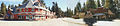
 TwentyninePalms1.jpg 775 × 290; 100 KB
-
 Washingtonia palm2.jpg 1,600 × 1,200; 1.33 MB
-
 Whipple Wash WikiMediaCommons.jpg 2,048 × 1,536; 1.12 MB
-
 Willow Wash at Kelbaker Road.jpg 2,400 × 1,600; 668 KB
-
 Wpdms shdrlfi020l coachella valley.jpg 300 × 270; 44 KB
-
 Wpdms shdrlfi020l colorado desert.jpg 300 × 267; 49 KB
-
 Wpdms shdrlfi020l san bernardino mountains.jpg 300 × 275; 49 KB
-
 Yucca Valley 2008r.jpg 800 × 600; 473 KB

.jpg)


.JPG)


.jpg)


.jpg)


.jpg)


.JPG)
.jpg)


.jpg)
_Gold_color.svg)
.svg)


_Gold_color_no_trans.png)