Category:Geography of Jo Daviess County, Illinois
Jump to navigation
Jump to search
Counties of Illinois: Champaign · Cook · DeKalb · DeWitt · DuPage · Franklin · Jo Daviess · Johnson · Kane · Kendall · Lake · Livingston · Macoupin · Madison · Mason · Ogle · Peoria · Pulaski · Rock Island · Union · Will ·
Wikimedia category | |||||
| Upload media | |||||
| Instance of | |||||
|---|---|---|---|---|---|
| Category combines topics | |||||
| Jo Daviess County | |||||
county in Illinois, United States   | |||||
| Instance of | |||||
| Named after | |||||
| Location | Illinois | ||||
| Capital | |||||
| Inception |
| ||||
| Population |
| ||||
| Area |
| ||||
| official website | |||||
 | |||||
| geography | |||||
science that studies the terrestrial surface, the societies that inhabit it and the territories, landscapes, places or regions that form it when interacting with each other     | |||||
| Pronunciation audio | |||||
| Instance of |
| ||||
| Different from | |||||
| Partially coincident with | |||||
| |||||
Subcategories
This category has the following 6 subcategories, out of 6 total.
Media in category "Geography of Jo Daviess County, Illinois"
The following 7 files are in this category, out of 7 total.
-
 Jo Daviess County IL U.S. 20 terrain1.JPG 3,072 × 2,304; 2.52 MB
-
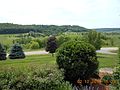
 LakeGalena GalenaTerritory E of GalenaIllinois.jpg 640 × 480; 159 KB
-
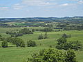
 Long Hollow Overlook - panoramio.jpg 5,472 × 3,648; 2.06 MB
-
 Rollinghills.JPG 4,000 × 3,000; 2.96 MB
-
 The Galena Territory, Guilford Township, IL 61036, USA - panoramio (1).jpg 4,608 × 3,456; 3.43 MB
-
 The Galena Territory, Guilford Township, IL 61036, USA - panoramio (2).jpg 4,608 × 3,456; 3.48 MB
-
 The Galena Territory, Guilford Township, IL 61036, USA - panoramio.jpg 3,264 × 2,448; 3.59 MB


.jpg)
.jpg)
