Category:Geography of Bad Tölz
Jump to navigation
Jump to search
Subcategories
This category has the following 16 subcategories, out of 16 total.
E
- Ellbach (Isar) (5 F)
H
- Habichauer Bach (10 F)
I
- Isar in Bad Tölz (51 F)
- Isarstausee Tölz (7 F)
K
- Katzenbuckel (Bad Tölz) (8 F)
- Klammerweiher (Bad Tölz) (8 F)
- Koglweiher (1 P, 9 F)
L
- Laubach (Kirchsee) (13 F)
M
N
R
- Rehgraben Bad Tölz (7 F)
- Reut (Bad Tölz) (1 F)
- Roßwies (1 F)
Z
- Zeller Wald (29 F)
Media in category "Geography of Bad Tölz"
The following 15 files are in this category, out of 15 total.
-
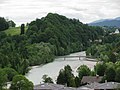
 Bad Tölz Bergblick.jpg 4,000 × 3,000; 2.04 MB
-
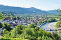
 Bad Tölz GO-2.jpg 2,592 × 1,944; 1.19 MB
-
 Bad Tölz Isarwanderweg 1.jpg 4,000 × 3,000; 4.15 MB
-
 Bad Tölz Isarwanderweg 2.jpg 3,000 × 4,000; 3.48 MB
-
 Bergblick Obermühlberg.jpg 5,472 × 3,648; 5.9 MB
-
 BY-toelz-kalvarienb-blick.jpg 1,215 × 807; 568 KB
-
 Felle Bad Tölz mit Isartal.jpg 343 × 542; 186 KB
-
 Findling Bad Tölz - 2022-04-22 - 188b.jpg 3,648 × 2,736; 2.17 MB
-
 Findling Bad Tölz - 2022-04-22 - 189b.jpg 3,648 × 2,736; 1.46 MB
-
 Findling Bad Tölz - 2022-04-22 - 190b.jpg 3,648 × 2,736; 1.9 MB
-
 Luftaufnahme Bad Tölz 1.JPG 3,648 × 2,736; 5.75 MB
-
 Luftaufnahme Farchet 1.JPG 2,788 × 2,685; 899 KB
-
 Luftaufnahme Flinthöhe 1.JPG 3,648 × 2,736; 4.77 MB
-
 Philipp Apian - Bairische Landtafeln von 1568 - Tafel 22 Tölz Lengries Walchensee.jpg 1,755 × 2,700; 2.3 MB
-
 Ratzenwinkl See.jpg 4,000 × 3,000; 4.69 MB


