Category:Geodetic control points in the United States
Jump to navigation
Jump to search
Subcategories
This category has the following 5 subcategories, out of 5 total.
Media in category "Geodetic control points in the United States"
The following 25 files are in this category, out of 25 total.
-
 2023-04-18, Diamond Head Summit Trail, 124413.jpg 3,024 × 4,032; 7.44 MB
-
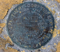
 BCR 52 survey marker United States Army Corps of Engineers.jpg 2,688 × 4,032; 3.88 MB
-
 Benchmark at Fulton.png 817 × 710; 1.47 MB
-
 Benchmark survey marker at Chamizal National Monument.jpg 2,448 × 3,264; 3.24 MB
-
 Black Hill survey marker.jpg 795 × 795; 347 KB
-
 Caltrans survey marker on bridge over CA-17 at Hamilton Avenue.jpg 1,523 × 1,531; 1.57 MB
-
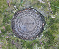
 Chenocetah Marker.JPG 3,264 × 2,448; 4.6 MB
-
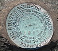 DarienCTUSCoastAndGeodeticSurvey1965Marker11042007.jpg 1,290 × 1,126; 606 KB
-
 Mount Elbert Survey marker.jpg 5,472 × 3,648; 16.36 MB
-
 Mount Pinos geodetic marker.jpg 1,500 × 1,000; 1,006 KB
-
 Mt Magazine NGS marker.jpg 447 × 474; 143 KB
-
 MUTCD-CA S2.svg 315 × 1,080; 22 KB
-
 MUTCD-OH I-H16.svg 1,080 × 1,350; 42 KB
-
 MY4112-Ref-Mark-1.jpg 800 × 667; 330 KB
-
 San Gorgonio Survey Marker.JPG 4,608 × 3,456; 2.92 MB
-
 Survey Marker at the Lake Wright Patman Dam.jpg 5,184 × 3,456; 11.52 MB
-
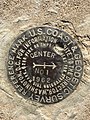 Survey Marker in the Center of the United States.jpg 3,024 × 4,032; 4.93 MB
-
 Survey marker in the Urban Greenbelt Trail, Richland, Washington - 2022-10-06.jpg 3,264 × 2,448; 5.96 MB
-

-
 Survey Monument, S.F-CAL - San Francisco, CA.jpg 1,962 × 1,962; 1.89 MB
-
 Township Range Section Marker on Forest Service Road.jpg 4,592 × 3,448; 7.75 MB
-
 United States National Geodetic Survey marker 5667.JPG 4,272 × 2,848; 7.26 MB
-
 US GENERAL LAND OFFICE Geodetic control point Douglas WY.JPG 3,264 × 2,448; 1.97 MB
-
 USArmyCorpsOfEngineersSurveyMarkerKDGP.jpg 2,048 × 1,536; 538 KB
-
 USGS Corner 469.jpg 4,608 × 3,072; 5.25 MB


