Category:Gannett Peak
Jump to navigation
Jump to search
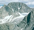
English: Media related to Gannett Peak, a mountain along the Continental Divide in the Wind River Range on the border between Fremont and Sublette counties in Wyoming, United States and, at 7,075 feet (2,156 m) is the highest point in the state.
mountain  Západní stěna hory | |||||
| Upload media | |||||
| Instance of | |||||
|---|---|---|---|---|---|
| Named after | |||||
| Location | Wyoming | ||||
| Significant event |
| ||||
| Mountain range | |||||
| Topographic prominence |
| ||||
| Elevation above sea level |
| ||||
| Parent peak | |||||
 | |||||
Media in category "Gannett Peak"
The following 4 files are in this category, out of 4 total.
-
 Gannet Peak with Gannett Glacier.jpg 450 × 301; 31 KB
-
 Gannett Peak.jpg 367 × 318; 48 KB
-
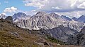 Ladd Peak.jpg 1,691 × 949; 499 KB
-
 Scr-gannett.jpg 371 × 550; 51 KB


