Category:Friedrichstraße (Fulda)
Jump to navigation
Jump to search
| Object location | | View all coordinates using: OpenStreetMap |
|---|
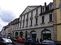
street in Fulda, Hesse, Germany | |||||
| Upload media | |||||
| Instance of | |||||
|---|---|---|---|---|---|
| Location | Fulda, Kassel Government Region, Hesse, Germany | ||||
 | |||||
Subcategories
This category has the following 5 subcategories, out of 5 total.
0
- Friedrichstraße 7 (Fulda) (4 F)
F
- Friedrichstraße 13 (Fulda) (2 F)
- Friedrichstraße 14 (Fulda) (2 F)
- Friedrichstraße 6 (Fulda) (2 F)
Media in category "Friedrichstraße (Fulda)"
The following 11 files are in this category, out of 11 total.
-
 Fulda - Friedrichstraße 13, Wappen über dem Eingang.JPG 3,072 × 2,304; 2.64 MB
-
 Fulda - Friedrichstraße 13.JPG 3,072 × 2,304; 2.61 MB
-
 Fulda - Wappen Friedrichstraße 13 links.JPG 2,232 × 2,216; 884 KB
-
 Fulda - Wappen Friedrichstraße 13, rechts.JPG 3,072 × 2,304; 2.74 MB
-
 Fulda, Friedrichstraße 1 20170309 001.jpg 5,995 × 4,002; 12.18 MB
-
 Fulda, Friedrichstraße 11 20170309 001.jpg 4,003 × 5,996; 10.84 MB
-
 Fulda, Friedrichstraße 24 20170309 001.jpg 4,003 × 5,996; 11.14 MB
-
 Fulda, Friedrichstraße 3 20170309 001.jpg 4,003 × 5,996; 10.88 MB
-
 Fulda, Friedrichstraße 5 20170309 001.jpg 5,996 × 4,003; 12.25 MB
-
 Fulda, Friedrichstraße 9 20170309 001.jpg 4,003 × 5,996; 10.18 MB
-


.jpg)